
Mallet head
|
Mallet head
|
||
 Aerial view |
||
| location | near Weiler near Bingen in the Soonwald | |
| Identifier | ND-7339-050 | |
| Geographical location | 50 ° 0 ′ N , 7 ° 49 ′ E | |
|
||

The Schlägelskopf is a natural monument in the Binger Stadtwald, northwest of Weiler near Bingen in the Soonwald .
It is an area monument on the top of the Schägleberg in the form of a bar made of weathered stratified rock approx. 270 m wide and 150 m deep, which runs from WNW to OSO. The highest point is 432.2 m above sea level. NHN indicated.
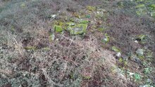
Since the rock formation is densely surrounded by trees, but the top is only overgrown with blackberry bushes, its shape and size can best be seen from the air, as the drone film shows.
A spring emerges below the southeast end of the formation, the so-called "Schäglebrunnen".
Nearby there are other sights such as the Steckeschäferklamm , the Morgenbachtal or the excavation of a Roman villa rustica in the Binger city forest.