Stony Island (Wayne County, Michigan)
| Stony Island | ||
|---|---|---|
| Waters | Detroit River | |
| Geographical location | 42 ° 7 '33 " N , 83 ° 7' 52" W | |
|
|
||
| length | 450 m | |
| width | 630 m | |
| surface | 40.5 ha | |
Stony Island is a 0.405 km² island in the Detroit River .
geography
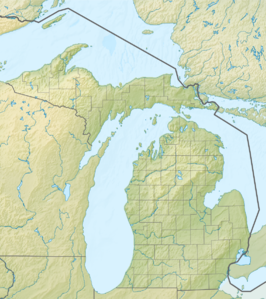
The island lies between Grosse Ile on the American side and Amherstburg on the Canadian side. On the eastern side of the island is the Livingston Channel . The island belongs to the Grosse Ile Township . To the east of the island there was a rock barrier in the river, called Limekiln Crossing, which was made navigable from 1876 by demolition.
The island has dry and humid areas, as well as areas that are temporarily covered by water. Currently, the island is one of the largest wildlife and spawning areas for 65 species of fish on the lower Detroit River. Man-made limestone barriers form an artificial bay. This is used by 23 species of birds during their migration .
history
Originally the island was part of the Potawatomi hunting and fishing area . In 1781 the island was transferred to the Macombe by treaty . In 1874 a ferry dock for the Canadian Southern Railway was set up on the island . A railway bridge was built to the Grosse Ile. The railway line was closed in 1888. Between 1908 and 1912, the Livingston Channel was completed. Several artificial dams were also built. In the 1920s and 1930s, Stony Island served as the center and base for the expansion of the Livingston and Amherstburg Channels . At that time there was a small settlement on the island. Today the remains of workshops and stranded barges can still be found on Stony Island. The island was classified as a residential area. There was no municipal supply and disposal.
The environmental protection organization Grosse Ile Nature and Land Conservancy has been trying to acquire the island since 1994 in order to set up a nature reserve on it. Eventually, the island was acquired by the Michigan State Natural Resources Trust Fund in 1997 for $ 700,000 .
Railway line
From the end of the 1860s, attempts were made to establish a permanent rail link between the United States and Canada in the Detroit area . This was an attempt to avoid the regular interruptions caused by the icing of the Detroit River. Several railway companies under the leadership of the Canadian Southern Railway therefore joined forces to build a railway line between Trenton and Amherstburg. The construction was carried out by the subsidiary Canada Southern Bridge Company . This required the construction of three bridges (Trenton – Grosse Ile, Grosse Ile – Stony Island and Stony Island – Amherstburg). In 1873 the first two bridges were completed. Due to resistance from ship owners, the last bridge section was not built. Therefore, in 1874 ferry docks were built on the island and on the Canadian side near Gordon (Ontario) . The planned construction of a tunnel was discarded early on. After the Canadian Southern Railway was acquired by the Michigan Central Railroad after financial problems , this moved the ferry service to Detroit in 1883. Until 1888, the route and the ferry connection were only used occasionally when the icing did not allow ferry service in Detroit. The bridge to Grosse Ile was then abandoned. The railway line to the island of Grosse Ile was in operation until 1929. Then the bridge between Trenton and Grosse Ile was converted for road traffic.
Web links
- A binational conference on rehabilitating and conserving Detroit River habitats: Conserving Critical Habitats in the Conservation Crescent - The Stony Island Story
- History of dredging and compensation St. Clair and Detroit Rivers, February 2009 (pdf; 8.6 MB)
- Michigan Central Great Ile Depot
literature
- Philip Parker Mason: The Ambassador Bridge: a monument to progress. Wayne State University Press, 1987, ISBN 0-8143-1839-8 , p. 40.
- George Woodman Hilton: The Great Lakes Car Ferries. Montevallo Historical Press, 2003, ISBN 0-9658624-3-7 , p. 30.
