
Trou de Fer

The Trou de Fer is a cauldron-like gorge about 250 meters deep on the island of Reunion . The name of this geological peculiarity (German: Eisenloch ) is probably a linguistic mistake and was originally Trou d'enfer (about Höllenloch ), as there are neither ferrous rocks nor evidence of ore smelting (smelting furnaces) in the area .
The Trou de Fer is located on a mountain flank in the northeast of the island. The inside is not accessible. A viewing platform on the southern edge of the basin can be reached via hiking trails, but the view into the depths is often clouded by fog and clouds. It is also developed for tourism through overflights with helicopters and microlight aircraft .
The six waterfalls falling from different sides over several hundred meters produce a very loud roar .
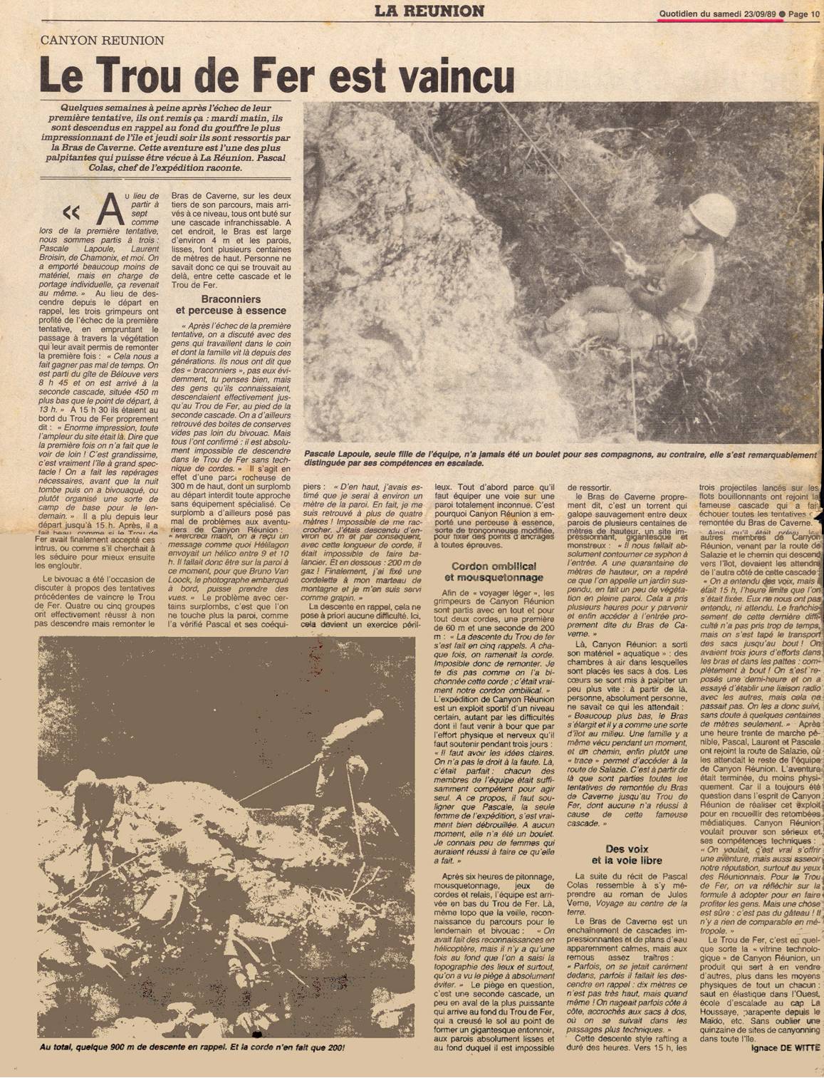
The largest waterfall is fed by the Bras de Caverne , which also forms the drain. It flows through a 3.2 km long, up to 850 meters deep and only a few meters wide, slot-shaped gorge, called the Corridor , into the Rivière du Mât . The first complete ascent along the Bras de Caverne through the Trou de Fer and through the corridor was made by Pascale Lapoule, Laurent Broisin and Pascal Colas from September 19 to 21, 1989.
swell
- Trou de Fer. In: wondermondo.com. Retrieved November 23, 2014 .
Web links
Individual evidence
- ↑ Pascal Colas: Les années 90: Pascal, histoire d'une passion. Retrieved November 23, 2014 (French).
- ↑ Ignace De Witte: Voyage au bout du Trou d'Enfer. In: Le Quotidien de la Réunion. August 28, 1989, accessed November 23, 2014 (French).
- ↑ Ignace De Witte: Le True de Fer est vaincu. In: Le Quotidien de la Réunion. September 23, 1989, accessed November 23, 2014 (French).
Coordinates: 21 ° 2 ′ 25 ″ S , 55 ° 33 ′ 23 ″ E