Vohilaid
| Vohilaid | ||
|---|---|---|
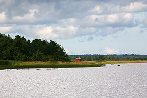
| View of Vohilaid (July 2009) | ||
| Waters | Baltic Sea | |
| Archipelago | Moonsund Islands | |
| Geographical location | 58 ° 54 '42 " N , 23 ° 2' 24" E | |
|
|
||
| surface | 4.16 km² | |
| Highest elevation | 10 m | |
| Residents | uninhabited | |
| Location of Vohilaid | ||
Vohilaid ( German Wohhi ) is an Estonian island in the Baltic Sea .
Location and history
Vohilaid is located northeast of the Estonian island of Hiiumaa . It belongs administratively to the Hiiumaa community . The sea between Hiiumaa and Vohilaid is only 40 cm deep, so that car traffic between the islands is possible.
The island is 416 hectares. The highest point is ten meters above sea level.
Vohilaid was first mentioned in 1586 under the name Killingeholm . The island was inhabited until the Second World War , especially as it was possible to farm on it. Today it is only used as pasture land.
In the north of Vohilaid there are other small islands: Hellamaa rahud, Uuemererahu, Ramsi rahu and Kadakalaid, on which even a small forest grows. 1.5 km southeast is the island of Hõralaid .
Individual evidence
- ↑ Hans Feldmann (founder), Heinz von ZurMühlen (ed.): Baltic historical local dictionary. Volume 1: Estonia (including Northern Livonia) (= sources and studies on Baltic history. Vol. 8, 1). Edited by Gertrud Westermann. Böhlau, Cologne et al. 1985, ISBN 3-412-07183-8 , p. 681.


