Arthur Island
| Arthur Island | ||
|---|---|---|
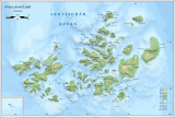
| The west of Franz Josef Land with Arthur Island | ||
| Waters | Arctic Ocean | |
| Archipelago | Franz Josef Land | |
| Geographical location | 81 ° 7 ′ N , 50 ° 41 ′ E | |
|
|
||
| length | 17.5 km | |
| width | 11 km | |
| surface | 110 km² | |
| Highest elevation | Leningrad ice cap 275 m |
|
| Residents | uninhabited | |
| Arthur Island on Frederick Jackson's 1898 map | ||
The Arthur Island ( Russian Остров Артура , Ostrow Artura ) is an uninhabited island of the to Russia belonging Arctic Franz Josef country .
It is the northernmost island in the west of the archipelago. It is separated from the Armitage Peninsula on the island of Prinz-Georg-Land to the south by the 10 km wide Leigh-Smith-Strait. Arthur Island is 110 km² in size and, with the exception of the coastal region in the north-west and the southern cape Mys Niski, is covered by an ice cap up to 275 m high .
The island was discovered by Frederick Jackson during the Jackson Harmsworth Expedition 1894-1897 and named after his brother Arthur. Jackson did not set foot on the island and only drew it imprecisely on his map, along with the Alfred Harmsworth and Albert Edward Islands , which later turned out to be the Phantom Islands .
Individual evidence
- ↑ Arthur Island on the website www.franz-josef-land.info , accessed on June 26, 2017.
- ^ Frederick G. Jackson: A thousand days in the Arctic . Harper, New York & London 1899, p. 631 (English).
Web links
- Topographic map of the island at a scale of 1: 200,000


