
Berstadt
|
Berstadt
Community Wölfersheim
Coordinates: 50 ° 25 ′ 35 ″ N , 8 ° 51 ′ 52 ″ E
|
|
|---|---|
| Height : | 143 m above sea level NHN |
| Area : | 13.08 km² [LAGIS] |
| Residents : | 1708 (Dec. 31, 2013) |
| Population density : | 131 inhabitants / km² |
| Incorporation : | December 31, 1971 |
| Postal code : | 61200 |
| Area code : | 06036 |

Berstadt is part of the municipality of Wölfersheim in the Wetterau district in Hesse and has around 1,700 inhabitants.
location
Berstadt is located northeast of Wölfersheim, the largest district of the municipality of the same name on the federal highway 455 . The place is directly at the junction Wölfersheim of the federal highway 45 (Sauerland line).

history
The name "Berstadt"
Berstadt is referred to as Berthenstat in Julian's documents around 800 . The Old High German name beraht means 'brightly shiny, splendid' in Low High German, i.e. a splendid place. Reuter sees references in the name to the “location art and soil quality” of the place. Various claims have been made that there was a sanctuary of a Germanic deity here in prehistoric times. However, given the current state of place name research, this is no longer tenable. Instead, Steen's interpretation is decisive. A description of the different interpretations can be found in Rieß / Roth.
Other historical forms of the place name are:
- Berhtenstat (817)
- Berhtdenstat (1056)
- Berchtenstat (1056)
- Berthenstat (1068)
- Berstationes (1073)
- Berstat (1150-1165)
- de Berstat (1232)
First mention
The district of Berstadt was first mentioned as a deed of Berhten during the term of office of the Fulda abbot Ratgar from 802 to 817 : In the Codex Eberhardi it says ( Latin ): “Wigo tradidit deo et sancto Bonfatio predia sua.”, Wigo gives God and Saint Boniface his possession. ' According to the practice of the Hessian State Archives in Darmstadt , the year 817 is accepted as the "safe terminus ad quem". This means that in 2017 the 1200th anniversary of the first mention can be celebrated. The forgeries that the monk Eberhard has assumed in previous research have been revised so that the forgeries are primarily related to the imperial and royal documents as well as those of the popes. The donations to Berstadt were of a private nature. Meyer zu Ermgassen also considers Eberhard's forgeries to be "insignificant in content". The year 817 is also the date of the first mention of another district of Wölfersheim, namely Melbach , as well as of the neighboring municipality of Grund-Schwalheim to the east , in which private donations were made to the Fulda monastery.
The historic village
The Zingelbach flows from the northwest to the place and surrounds it in a western and southern direction. This part of the village is called Zingeldorf. After the Zingelbach is crossed by the road in the area of the former bridge, it changes its name. In front of the Brückenstraße 22 property, it continues to flow in a south-easterly direction and is called from here on Waschbach.
To the south of the lower village it enclosed the moated castle , of which remains were present until the 19th century. In the western course of the Zingelbach there is a clear rise in altitude. The slope in the area of the upper gate was used in the 18th and 19th centuries to build rock cellars. The original, three-part medieval village image is completed in the northern part by the upper village. The monument topography describes this area as Kirchberg.
The church, built in the first half of the 11th century, and its mighty spire still shape the townscape , reinforced by the jump in terrain at the upper gate, which continues to the church and overcomes another 5 m - 10 m. The church was first mentioned in the 11th century. To the north of the church and rectory is the Mainzer Hof. Together with the church and the dance hall, it formed the historic town center. The former community inn at the Oberpforte has been adjacent to this in the west since the late Middle Ages. Up until the 18th century, the rectory and community inn formed a structural unit. The example of new family names shows that Berstadt was certain of its attractiveness for the residents of surrounding towns in the second half of the 14th century. These family names indicate their place of origin, e.g. B. Echzell Bessingen , April 4, 1368: "Contze Beszunger scheffen zu Berstad." Since 1371, the originally low-nobility Rode family in Berstadt can be traced back to the fact that they moved from Wohnbach to Berstadt: "ampmann Johan Rode". New residents also came from Feldheim bei Hungen , which later became desolate : May 19, 1391 "Heincze Feltheim" The strong influx of noble families who owned large farms here as fiefs determined the village image for centuries. "In the 14th century there are more than a dozen, at least half of which also resided here permanently."
Since the 14th century, the Mainzer Hof has been divided up between new owners again and again. Up to four individual farms were formed, but their real estate repeatedly resulted in the original size of five hooves . In the late 19th century the farm was further divided. "In addition to today's Reuter farm, there is also the Wolff farm and the two present-day areas of the former large forge."
The village in the early modern period
The establishment of a significant Latin school accelerates economic and social development again. During this time the still recognizable settlement edge of the medieval town was blown up for the first time, verifiably the mill in front of the Zingelpforte, but other buildings were also built in this area. The brewery is also built here later, so that the Zingelplatz is a counterpart to the Tanzhof. The mill and brewery were under the rule of the landgrave. Town hall, church and school, community scales, etc. represented a piece of village autonomy. The dominant courtyard of the lower village, Licher Straße 17, was the former Vogteihof, which later became the property of the Landgraves of Hesse.
Fortifications and gates
The late medieval place was fortified. A trench was first mentioned on August 14, 1380: "uff des dorffis dig." The fortification of the villages in the Wetterau is related to the feuds and warfare of the 14th and 15th centuries. As the property of the Counts of Ziegenhain , Berstadt was burned by Landgrave Hermann II on November 30, 1401, six prisoners were deported to Grünberg . In the following year landgraves' troops again invaded the Fuldische Mark, an attack on Berstadt on August 10, 1402 is documented. The original feud of the Hen of the Younger von Berstadt on January 30, 1413 against Archbishop Werner von Trier and his county Falkenstein to waive all claims for damage, loss, service, consumption, stallions and horses belongs in this context.
The root word Zingel in Zingelbach, Zingeldorf, Zingelpforte, Zingelgärten also proves the fortification of the place. In 1811 a bridge was built over the Zingelbach as part of the road construction. There was a ford here before. Large parts of the Schanzengraben were destroyed by road construction. There was a gate for each of the three parts of the village. " The three original entrances to the town center (are still) particularly striking in terms of the topography of the settlement ." The upper gate served at times as a shepherd's house. In 1811 it was auctioned for demolition and demolished in 1814. The old community inn was located here. The lower gate at the end of Untergasse was also the community poor house. It was demolished in 1854. The customs post was at the Zingelpforte. The tithing on the winnings which was raised here was the property of Fulda. The tenth of the gate was ½ meste of grain in the 17th century. Since 1664 it was a fiefdom of the Löw zu Steinfurth . The Fulda monastery pledged the door tithes to Berstadt on July 26, 1354, "we have to undirphand ... our doors in ... Berstat" to "Johan Crige von Voytzberg ."
In 1356, Emperor Charles IV permitted the Fulda monastery to levy a duty. A schilling of old Heller could be demanded from every horse, "for this purpose with laste or with koufmannschaft, get or zuhet". Thanks to the favorable traffic situation in Berstadt, this was a very profitable business. Because the customs office was next to the Neumühle, the mill leaseholder was also often the customs administrator and tenant. The offices were often inherited in the same family over generations. In front of the Zingelpforte and thus outside the fortifications, the Neumühle was built in 1561. Later the communal brewery was built here. The fountain there was owned by the Counts of Nassau-Saarbrücken in the 16th century . At the same time there was a glassworks in front of the Zingelpforte . With the establishment of the Acker blue dye works on Zingelplatz in the second half of the 19th century, the further expansion of the place towards Wohnbach began , which was considerably reinforced by the railway connection at the end of this century. The street outside Oberpforte runs dead straight. Here you can see a planned expansion of the site that began before 1500. Dendrochronological investigations showed that a post structure was built before 1480 in the area of Hofreite Oberpforte 15. This can be seen as the northwestern part of the Mainzer Hof.
middle Ages
Berstadt has had a continuous history of settlement since the early Middle Ages.
Frankish settlement
In 2006 a large cemetery from the Merovingian era was discovered during development work on the new building area Über den Holdergärten east of Berstadt . Then archaeologists uncovered around 400 graves by means of block salvage , which later could be assigned mainly to the 5th to 7th centuries. After two years of excavations and half a year of documentation, excavation manager Sascha Piffko and district archaeologist Dr. Lindenthal sent a comprehensive excavation report to the community. The restoration of the uncovered finds and the analysis of seized DNA samples by the State Office for Monument Preservation in Wiesbaden is still ongoing. Some of the previously restored finds have already been exhibited in the Wölfersheim town hall.
The first report of a Franconian grave find comes from the year 1845. Another excavation took place in 1934 by the Berstadt pastor Kullmann in the choir of the church. The unauthorized excavation was carried out to a depth of 2.40 m. Among other things, a wall pot from the Merovingian period was found. In Carolingian times, there was a large manor house here, later the Mainzer Hof. There was only a royal court in neighboring Echzell.
High Middle Ages
A moated castle ( Berstadt Castle ) (near Burggasse, not visible) dates from the Salier period . The repeated visits of the Emperor Heinrich III. and Heinrich IV. are the outstanding events of the High Middle Ages. While Beranek and Kropat suspected the existence of a royal court as the reason for the imperial visits, this can now be seen to be due to the convenient location of the place. Even in the Bingenheimer Weistum of 1434, the duty of imperial guest house and the duty of lodging for the bishops of Fulda for Bingenheim Castle , for Echzell or Berstadt is recorded.
- 1056 July 10/11
Emperor Heinrich III. on July 10th, “actum in Berhdtenstat”, / Bertdenstat, certified areas in the northeast of Lower Austria for the Episcopal Church of St. Stephan in Passau and the following day an estate in the Gau Maasland for the imperial abbey of Burtscheid near Aachen . The Empress Agnes , King Heinrich IV, Bishop Egibert von Passau and Chancellor Winither are present. Iternar: Previously, Heinrich III. on July 7th in Worms , then traveled on to Fulda and was in Goslar on August 2nd .
- 1068 August 12
On this day, King Heinrich IV confirmed “actum in Berthanstad” to Bishop Hermann zu Bamberg donations for the diocese, namely counties in the Saalegau, Ratzengau, Volkfeld and Gropfeld. Queen Berta, Bishop Hermann von Bamberg and Chancellor Pibo were present. Iternary: Heinrich IV was previously in Goslar on August 5th, then in Augsburg on September 8th .
- 1070 June 7
King Heinrich IV. Documents, "actum Berthestad", the donation of the Ebrinvirst monastery to the Hersfeld Abbey on this day . Abbot Ruthard von Hersfeld and Chancellor Adalbero are present. Iternar: Heinrich IV. Was in Merseburg on May 23 , then in Mainz on June 9 and in St. Goar on June 15 .
- 1073 August
King Heinrich IV. Confirms “actum Bertestations” at the request of the Chancellor, Bishop Gregory von Vercelli , possessions of the monastery of St. Mary in Florence . In addition to the two aforementioned people, Abbot Peter of the Monastery of St. Mary is also present. Iternar: Before that, the emperor is on 12./13. August in Eschwege , Hersfeld and Grebenau , then at the end of August in Trebur .
In the late Middle Ages Berstadt belonged to the county of Nidda . Later, from 1651, Berstadt belonged to Hessen-Bingenheim and around 1682 to Hessen-Darmstadt . On December 31, 1971 Berstadt was incorporated into the community of Wölfersheim.
Attractions
- The Evangelical Lutheran Church
- The base lion of a baptismal font from the Staufer period
- Heiligenstock at the southern entrance to the village
The wayside shrine or Heiligenstock, dialect: Helgestetzel , at the southern entrance to the village, most likely dates from the 15th century. A special feature is that a pre-Reformation land monument has been preserved in a Protestant area for a long time. The wayside shrine was made of red sandstone. Remnants of lead indicate that an aedicula was attached. In 2005, the Protestant parish of Berstadt donated a little holy house that was created by a local sculptor. Originally the Heiligenstock was about 10 m closer to the village. As part of the land consolidation in 1906, the Heiligenstock was moved to its current location at the instigation of the Catholic barons of Frankenstein .
- Medieval tombstone on the northeast side of the church
- Baroque tombstone of the Rev. Johannes Meles
The tombstone was found during renovation work in a private property and had been used as a step. The imagery of the tombstone symbolizes death and resurrection: at the top left and right two angelic faces with wings, as a counterpart there is a skull each at the bottom left and right. While the inscription in Latin reproduces the life of Pastor Johannes Meles in Latin, the German-language inscription emphasizes the pastor's firm belief. The inscription above is partially destroyed. “I HAVE COMPLETED THE RUN, I KEEP THE FAITH.” Inscription: “M.JOHAN MELES 4 FEBR AO 1600 MITLAVIAE YSENB NAT VIXIT ANOS MINISTERIT OPPENH IN SCHOLA ET SUGGESTU Z ECHELLIS IN PATACONA TU JO HELLIS IN PATACONA TU JO HELLIS IN PATACONA TU JO HELLIS STEPHANIA LANIN 54 AETATIS 83 BEATE OBIIT 23 JAN ANNO 1683 "
" ANNA STEPHANIA MELESIN NATA AO 1609 IN MENSE X DERIATIA 1687; V FEBR AETAT 77 AN V SEPTIM VIXIT IN CONJUGIO 54 IN VIDATU 4 AN 14 THIS TEXT 9 ex CANTU ALREADY I HAVE SEEN. "
- The Mainzer Hof
- Former historic inn at the Löwen
- Historic half-timbered house in post construction at the upper gate
- The water tower , today contains the archive of the working group village development and a folklore museum , looked after by the same association.
- The fountain on the Zingelplatz
- The fountain in the dance courtyard
- The well in the cemetery
- Markwald Berstadt with Karlsteich
Personalities
- Wilhelm Butte
- Friedrich Wilhelm Koch , doctor, politician, member of the WHO.
traffic
The Berstadt-Wohnbach stop was on the Friedberg – Mücke railway line . Freight traffic ended on December 31, 1997; Passenger traffic ended on April 4, 2003. Since then, the line between the Wölfersheim and Berstadt stops has not been used any more. The transport connection is done with regular buses .
Nevertheless, Berstadt has the best conditions for industrial and commercial settlements as well as a residential community. The Wölfersheim motorway junction is located directly on the Berstadt industrial and commercial area. The nearby Gambacher Kreuz junction forms the intersection of the A 5 and A 45 federal motorways. In addition, the B 455 runs directly past Berstadt.
economy
Agriculture in the Berstadt area underwent significant changes as a result of open-cast lignite mining.
In Berstadt there is an industrial and commercial area that was built in the 1980s. Its current size is 400,000 m². In May 1975, the community prepared the development plan for an industrial and commercial area "Auf der Kaulbahn". The original size was about 20 hectares. A local company’s specialist market was the first to open on October 9th . After a hesitant beginning, more and more industrial and commercial enterprises have settled here since 1989, so that in 1999 the area was expanded by 10 hectares in the corridor "An der Friedberger Chaussee". Just one year later, the area was again enlarged by 3 hectares. Today the industrial park covers approx. 400,000 m². A large bakery , a manufacturer of pipes, and, since 2005, the production plant of a large company for valve technology belonging to a Stuttgart-based group are located in the area. In 2012, the biogas plant of an energy supplier was put into operation. A discount store and a large supermarket opened and many other businesses. The settlement of two specialist stores in the "Holdergärten" building area failed due to the contradiction of the city of Hungen .
Residential areas
At the same time as the industrial and commercial area was expanded, new residential areas were developed.
- "Holder gardens" on the eastern edge of the village in 1997
- "Am Teich" in the west of the village in the direction of Wohnbach
societies
- Gymnastics Club TV 1906 Berstadt
- Gesangverein 1844 Berstadt eV
- Berstadt volunteer fire department
- Berstadt village development working group
- Berstädter onion breeding association BZV
- Football club KSV 1922 (cultural and sports club 1922 Berstadt)
- Sleeper Club
- Berstadt ski club
- Berstadt construction trailer
photos

Place-name sign

Protestant church

Berstadt water tower
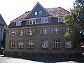
Former school

former Berstadt-Wohnbach train station

Berstadt dance court

.JPG)
.JPG)

.JPG)


See also
literature
- Christian Aledter: The historic Berstadt from 852 - 1972. Wölfersheim 1980.
- Franz J. Beranek: Imperial visits to Berstadt. (= Wetterauer Geschichtsblätter (WGBll) 11), 1962, pp. 7-21
- Wilhelm Butte : Static = political and cosmopolitan views into the Hessen = Darmstadt region. 2 vols., Giessen 1804.
- Fritz H. Herrmann: A Berstadt episode from the Thirty Years War . In: WGBll. 1 (1952), p. 113 f.
- Ingo Kattenberg: Markwald Berstadt. Diploma thesis Göttingen, 1994.
- Eugen Riess, Willy Roth: Berstadt. People and history. 2 vol., Verlag Bingel, Rockenberg 2005, ISBN 3-923907-08-7
- Eugen Riess, Willy Roth: Berstadt. People and history. Vol. 3. 1200 years of Berstadt. Our village 817 - 2017 . Friedberg Hessen, ISBN 978-3-00-056100-9 .
- Herta Wolf-Beranek: Lundendorf in South Moravia and Berstadt in the Wetterau in an imperial charter from the year 1056. (= Büdinger Geschichtsblätter 1974/75), pp. 176-181.
Web links
- Berstadt on the website of the municipality of Wölfersheim
- "Berstadt, Wetteraukreis". Historical local dictionary for Hessen. (As of March 15, 2016). In: Landesgeschichtliches Informationssystem Hessen (LAGIS).
- Literature about Berstadt in the Hessian Bibliography
- History of Berstadt at the Berstadt Village Development Working Group.
Individual evidence
- ↑ Population figures HW. In: Internet presence. Wölfersheim community, archived from the original on August 26, 2016 ; accessed in November 2018 .
- ^ Ernst Friedrich Johann Dronke : Traditiones et Antiquitates Fuldenses 1844. (TAF) ND 1966, cap. 42. No. 140, 159
- ^ Eugen Riess, Willy Roth: Berstadt. People and history. Vol. 1: From the beginnings to the beginning of modern times. P. 35 ff.
- ^ Reinhard Reuter: Villages in Hessen. Vol. 3, p. 118
- ↑ Christian Aledter: Chronicle Berstadt or Ernst Förstemann : Althochdeutsches Namenbuch I: personal names. Reprint of the 2nd completely revised edition, Munich 1966, p. 281. Förstemann makes a false reference to the personal name "Berht" and interprets the place name as "St Place des Berhto".
- ^ Jürgen Steen, Kings and nobility in the early medieval settlement, social and agricultural history of the Wetterau. Frankfurt am Main 1917 = Writings of the Historisches Museum Frankfurt am Main , p. 92 f
- ↑ Eugen Rieß, Willy Roth, Berstadt , vol. 1, p. 36 ff.
- ↑ TAF cap. 42; No. 140, 159
- ^ DH III Harry Bresslau / Paul Fridolin Kehr edit., The documents of Heinrich III. = Monumenta Germaniae Historica. The documents of the German emperors 5, 1926 - 1931, reprint 1993
- ↑ DH III, 376
- ^ DH IV = Dietrich von Gladiß / Alfred Gawlik , arr., The documents of Heinrich IV. = Monumenta Germaniae Historica. The documents of the German emperors 6, 1941 - 1978, 208, or
- ↑ DH IV 232 or
- ^ Albert Huyskens : Studies on the history of St. Elsabeth, Landgrave of Thuringia . Marburg 1908, No. 55, p. 20
- ↑ quoted from: Heinrich Meyer zu Ermgassen: The Codex Eberhardi of the Fulda Monastery. Vol. 2, No. 140, p. 210
- ↑ This is especially true for Edmund Ernst Stengel : Document book of the Fulda monastery. Vol. I, 2, pp. XXXII
- ↑ Meyer to Ermgassen: Codex Eberhardi. Vol. 1, p. X
- ↑ cf. total Eugen Rieß, Willy Roth: Berstadt - people and history. 2 Vols. Rockenberg 2005. Vol. 1: From the beginnings to the modern age. Vol. 2: New times. Here: Vol. 1, pp. 341-361.
- ↑ Monument topography of the Federal Republic of Germany . Cultural monuments in Hessen. Wetteraukreis II. Spangenberg 1999, p. 1034
- ^ Reinhard, Reuter, Christoph Beck: Villages in Hessen. Vol. 3: Between Taunus, Vogelsberg and Main. (Ed.) State Office for Monument Preservation , Wiesbaden 2004; P. 118
- ^ Reinhard Reuter, Christoph Beck: Villages in Hessen. P. 119
- ↑ March 3, 1353: "Heinrich Echzilere scheffene zu Berstad [called]", Baur, AUB , No. 801, p. 494f
- ↑ Baur, AUB , No. 801, p. 495, footnote
- ↑ Baur, AUB , No. 995, p. 608
- ↑ Baur, AUB , No. 1100, p. 669
- ^ Eugen Riess, Willy Roth: Berstadt. Vol. 1; P. 349
- ^ Eugen Riess, Willy Roth: Berstadt. Vol. 1, p. 349
- ↑ Ludwig Baur, document book of the Arnsburg monastery in der Wetterau (AUB), Darmstadt 1851, No. 1041, p. 631
- ↑ Dieter Wolf , On the medieval fortification of villages and spots in the Wetterau - with special consideration of Rodheim in front of the height. in: Rodheimer Hefte Nr. 2, 1996, pp. 25-83.
- ↑ Waldemar Küther , Grünberg. Grünberg 1972, p. 105
- ↑ Dieter Wolf, ma. Fortifications, p. 90
- ↑ Friedrich Battenberg , Solmser Urk. Vol. I .: Documents regesten . Darmstadt 1981, no.790
- ^ Eugen Riess, Willy Roth: Berstadt. Vol. 1, p. 344
- ↑ Monument topography Berstadt. P. 1034
- ↑ Ludwig Baur, Hess. Document I. No. 892, p. 602
- ^ Johann Friedrich Schannat , Historia Fuldensis. Codex Probantionum. Frankfurt 1729, No. 176
- ↑ Eugen Riess, Willy Roth, Berstadt. Vol. 1, pp. 341-348.
- ↑ On ancient and modern grave robbers . In: Gießener Allgemeine Zeitung , February 6, 2009. Accessed June 7, 2012.
- ↑ The excavation report was handed over to the municipality (press release) hallo-wetterau.de. June 26, 2008. Archived from the original on January 29, 2012. Info: The archive link was automatically inserted and not yet checked. Please check the original and archive link according to the instructions and then remove this notice. Retrieved June 7, 2012.
- ↑ Merovingians visiting the town hall . woelfersheim.de. October 14, 2010. Retrieved June 7, 2012.
- ^ Johann Philipp Dieffenbach : To the prehistory of the Wetterau. In: Archives for Hessian History. Vol. IV, p. 12, also ders .: Excerpt from the diary of a trip undertaken on behalf of the historical association. III. Department, the southern and western part of the province of Upper Hesse. In: Archive for Hessian History (AHG). 5, 1848, p. 135. See also Niddaer Kreisblatt No. 24 of 1845. For the Franconian settlement history of Berstadt cf. overall Eugen Rieß, Willy Roth, Berstadt. Vol. 1, pp. 31-35
- ^ Germania. Scoreboard of the Roman-Germanic Commission of the German Archaeological Institute . Special print 19, 1935, no. 2, p. 169
- ↑ On the settlement history of the Merovingian Franks in the Wetterau cf. Andreas Thiedmann: The grave finds of the Merovingian period in the Wetterau. 2 vol., Marburg 1995
- ↑ Complete presentation by Eugen Rieß, Willy Roth: Berstadt. Vol. 1, pp. 50 - 52, for the first time in detail with Franz J. Beranek: Imperial visits to Berstadt in the 11th century. In: Wetterauer Geschichtsblätter (WGBll). 11, 1961; Pp. 7-21
- ↑ Beranek: Imperial visits. P. 13 ff, Wolf-Arno Kropat : Empire, nobility and church in the Wetterau. = WGB ll, 15, 1965, p. 116
- ^ Michael Gockel: Berstadt (B) district of Wölfersheim (Wetteraukreis). In: The German royal palaces. Repertory of the Palatinate, royal courts and other places of residence in the German Empire in the Middle Ages. Vol. 1, Hessen, 1st delivery Berstadt-Eschwege, Göttingen 1983, pp. 1-15
- ↑ Waldemar Küther: 1200 years of Echzell. P. 55
- ↑ DH III 376 MGH DD, p. 518
- ^ DH III 377
- ↑ DH IV 208 or. St. 2717
- ↑ DH IV 232 or. 2734
- ↑ DH IV 262b or. St. 2781
- ^ Federal Statistical Office (ed.): Historical municipality directory for the Federal Republic of Germany. Name, border and key number changes in municipalities, counties and administrative districts from May 27, 1970 to December 31, 1982 . W. Kohlhammer GmbH, Stuttgart and Mainz 1983, ISBN 3-17-003263-1 , p. 360 .
- ↑ Eugen Rieß, Willy Roth: A pre-Reformation land monument in Berstadt. Berstadt, Vol. 1, pp. 178-181
- ↑ printed in: Eugen Rieß, Willy Roth, Berstadt, Vol. 1, p. 227; See also Eugen Rieß: A Berstadt tombstone tells a chapter in the church history of the large community after the Reformation. In: Wölfersheimer Anzeiger. 12, 2000, No. 1 of January 7, 2000, pp. 1 and 15
- ↑ www.tanzhof.de
- ^ Eugen Rieß, Willy Roth, family archive in the Darmstadt State Archive . in: Eugen Rieß, Willy Roth, Berstadt. People and history. Vol. 3: 1200 years of Berstadt. Our village 817 - 1200 . Friedberg 2017, pp. 202-204.
- ↑ Eugen Riess, Willy Roth, Berstadt. Vol. 2, p. 349
- ↑ Bernd Jäger, The lignite mining in the northern Wetterau and the visible and invisible changes in the landscape . in: Eugen Rieß, Willy Roth, Berstadt. People and history. Vol. 3: 1200 years of Berstadt. Our village 817 - 1200 . Friedberg 2017, pp. 207-217.
- ↑ cf. overall: Eugen Rieß, Willy Roth, Berstadt. Vol. 2, p. 349 f
