
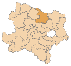
Hollabrunn district
| location | |
|---|---|
  |
|
| Basic data | |
| state | Lower Austria |
| NUTS III region | AT-125 |
| Administrative headquarters | Hollabrunn |
| surface | 1011 km² |
| Residents | 51,033 (January 1, 2020) |
| Population density | 50 inhabitants / km² |
| License Plate | HL |
| District Commission | |
| District Captain | Andreas Strobl |
| website |
www.noel.gv.at/Bezirke/ BH-Hollabrunn |
| map | |
  |
|
The Hollabrunn district ("Oberhollabrunn" until 1927) is an administrative district of the Province of Lower Austria .
history
A fundamental reorganization of the political administration in 1849 resulted in the establishment of the district, which was officially effective from 1850. Initially with the judicial districts of Oberhollabrunn and Haugsdorf. In 1854 the district, which was then run under the name Oberhollabrunn, was dissolved and rebuilt on August 31, 1868 and at the same time expanded to include the judicial districts of Retz and Ravelsbach (previously at BH Horn).
District captains
- until 2005 Josef Kronister
- 2006–2017 Stefan Grusch
- since 2017 Andreas Strobl
geography
It borders Moravia ( Czech Republic ) in the north . In terms of landscape, it is part of the Weinviertel except for the extreme northwest, which is part of the Waldviertel . For the spatial planning of the country it belongs completely to the main region Weinviertel .
Neighboring districts
| Jihomoravský kraj (Cz) | ||
| Horn district |
.svg)
|
Mistelbach district |
| Krems-Land district | Tulln district | Korneuburg district |
Administrative division
 The Hollabrunn district is divided into 24 communities , including 6 towns and 15 market communities.
- Regions are small regions in Lower Austria
| local community | location | Ew | km² | Ew / km² | Judicial district | region | Type | Metadata |
|---|---|---|---|---|---|---|---|---|
Alberndorf in the Pulkau Valley
|

|
745 | 9.88 | 75 | Hollabrunn | Pulkautal | local community |
According to code: 31001 |
Goellersdorf
|

|
3,064 | 59.65 | 51 | Hollabrunn | market community |
According to code: 31008 |
|
Digging
|

|
1,694 | 30.94 | 55 | Hollabrunn | market community |
Acc. To code: 31009 |
|
Guntersdorf
|

|
1,154 | 28.41 | 41 | Hollabrunn | market community |
According to code: 31014 |
|
Hadres
|

|
1,704 | 34.46 | 49 | Hollabrunn | Pulkautal | market community |
According to code: 31015 |
Hardegg
|

|
1,305 | 93.2 | 14th | Hollabrunn | Taffa Thaya game | urban community |
According to code: 31016 |
Haugsdorf
|

|
1,551 | 21.24 | 73 | Hollabrunn | Pulkautal | market community |
According to code: 31018 |
Heldenberg
|

|
1,347 | 27.47 | 49 | Hollabrunn | Schmidatal | local community |
According to code: 31019 |
Hohenwarth-Mühlbach on Manhartsberg
|

|
1.310 | 43.54 | 30th | Hollabrunn | Schmidatal | market community |
Acc. To code: 31021 |
Hollabrunn
|

|
11,882 | 152.43 | 78 | Hollabrunn | urban community |
Acc. To code: 31022 |
|
Mailberg
|

|
575 | 15.73 | 37 | Hollabrunn | Pulkautal | market community |
According to code: 31025 |
Maissau
|

|
1,935 | 43.1 | 45 | Hollabrunn |
Manhartsberg Schmidatal |
urban community |
According to code: 31026 |
Nappersdorf-Kammersdorf
|

|
1,224 | 38.85 | 32 | Hollabrunn | market community |
Acc. To code: 31028 |
|
Pernersdorf
|

|
1,017 | 25.82 | 39 | Hollabrunn | Pulkautal | market community |
According to code: 31033 |
Pulkau
|

|
1,538 | 36.72 | 42 | Hollabrunn | Retz country | urban community |
According to code: 31035 |
Ravelsbach
|

|
1,603 | 26.34 | 61 | Hollabrunn | Schmidatal | market community |
According to code: 31036 |
Retz
|

|
4,255 | 45.02 | 95 | Hollabrunn | Retz country | urban community |
Acc. To code: 31037 |
Retzbach
|

|
1,022 | 18.15 | 56 | Hollabrunn | Retz country | local community |
According to code: 31038 |
Schrattenthal
|

|
865 | 22.41 | 39 | Hollabrunn | Retz country | urban community |
According to code: 31041 |
Seefeld-Kadolz
|

|
945 | 21.85 | 43 | Hollabrunn | Pulkautal | market community |
According to code: 31042 |
Sitzendorf on the Schmida
|

|
2.141 | 61.83 | 35 | Hollabrunn | Schmidatal | market community |
According to code: 31043 |
Wullersdorf
|

|
2,352 | 63.89 | 37 | Hollabrunn | market community |
According to code: 31051 |
|
Zellerndorf
|

|
2,425 | 41.15 | 59 | Hollabrunn | Retz country | market community |
According to code: 31052 |
Ziersdorf
|

|
3,380 | 48.69 | 69 | Hollabrunn | Schmidatal | market community |
According to code: 31053 |
Population development
In 1890 the population of the district reached its highest level with 77,584 people, because since then the population has been steadily decreasing in contrast to the state. Currently (January 1, 2020) 51,033 people live in the district.

See also
Web links
Individual evidence
- ^ ÖNB-ALEX - State Law Gazette Lower Austria 1848-1971. Retrieved January 10, 2020 .
- ↑ Wutte, Heidemarie Sabine: The territorial development of administration and jurisdiction in Lower Austria and Vienna from 1848 to today / presented by: Heidemarie Sabine Wutte . Graz 2015.
Statutory cities: Krems an der Donau | St. Pölten | Waidhofen an der Ybbs | Wiener Neustadt
Administrative districts: Amstetten | Bathing | Bruck an der Leitha | Gänserndorf | Gmünd | Hollabrunn | Horn | Korneuburg | Krems | Lily field | Melk | Mistelbach | Mödling | Neunkirchen | St. Pölten | Scheibbs | Tulln | Waidhofen an der Thaya | Wiener Neustadt | Zwettl
Former districts: Floridsdorf area | Groß-Enzersdorf | Hernals | Hietzing | Hietzing area | Pöggstall | Six house | Währing | Vienna Area
Former branch: Pöggstall
Coordinates: 48 ° 34 ' N , 16 ° 5' E