
Blonay
| Blonay | |
|---|---|
 |
|
| State : |
|
| Canton : |
|
| District : | Riviera-Pays-d'Enhaut |
| BFS no. : | 5881 |
| Postal code : | 1807 |
| Coordinates : | 558 219 / 146 140 |
| Height : | 618 m above sea level M. |
| Height range : | 437–1888 m above sea level M. |
| Area : | 16.07 km² |
| Residents: | 6173 (December 31, 2018) |
| Population density : | 384 inhabitants per km² |
| Website: | www.blonay.ch |
 View over the town center and Lake Geneva |
|
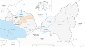
| Location of the municipality | |
  |
|
Blonay with the quarters Tercier and Cojonnex is a village in the political municipality of the same name in the Riviera-Pays-d'Enhaut district above Vevey and Montreux on the Vaud Riviera in the canton of Vaud in Switzerland .
geography

Blonay is 618 m above sea level. M. , 4 km east of the district capital Vevey (air line). The village extends on a terrace on the southwest slope of the Pléiades, between the streams of Baye de Clarens in the south and Ognona in the north, in a panoramic position around 250 m above lake level of Lake Geneva , above Vevey.
The area of the 16.0 km² municipal area covers a section of the western Vaudois Alps. The westernmost part of the municipality with the village of Blonay is located on the slopes gently sloping towards Lake Geneva at the foot of the Pléiades . In the south, this slope is bounded by the Baye de Clarens valley cut . To the northeast, the municipality extends over the pre-alpine panoramic mountain Les Pléiades ( 1361 m above sea level ) into the strongly reliefed terrain in the headwaters of the Baye de Clarens torrent. The municipal area also includes the forest and alpine pastures covered northern slopes of Le Folly ( 1730 m above sea level ) and Le Molard ( 1751 m above sea level ) and extends to the upper reaches of the Veveyse de Fégire . The highest point of Blonay is 1892 m above sea level. M. on Le Pila , a summit in the chain between Moléson and Rochers de Naye . In 1997, 17% of the municipal area was in settlements, 45% in forests and woodlands, 35% in agriculture and a little more than 3% was unproductive land.
The political municipality of Blonay with the quarters Tercier and Cojonnex also includes the settlements of Tusinge ( 720 m above sea level ) and Les Chevalleyres ( 758 m above sea level ) above the village, Ondallaz ( 1090 m above sea level ) and Lally ( 1241 m above sea level ) on the south and south-east slopes of the Pléiades as well as numerous individual farms, Alpine settlements and holiday homes. Neighboring municipalities of Blonay are Montreux , La Tour-de-Peilz and Saint-Légier-La Chiésaz in the canton of Vaud and Châtel-Saint-Denis and Haut-Intyamon in the canton of Friborg .
population
| Population development | |
|---|---|
| year | Residents |
| 1850 | 832 |
| 1900 | 1048 |
| 1910 | 1177 |
| 1930 | 1247 |
| 1950 | 1351 |
| 1960 | 1482 |
| 1970 | 2116 |
| 1980 | 3109 |
| 1990 | 4239 |
| 2000 | 4695 |
With 6,173 inhabitants (as of December 31, 2018), Blonay is one of the medium-sized municipalities in the canton of Vaud. 82.7% of the residents are French-speaking, 8.8% German-speaking and 3.9% English-speaking (as of 2000). The population of Blonay increased slowly but steadily in the first half of the 20th century. A marked increase in population has been recorded since 1960, which has tripled the number of inhabitants within 40 years. Today the settlement area of Blonay has merged seamlessly with that of Saint-Légier-La Chiésaz.
economy
Until the beginning of the 20th century, Blonay was a predominantly agricultural village. With the improved transport links through the railway line Vevey-Saint-Légier-Blonay-Chamby (1902) the economic and tourist development began.
Today agriculture with arable farming , fruit growing and viticulture in the lower elevations as well as dairy farming and cattle breeding in the upper parts of the municipality only has a subordinate role in the income structure of the population. On the optimally sunny southern slopes below Blonay, around 50 hectares of wine are grown. Further jobs are available in local small businesses and especially in the service sector. In addition to everyday goods, Blonay's business is also geared towards tourism. In recent decades the village has developed into a residential community thanks to its attractive location (with a view of the Alps and across Lake Geneva to the Jura). A large number of those in employment are commuters who work in the Vevey-Montreux region, sometimes also in Lausanne .
tourism
Blonay with its castle, the Les Pléiades lookout point and the museum railway is a popular destination for day tourism. In winter there is skiing and cross-country skiing on the slope of the Pléiades.
traffic

The community has good transport links and is accessible from both Vevey and Montreux . The nearest motorway connections to the A9 motorway (Lausanne – Sion), which opened in 1970 and crosses the municipality, are at Vevey (in the west) and at Montreux (in the east), each around two kilometers from the town center.
On October 1, 1902, the meter-gauge railway line Vevey-Saint-Légier-Blonay-Chamby was opened by what was then Chemins de fer électriques Veveysans (CEV) with several stops in town. On July 8, 1911, the also meter-gauge railway line Blonay – Les Pléiades was opened by the former railway company of the same name Blonay – Les Pléiades (BP), which initially operated as a pure cog railway only between Blonay and Les Pléiades.
On November 23, 1911, the Clarens – Chailly – Fontanivent – Blonay meter-gauge railway was opened by the Clarens – Chailly – Blonay (CCB) railway company . On January 1, 1956, buses took over and the railway line was demolished.
On May 21, 1966, rail traffic on the Blonay – Chamby line was discontinued without replacement. On July 20, 1968, the first museum railway in Switzerland was opened on this railway line , the Blonay – Chamby (BC) museum railway .
history
The place was first mentioned in a document in 861 under the name Blodennaco . Numerous other names appeared later: Bloniacum (1090), Bloniaco (1108), for the first time Blonay (1142), Blenai (1147), Blanay and Blanoi (1163), Bleniacum (1176), Blonacho (1177), Blunais (1215), Blunai (1236), Blunaium (1250) and Blognay (1330). The place name is probably derived from the Gallo-Roman personal name Blanius .
Blonay had been the center of an important rule since the 11th century, which also included Saint-Légier-La Chiésaz, Vevey and Corsier. In the second half of the 13th century, the Lords of Blonay became vassals of the House of Savoy . From then on, they held influential offices in Vaud under the rule of Savoy. Lordship and the castle were always owned by the Lords of Blonay. They did not have to sell until 1750 because of financial difficulties. However, the castle was bought back in 1806 by a descendant of the Blonay line.
The Bishop of Lausanne donated the Blonay church to the Molesme Abbey in France in the 12th century . This established a small priory in the village, which was subordinate to the Saint-Sulpice priory . With the conquest of Vaud by Bern in 1536, Blonay came under the administration of the Bailiwick of Vevey . The Reformation was introduced, the priory was secularized and its rights were transferred to the city of Lausanne. After the collapse of the Ancien Régime , Blonay belonged to the canton of Léman from 1798 to 1803 during the Helvetic Republic , which then became part of the canton of Vaud when the mediation constitution came into force . In 1798 it was assigned to the Vevey district. Since 1811, a sulfur spring in the headwaters of the Baye de Clarens has been expanded into the Bains-de-l'Alliaz spa and used until the beginning of the 20th century. From 1953 until his death in 1963, the composer and musician Paul Hindemith lived in his Villa La Chance in Blonay. The Hindemith Foundation has been based in Blonay since the death of his wife in 1967 . The foundation maintains a Hindemith music center there and supports the Hindemith Institute in Frankfurt am Main.
Attractions
The Saint-Antoine chapel in Tercier was built in 1503 and restored in 1981. The Catholic chapel Sainte-Croix dates from the 1930s. Blonay belongs to the parish of Saint-Légier-La Chiésaz.
An outstanding building is the imposing Blonay Castle standing on a hill northwest of Blonay , the original structure of which dates from the 12th century; however, numerous alterations were made later.
The house, Villa La Chance , of the famous German composer Paul Hindemith , who lived in Switzerland from 1938 to 1940 and again from 1953, is also in Blonay. Numerous courses, seminars and working weeks are held there.
Personalities
- Louise Odin , linguist
Web links
- Official website of the municipality of Blonay (French)
- Elisabeth Salvi: Blonay. In: Historical Lexicon of Switzerland .
- Aerial views of the village
- Museum Railway Blonay – Chamby (BC)
- Paul Hindemith Center Blonay
Individual evidence
- ↑ Permanent and non-permanent resident population by year, canton, district, municipality, population type and gender (permanent resident population). In: bfs. admin.ch . Federal Statistical Office (FSO), August 31, 2019, accessed on December 22, 2019 .
Blonay | Chardonne | Château-d'Oex | Corseaux | Corsier-sur-Vevey | Jongny | Montreux | Rossinière | Rougemont | Saint-Légier-La Chiésaz | La Tour-de-Peilz | Vevey | Veytaux
Former municipalities: Montreux-Châtelard | Montreux Planches
Canton of Vaud | Districts of the canton of Vaud | Municipalities of the canton of Vaud