Burgstall Knickhagen
| Knickhagen Castle | ||
|---|---|---|
|
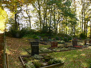
Cemetery on the former castle grounds |
||
| Creation time : | in the Middle Ages ; the exact period of construction is unknown | |
| Castle type : | Höhenburg, hillside location | |
| Conservation status: | Wall and moat remains | |
| Standing position : | unknown | |
| Place: | Knickhagen | |
| Geographical location | 51 ° 23 '57 " N , 9 ° 33' 11.5" E | |
| Height: | 200 m above sea level NHN | |
|
|
||
The Postal Knickhagen is an Outbound Höhenburg ( hillside castle ) from the Middle Ages in Knickhagen in the district of Kassel, in northern Hessen ( Germany ).
Geographical location
Knickhagen Castle stood in the southern foothills of the Reinhardswald in Knickhagen, which is now part of the municipality of Fuldatal . It was located around 600 m south-southwest below the summit of the Steinkopf (approx. 250 m above sea level ) on a slope above the Osterbach at the site of today's village cemetery (approx. 200 m ). The "Eco path, cultural history Knickhagen − Wilhelmshausen" leads past.
history
The time of the plant is unclear, documents have not been handed down. Parallels are drawn to the emergence of castles during the safeguarding of the Reinhardswald during the Carolingian era, around the 8th to 10th centuries. An investigation on July 7th and 8th, 1893, in which three sectional profiles were created, revealed medieval remains and black-brownish pot shards that were assigned to prehistoric times. The finds brought to the Hessisches Landesmuseum in Kassel were destroyed by bombing raids in 1943 during World War II.
It is not known when the castle was abandoned, abandoned and fell into disrepair. The castle site was mentioned as "Königsberg" until the 19th century. A road or field path from this point along the edge of the forest to the east is still called "The Castle" today.
investment
The slightly trapezoidal complex was probably protected on all sides by a wall system with a pointed moat. Today the Burgstall is only visible from the elevation and the eastern wall and moat. Another upstream section wall in the east can still be seen in the area. The remaining parts of the ramparts were destroyed by sand mining and road construction. The north and west flanks were additionally protected by natural steep slopes to the Osterbach, which flows around the Burgstall in the western valley in an arc. The original access to the facility is presumed to be in the south, but it can no longer be seen whether the rampart secured the southern part. Since investigation sections were only made in the ramparts, no statements can be made about internal development.
Individual evidence
- ↑ a b c Knickhagen Castle , on eco-pfade.de
- ↑ Eco path cultural history Knickhagen − Wilhelmshausen , on eco-pfade.de
Web links
- Information and pictures: Knickhagen Castle , on planetground.de


