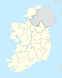
Donegal
| Donegal Dún na nGall Donegal |
||
|---|---|---|
|
|
||
| Coordinates | 54 ° 39 ′ 16 ″ N , 8 ° 6 ′ 39 ″ W | |
| Symbols | ||
|
||
| Basic data | ||
| Country | Ireland | |
| Ulster | ||
| county | Donegal | |
| ISO 3166-2 | IE-DL | |
| height | 9 m | |
| surface | 2.7 km² | |
| Residents | 2618 (2016) | |
| density | 987.9 Ew. / km² | |
| Telephone code | +353 (0) 74 | |
| Website | www.donegaltown.ie (English) | |
Donegal ( Irish Dún na nGall 'Fortress of the Strangers' ) is a city in the north-west of the Republic of Ireland .
Although Donegal is named for the northernmost Irish county in the south-west of which the city is located, Donegal is neither the main town nor the administrative seat (this is Lifford ) nor the largest town in the county (this is Letterkenny ). The 2016 census found the population of Donegal to be 2,618.
geography
Donegal is located near the tip of Donegal Bay and is traversed by the River Eske, which flows into the Atlantic Ocean southwest of Donegal . North of Donegal lie the Bluestack Mountains , which stretch like a natural barrier between the southern and northern parts of the county.
| Donegal | ||||||||||||||||||||||||||||||||||||||||||||||||
|---|---|---|---|---|---|---|---|---|---|---|---|---|---|---|---|---|---|---|---|---|---|---|---|---|---|---|---|---|---|---|---|---|---|---|---|---|---|---|---|---|---|---|---|---|---|---|---|---|
| Climate diagram | ||||||||||||||||||||||||||||||||||||||||||||||||
| ||||||||||||||||||||||||||||||||||||||||||||||||
history
Archaeological finds indicate that the area around Donegal was already settled in prehistoric times. In 1159, according to records, a Danish Viking fortress was destroyed here by the Irish high king Muirchertach Mac Lochlainn . The name "Fortress of Strangers" is also attributed to the Viking settlement.
Later, Donegal was the seat of the O'Donnell clan , who played a central role in Irish history and represented the main opposition to the English conquerors from the 15th to the beginning of the 17th century, until the flight of the counts .
The O'Donnell family founded the Franciscan monasteries Magherabeg and Donegal on Donegal Bay south of the city center in the 15th century .
traffic
Despite its small size and lack of administrative importance, Donegal is widely known as it is passed by all tourists entering County Donegal via Sligo and Ballyshannon from the west of Ireland . After the expansion of the road system in Ireland in the 1990s and 2000s, through traffic now flows past Donegal on the N15 or N56 , with the N56 starting in Donegal and as a circular route via Killybegs , Glenties , Dungloe , Gweedore , Gortahork , Falcarragh and Dunfanaghy opens up the west and north of the county and then returns to Donegal via Letterkenny and Stranorlar as the N15.
Via the small Donegal Airport near Dungloe, the county is connected twice a day by Aer Lingus with Dublin and five times a week by the Scottish Loganair with Glasgow in Scotland (as of 2018). However, the main part of public transport is handled by Bus Éireann , as everywhere in Ireland , which connects Donegal via Enniskillen (NI) with Dublin and via Letterkenny with Derry in Northern Ireland and via Sligo with Galway in the central west of Ireland; two small private companies also serve (mostly once a day) places in County Donegal that Bus Éireann does not serve. At the railway in Ireland , has the country's only marginal importance, Donegal has been disconnected since the 1960s. The former station building now houses the Donegal Railway Heritage Center, a railway museum that shows the history of the two narrow-gauge railways in County Donegal between 1863 and 1959.
Infrastructure
As a starting point and base for tourist excursions, Donegal has a large number of hotels, but for the local population the social infrastructure is rather unsatisfactory due to the lack of public facilities. There are also no large shopping centers on site.
Donegal Castle: Donjon (right), built by the O'Donnell clan
Attractions
- Donegal Castle
- Ruins of the Franciscan monastery founded in 1474
- Eske Castle
sons and daughters of the town
- Henry Joseph Clarke (1833–1889), Canadian politician and lawyer
- Angela Farrell (* 1952), pop singer
- Davey Arthur (* 1954), folk musician and singer-songwriter
- Mary Coughlan (* 1965), politician (Fianna Fáil)
- Séamus Coleman (* 1988), football player
- Stephen McLaughlin (* 1990), football player
- Jason Quigley (* 1991), professional boxer
Web links
Individual evidence
- ↑ Map of Ireland (can be enlarged greatly)
- ↑ Donegal (Town) on citypopulation.de, accessed on July 7, 2017 (English)
- ↑ Donegal Airport Timetable - website
- ^ County Donegal Railway Restoration Ltd. - website
- ↑ Eske Castle on solishotels.com


