
Flumenthal
| Flumenthal | |
|---|---|
 |
|
| State : |
|
| Canton : |
|
| District : | Livers |
| BFS no. : | 2545 |
| Postal code : | 4534 |
| Coordinates : | 612 115 / 231854 |
| Height : | 430 m above sea level M. |
| Height range : | 417–492 m above sea level M. |
| Area : | 3.11 km² |
| Residents: | 976 (December 31, 2018) |
| Population density : | 314 inhabitants per km² |
| Website: | www.flumenthal.ch |
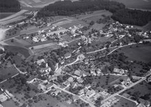
 View of Flumenthal |
|
| Location of the municipality | |
  |
|
Flumenthal (in the local dialect Flumedau ) is a municipality in the Lebern district in the canton of Solothurn in Switzerland .
geography
Flumenthal is a clustered village and is 430 m above sea level. M. , six kilometers east-northeast of the canton capital Solothurn (linear distance ). The municipality is located in the Unterer Leberberg region . The village extends slightly higher on the northern edge of the Aareniederung , near the mouth of the Siggern , at the southern foot of the Jura , in the Solothurn plateau . The Aarbächli flows through the municipality , a small tributary of the Aare, which does not carry any water on very warm days and freezes on very cold days.
The area of the 3.1 km² municipal area covers a section of the Solothurn Mittelland. The southern part of the municipality is taken up by the broad Aare lowlands, with a small part of the area with the Mösli and the Schachen establishment located south of the Aare. To the north, the municipality extends from the Aare level to the gravel terrace of Flumenthal ( 460 m above sea level ) and reaches 490 m above sea level at the height west of the village . M. the highest point in Flumenthal. In the east, the area is limited in parts by the lower reaches of the Siggern , a left tributary of the Aare. In 1997, 19 percent of the municipal area was in settlements, 26 percent in forests and woodland, 49 percent in agriculture and a little less than 6 percent was unproductive land.
Several individual farms belong to Flumenthal. These are the Egghof at 477 m above sea level. M. , the Scharlenmatt at 467 m above sea level. M. , the Höchi at 455 m above sea level. M. , the Flos at 430 m above sea level. M. , the Waldau at 422 m above sea level. M. , and the Unter dem Bord at 425 m above sea level. M. Neighboring communities of Flumenthal are Deitingen , Riedholz and Hubersdorf in the canton of Solothurn and Attiswil and Wangen an der Aare in the canton of Bern .
population
| Population development | |
|---|---|
| year | Residents |
| 1999 | 1025 |
| 2000 | 1022 |
| 2001 | 1023 |
| 2002 | 1018 |
| 2003 | 990 |
| 2004 | 1013 |
| 2005 | 999 |
| 2006 | 1016 |
| 2007 | 1017 |
| 2008 | 1003 |
The village has a total of 453 households (as of 2005). With 976 inhabitants (as of December 31, 2018), Flumenthal is one of the smaller communities in the canton of Solothurn. 95 percent of the residents speak German , 1.1 percent speak Albanian and 1.0 percent speak Italian (as of 2000). The population of Flumenthal was 346 in 1850 and 483 in 1900. In the middle of the 19th century, Yenish families were naturalized on the basis of the law to combat homelessness . In the course of the 20th century, the population increased continuously, especially after the cellulose factory was built in Attisholz. Flumenthal reached its highest level in 1999 with 1025 inhabitants.
economy
Until the second half of the 20th century, Flumenthal was a village dominated by agriculture . Today agriculture , fruit growing and cattle breeding have only a minor role in the income structure of the population. Numerous other jobs are available in local small businesses and especially in the service sector. In Flumenthal today there are companies in the building trade, the electrical industry, IT and carpentry shops. The cellulose factory in nearby Attisholz (municipality of Riedholz ) was closed in 2008. One now fears a population decline. There is a substation southeast of the village ; southwest of Flumenthal, the Aare is dammed by a run-of-river power plant on the soil of the municipality of Riedholz up to above Solothurn. In the last few decades the village has developed into a residential community. Many employed people are therefore commuters who mainly work in the Solothurn region.
The Scharlenmatt will also be developed for industrial and commercial buildings and will ultimately be sold. Furthermore, with the Lättackerstrasse and the Grubenackerweg, new space for residential buildings will be developed.
politics
The village is mainly shaped by the politics of the FDP and the SP. These are the municipal council members for the 2013–2017 legislative period:
- Heiniger Christoph (Mayor, FDP)
- Zubler Markus (Vice Mayor, FDP)
- Porta Daniel (FDP)
- Stampfli Nathalie (SP)
- Würsch Marianne (FDP)
Culture and leisure
Along the Aare and the Siggern there is a popular local recreation area that is well-known beyond the canton's borders. A small part of the Wylihof golf course south of the Aare is located in the municipality of Flumenthal.
The Kressmatt football field is used by the SC Flumenthal football club as a playing and training field. The SC achieved good results in the Solothurn League and was among the top 10.
The Flumenthal Music Society (founded in 1907) is one of the oldest clubs in Flumenthal and can look back on numerous successes.
traffic
The community has good transport connections. The center is next to the main road 5 , which leads from Solothurn to Olten . The nearest connection to the A1 motorway (Bern – Zurich) is around 5 km from the village. On January 9, 1918, the Solothurn-Niederbipp-Bahn line with a train station in Flumenthal was put into operation.
history


The municipality of Flumenthal was inhabited early on. For example, wall foundations of several Roman villas were discovered in the forest against attic wood . The first written mention of the place took place in 1228 under the name Blummenta . The names Blomentana (1285), Blumental (1312), Flumendal (1336) and Flumental (1374) appeared later . In the 17th century the spelling Flummenthal was used. The place name means something like grassy valley, since the Middle High German word bluome was also used to mean grass growth .
What makes Flumenthal stand out historically in its importance from the average is the importance of the Siggern as a border in the early Middle Ages . The relatively inconspicuous brook served for several centuries as a border marker between the two dioceses of Lausanne (Flumenthal side) and Basel ( Attiswil side; the area south of the Aare belonged to the diocese of Constance). At the time, this border was much more important than today's diocesan borders, because the episcopate was given a higher socio-political status. According to some indications (there are no written sources on this), today's canton border in the form of the Siggern formed at the time of the Merovingians in the 7th / 8th centuries. Century, so even earlier, also roughly the border between the tribal duchies of Burgundy (Flumenthaler side) and Alemannia (Attiswil side). Under the Carolingians , in addition to the dioceses, the administrative regions of Waldgau and Buchsgau also separated. According to the current map representations (some contradict each other) there was even a short border section along the Siggern as part of the pan-European division of Ribemont .
In the further course of the Middle Ages, Flumenthal came under the rule of Balm . Together with this rule, the village came to the Counts of Strassberg as an imperial fief in 1312 and, after various changes of ownership, to Solothurn in 1411. The city had already had high jurisdiction over Flumenthal since 1344. In the 15th century, the village was under the Bailiwick of Balm, which was expanded to include the court of Oberdorf before 1487 and from then on was listed as the Bailiwick of Flumenthal. The bailiwick area comprised the southern slope of the Jura between Bellach and Flumenthal, with the bailiff not having his seat in the area but in the city of Solothurn. Flumenthal served as the place of jurisdiction until 1798.
Since the Middle Ages, Flumenthal was the location of the parent church of the Balm rule and formed the center of the parish. It was not until 1695 that Günsberg was raised to the status of an independent parish. After the collapse of the Ancien Régime (1798), Flumenthal belonged to the Solothurn administrative district during the Helvetic and from 1803 to the Lebern district. After the cellulose factory was founded in neighboring Attisholz (municipality of Riedholz), Flumenthal also experienced a significant increase in population around 1900.
For some time now, discussions have been held in Unterleberberg about a merger of the communities of Riedholz , Hubersdorf , Günsberg , Kammersrohr , Niederwil , Balm bei Günsberg and Flumenthal themselves. On January 1, 2011, the municipalities of Riedholz and Niederwil merged; a merger with the participation of the municipality of Flumenthal has not yet come about.
Attractions

The church of St. Peter and Paul was given its current appearance when it was rebuilt in 1513. It contains significant frescoes from the time it was built, which were discovered during a renovation.
Public buildings
The Swiss Post has an office in Flumenthal, as does the Raiffeisenbank Solothurn. In Flumenthal there is also a bakery (which was closed in summer 2009) in the lower part of the village and a cheese dairy in the upper part of the village. The Gasthof Neuhüsli was founded in 1702 and is now the only restaurant in Flumenthal after the Post restaurant was closed. There are also other smaller businesses such as the Regina flower shop and a doctor's practice.
The primary school in Flumenthal is located in the center of the village on the gravel terrace and therefore has a beautiful view of the Swiss plateau and the Alps . The school, which has 6 classes, has a pavilion in which the Flumenthal kindergarten is housed.
coat of arms
- In yellow, a black head with a white headband and collar and red lips
The municipal coat of arms goes back to the former bailiwick coat of arms. It may indicate an earlier patronage; the present day is dedicated to the apostles Peter and Paul. Presumably, the portrayed is Saint Mauritius , the leader of the Theban Legion , to which the Solothurn city and country patrons St. Urs and St. Viktor also belonged. The village church was consecrated on September 22, 1514 on Mauritzentag by Bishop Aymon de Montfalcon , who had his own Thebaic chapel built and equipped in the cathedral of Lausanne .
Web links
- Official website of the municipality of Flumenthal
- Urs Zurschmiede: Flumenthal (community). In: Historical Lexicon of Switzerland .
Individual evidence
- ↑ Permanent and non-permanent resident population by year, canton, district, municipality, population type and gender (permanent resident population). In: bfs. admin.ch . Federal Statistical Office (FSO), August 31, 2019, accessed on December 22, 2019 .
- ↑ Canton of Solothurn: Population figures of the municipality of Flumenthal 1999-2006 ( page no longer available , search in web archives ) Info: The link was automatically marked as defective. Please check the link according to the instructions and then remove this notice.
- ^ B. Amiet: History of Solothurn , 1952
- ↑ B. Amiet: From history of Solothurn (teaching material), 1943
- ^ Putzger / Atlas zur Weltgeschichte , 2002; therein map to the division of the empire of Ribemont
Balm near Günsberg |
Bellach |
Bettlach |
Feldbrunnen-St. Niklaus |
Flumenthal |
Grenchen |
Günsberg |
Hubersdorf |
Chamber tube |
Langendorf |
Lommiswil |
Oberdorf |
Riedholz |
Rüttenen |
Selzach
Former municipality:
Niederwil
Canton of Solothurn | Districts of the Canton of Solothurn | Municipalities of the Canton of Solothurn