Tataouine Governorate
| تطاوين Tataouine
|
|
|---|---|
| Basic data | |
| Country | Tunisia |
| Capital | Tataouine |
| surface | 38,889 km² |
| Residents | 150,000 (2014) |
| density | 3.9 inhabitants per km² |
| ISO 3166-2 | TN-83 |
Coordinates: 32 ° 56 ' N , 10 ° 27' E
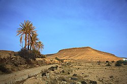
The Tataouine Governorate ( Arabic تطاوين, DMG Taṭāwīn ) is the southernmost and largest of the 24 governorates of Tunisia . The area is 38,889 km² (23.8% of the total area of Tunisia), but only about 150,000 people live in the area between 250 and 800 m high. The capital of the region is the city of the same name, Tataouine . The governorate as it is today was established on March 2, 1981 by separating part of the Medenine governorate. Parts of the Sahara area are restricted areas , residence is only permitted with official approval.
Geography and climate
The governorate of Tataouine is bounded in the north by the governorates of Kebili and Medenine , in the east it joins Libya and in the west Algeria . A large part of the south of the governorate lies in the Sahara and is shaped by the sand dunes of the Ergs .
The daytime temperatures in winter are 15 to 25 ° C; in summer temperatures around 35 ° C are the rule. At night it can cool down to almost 0 ° C when the sky is clear. The average annual rainfall is less than 150 millimeters.
economy
In earlier times, the date harvest in the few oases and the associated caravan trade played the main role in the economic life of the region. Today, agriculture made possible by irrigation dominates in the north. The Sahara tourism is also playing an increasing role; in addition, crude oil is produced in the southern area .
Administrative division
The Medenine Governorate is divided into 7 delegations :
| delegation | 2004 residents |
Residents 2014 |
|---|---|---|
| Bir Lahmar | 9,270 | 8,460 |
| Dahibah | 3,971 | 4,295 |
| Qom races | 18,335 | 15,957 |
| Remada | 9,977 | 10.173 |
| Smar | 13,826 | 14,793 |
| Tataouine North | 54,362 | 61,431 |
| Tataouine South | 33,783 | 34,344 |
| total | 143,524 | 149,453 |
history

The area around Tataouine was shaped by the caravan trade for centuries. The Romans secured the southern border of their empire through a Limes ( Limes Tripolitanus ), which consisted of numerous forts (including the Tillibari fort near Remada ). From the second half of the 7th century, Islam gradually took control of the region.
Culture
Apart from a few remains from Roman times, the Berber fortified and storage castles ( ksour ), including the Ksar Ouled Soltane or the partially abandoned mountain villages of Chenini and Douiret, bear witness to the history of the region. The stone-walled minarets and mosques did not appear until the 20th century; previously there were only simple prayer rooms made of rubble and clay - probably due to the semi-nomadic way of life .


