High hawk forest
| High hawk forest | |
|---|---|
|
Location of the High Habichtswald in the Habichtswälder Bergland |
|
|
High Habichtswald from the northwest ( Großer Bärenberg ) |
|
| Highest peak | Tall grass ( 614.8 m above sea level ) |
| location | Independent city of Kassel and the district of Kassel ; North Hesse ( Germany ) |
| part of | Habichtwald mountain country |
| Coordinates | 51 ° 18 '50 " N , 9 ° 22' 54" E |
| Type | Low mountain range |
| rock | Basalt , basalt tuff |
| surface | 38.21 km² |
The Hohe Habichtswald , mostly just called Habichtswald , is a 38.21 km² large, with the mountain Hohes Gras at a maximum of 614.8 m above sea level. NHN high and mainly wooded low mountain range in the area of the independent city of Kassel and in the northern Hessian district of Kassel . It is the (eponymous) part and the sub-natural area of the High Habichtswald of the low mountain range Habichtswälder Bergland, which is also often referred to as Habichtswald .
The eruptive stock was created by basaltic volcanism in the vicinity of the Mediterranean Mjosen Zone , an approximately 2000 km long fracture zone in the earth's crust in Europe .
The majority of the Hohen Habichtswald , which is located in the Habichtswald Nature Park , belongs to the area of the city of Kassel, whose buildings partially extend into the mountains; the rest are among several neighboring communities in the Kassel district.
The Hohe Habichtswald is internationally known through the Bergpark Wilhelmshöhe , which includes the Wilhelmshöhe Castle , the Hercules and the Löwenburg . The Kassel water games take place here.
geography
location
The Hohe Habichtswald , which is located in the eastern part of the Habichtswald Nature Park, is located directly west of the city of Kassel between the municipality of Ahnatal in the north, the municipality of Habichtswald in the north, northwest and west, the municipality of Schauenburg in the southwest and south and the town of Baunatal in the southeast. The highest mountain in the mountain range is the Hohe Gras ( 614.8 m ). The longest flowing waters that arise within the mountain range are the Fulda tributaries Ahne , Bauna and Drusel .
Natural allocation
The low mountain range forms in the natural spatial main unit group West Hessisches Bergland (No. 34), in the main unit Habichtswälder Bergland (342) and in the subunit Hoher Habichtswald (with Langenberg) (342.0) the natural area Hoher Habichtswald (342.00).
The landscape drops to the north to the natural area Dörnbergpass (342.30), which belongs to the subunit Dörnberg and Schreckenberge (342.3); in the latter, the Hohe Dörnberg massif rises . To the west it falls into the natural area Zierenberger Grund (342.11) belonging to the subunit Habichtswälder Basin (342.1) ; beyond that is the subunit Hinterhabichtswälder Kuppen (342.2) with the Great Bear Mountain . To the southwest and south, the landscape drops into the natural area Hoofer Pforte (342.01); beyond that, in the south, is the subunit Langenberg (342.02). To the south-southeast through east to northeast it falls into the large-scale subunit Kassel Basin (343.3), which is part of the main unit West Hessian Basin (343). From the eastern flank of the Hohen Habichtswald the natural area Kasseler Graben (343.31) advances like a spur into the Kassel Basin, to which the natural area Kasseler Fuldaaue (343.30), which is centrally located in the basin, adjoins.
description

The Hohe Habichtswald is a forest area with near-natural deciduous trees in which there are many meadows and pastures. With many hiking trails, it is a popular local recreation area in the North Hessian metropolitan area. In the varied forest areas there are also rare tree species (sycamore maple, sycamore elm and service tree). Many old beech stocks have naturally rejuvenated and now show multi-layered forest patterns.
There are some smaller lakes that can be traced back to basalt mining (e.g. Blauer See, Erlenloch, Höllchen and Silbersee). In addition, there are numerous ponds and reservoirs (e.g. Asch, Fontainenteich, Lac or Schlossteich and Sichelbachbecken ) within the Bergpark Wilhelmshöhe.
The forestry use is of great importance, whereby special consideration is given to the fauna and flora, which benefits the flora and fauna . The Hohe Habichtswald is a state forest, i.e. owned by the State of Hesse, and is looked after by the Wolfhagen Forestry Office and 3 foresters. Within the mountain range the visitor gets to see varied, beautiful forest images in many places, on many hikes one encounters large stands of spruce, young colorful mixed forests and old gnarled beeches, on the large forest meadows, which are mowed only once a year (August), flourish and bloom in the spring and summer months numerous, often rare, flowers and grasses.
Beautiful avenues with mountain ash, horse chestnut, whitebeam and fruit trees have been laid out along numerous forest paths and large meadows, which impressively show their brightly colored and bright fruits in autumn. The elongated Kastanienallee , for example , which is located in the area between the Herkules , the Essigberg and the Wuhlhagen, offers a beautiful picture for every nature lover .
From the many walking and hiking trails of the Hohe Habichtswald , where numerous forest restaurants invite you to linger, you can enjoy good views of the North Hessian landscape. Many forest paths are specially designed for hikers and have rest areas. The forest visitor does not have to do without art; In addition to the old trees, which have been artistically designed by nature, you will find the artist necropolis near the Blue Lake .
Windthrow damage from Kyrill
On the night of January 18-19, 2007, hurricane Kyrill hit the Hohen Habichtswald very hard with wind speeds of up to 200 km / h . Over 350,000 trees were uprooted or knocked over, which corresponds to about 150,000 solid meters . The areas have now been cleared of broken or thrown trees and new plantings of different tree species (beech, sycamore maple, ash, Douglas fir, etc.) have been made.
mountains

→ see also: List of mountains and elevations in the Habichtswald Nature Park
The mountains, elevations and their foothills of the Hohe Habichtswald include - sorted by height in meters (m) above sea level (NHN):
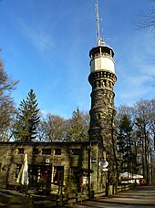
- High grass ( 614.8 m ) - with an observation tower from 1890 and a small ski area with ski lift
- Uhlenstein (approx. 607.5 m ) - western foothills of the Hohen Grass
- Essigberg (approx. 597.5 m ) - with Habichtswald telecommunications tower , fitness trail and ancestral source area
- Large cairn ( 597 m ) - with a cross-country ski run
- Ahrensberg (approx. 570 m ) - the Bauna spring is located on the southern slope
- Ziegenkopf ( 564.7 m ) - with the source of the Drusel ; until 1980 location of a wooden ski jump
- Kaulenberg (approx. 545 m ) - with the origin of the "Little Bauna "
- Elfbuchen (approx. 535 m ) - with an observation tower towered over by trees
- Karlsberg ( 526.2 m ) - location of Hercules at approx. 515 m height
- Großer Auskopf ( 518 m ) - Essigberg foothills
- Junkerkopf ( 466 m ) - with the Igelsburg castle ruins and nearby Silbersee
- Brasselsberg ( 434.2 m ) - with the Kassel Bismarck Tower observation tower
- Baunsberg ( 413.4 m ) - Baunatal's local mountain
In front of the Hohen Habichtswald northeast in the Kassel Basin is a ridge with this elevation adjoining the low mountain range:
- Firnskuppe ( 313.9 m ) - with nearby Daspel , the local mountain of the Kassel district of Harleshausen
Waters
In High Habichtswald or on its edges there are numerous water bodies , including:
Flowing waters |
Still watersin the Kassel part:
in the Habichtswalder part:
|
Mining
Lignite has been mined underground in the Hohen Habichtswald since the 16th century . Already in the Middle Ages it was extracted in open-cast mining , mostly to supply small glassworks . Minor turf iron stone occurrences were also processed. The last coal mines disappeared in the 1960s. Today there are only a few quarries left in which mainly basalt is mined; Especially for the purpose of the Hercules restoration, which has been taking place since 2005, an old quarry was opened near the Druseltal to extract Habichtswälder tuff . The Hercules Railway was used to transport coal and basalt from 1903 to 1961 .
Sightseeing and hiking
On the eastern flank of the Hohen Habichtswald , towards the city of Kassel, is the Bergpark Wilhelmshöhe with Wilhelmshöhe Castle , the Löwenburg and the Hercules , the starting point for the Kassel water games . The Elfbuchen observation tower , which is currently closed , is located a little north of the Hercules , a little below it is the Blue Lake with the artist necropolis . The hiking trails in the landscape include: Ederseeweg , Fulda-Diemel-Weg , Habichtswaldsteig , Herkulesweg , Kassel-Steig , Märchenlandweg and student path .
Individual evidence
- ↑ Martin Bürgener: Geographical Land Survey: The natural spatial units on sheet 111 Arolsen. Federal Institute for Regional Studies, Bad Godesberg 1963. → Online map (PDF; 4.1 MB)
- ^ Hans-Jürgen Klink: Geographical land survey: The natural space units on sheet 112 Kassel. Federal Institute for Regional Studies, Bad Godesberg 1969. → Online map (PDF; 6.9 MB)
- ^ Map and description in the Environmental Atlas of Hesse
- ↑ Heights according to the individual records mentioned in the Height column of the article List of mountains and elevations of the Habichtswald Nature Park
General sources
-
BfN
- Map services
- Landscape profile Habichtswälder Bergland
- "Geological overview map of Hessen". Historical atlas of Hessen. In: Landesgeschichtliches Informationssystem Hessen (LAGIS).
literature
- Habichtswald . In: Meyers Konversations-Lexikon . 4th edition. Volume 7, Verlag des Bibliographisches Institut, Leipzig / Vienna 1885–1892, p. 985.
Web links
- Map / aerial photo of the Habichtswald with borders and all important elevations / placemarks ( Google Earth required)


