
Lippstadt district
| coat of arms | Germany map | |
|---|---|---|

|
Coordinates: 51 ° 40 ′ N , 8 ° 21 ′ E |
|
| Basic data (as of 1974) | ||
| Existing period: | 1817-1974 | |
| State : | North Rhine-Westphalia | |
| Administrative region : | Arnsberg | |
| Regional association : | Westphalia-Lippe | |
| Administrative headquarters : | Lippstadt | |
| Area : | 508.17 km 2 | |
| Residents: | 113,500 (Dec. 31, 1973) | |
| Population density : | 223 inhabitants per km 2 | |
| License plate : | LP | |
| Circle key : | 05 8 36 | |
| Circle structure: | 60 parishes | |
| District Administrator : | Josef Raulf ( CDU ) | |
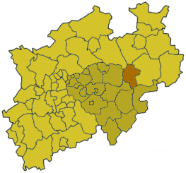
| Location of the Lippstadt district in North Rhine-Westphalia | ||
  |
||

The Lippstadt district was a district in the North Rhine-Westphalian administrative district of Arnsberg . It was on the southern edge of the Westphalian Bay between the Lippe and the Möhne .
geography
Neighboring areas
The district of Lippstadt bordered in 1972 in a clockwise direction in the northwest on the districts of Beckum , Wiedenbrück , Paderborn , Büren , Brilon , Meschede , Arnsberg and Soest .
history
The district of Lippstadt was formed in 1817 in the administrative district of Arnsberg in the Prussian province of Westphalia . It was initially divided into the six mayor offices of Anröchte, Erwitte, Geseke, Horn, Lippstadt and Rüthen. As part of the introduction of the rural community order for the province of Westphalia, the mayor's offices were dissolved in 1843 and replaced by the five offices of Anröchte, Altenrüthen, Erwitte, Horn and Störmede. The Horn office was dissolved again in 1845 and divided between the offices of Anröchte and Erwitte.
The initially free city of Rüthen came to the Altenrüthen office in 1937, which was also renamed the Rüthen office . In 1938, eight communities moved from the Anröchte office to the Erwitte office. On October 1, 1949, the two Lippian exclaves, Cappel and Lipperode, located near Lippstadt, were reclassified from the Detmold district as non-official communities in the Lippstadt district.
From September 28th to 30th, 1948, the second day of the association of the former regional associations of the German metalworkers association of the British occupation zone and the state of Bremen took place in Lippstadt. On this association day, IG Metall was founded for the British occupation zone and the state of Bremen. About a year later, on September 1, 1949, IG Metall was founded for the Federal Republic of Germany.
On October 1, 1969, the district became the district of Lippstadt.
As part of the North Rhine-Westphalian regional reform , the Lippstadt and Soest districts and parts of the Arnsberg district were merged into the new Soest district on January 1, 1975 by the Münster / Hamm Act .
Population development
| year | Residents | source |
|---|---|---|
| 1819 | 25,451 | |
| 1832 | 26,956 | |
| 1871 | 34,757 | |
| 1880 | 37.199 | |
| 1890 | 37,990 | |
| 1900 | 41.093 | |
| 1910 | 49.011 | |
| 1925 | 54,188 | |
| 1939 | 61,848 | |
| 1950 | 90.227 | |
| 1960 | 92,600 | |
| 1970 | 108,500 | |
| 1973 | 113,500 |
politics
Results of the district elections from 1946
The list only shows parties and constituencies that received at least two percent of the votes in the respective election.
Share of votes of the parties in percent
| year | CDU | SPD | FDP | DZP | BHE | KPD |
|---|---|---|---|---|---|---|
| 1946 | 65.3 | 23.6 | 6.3 | 4.5 | ||
| 1948 | 42.0 | 27.2 | 14.2 | 12.5 | 2.7 | |
| 1952 | 43.7 | 25.6 | 11.2 | 9.7 | 8.2 | |
| 1956 | 47.3 | 30.5 | 5.9 | 6.8 | 9.5 | |
| 1961 | 52.6 | 30.5 | 5.2 | 4.6 | 7.1 | |
| 1964 | 48.2 | 38.4 | 5.4 | 3.6 | 4.4 | |
| 1969 | 52.4 | 41.1 | 4.0 | 2.5 |
District administrators
- 1817–1821 Engelbert Matthias von Hörde
- 1821–1857 Maximilian von Schade
- 1857–1875 Wilhelm von Schorlemer , center
- 1875–1916 Ernst von Werthern
- 1917–1919 Friedrich Gorius
- 1920–1933 Maximilian Raitz von Frentz , center
- 1933 Ludwig Malzbender , NSDAP
- 1934–1935 Erich Flottmann , NSDAP
- 1936–1940 Heinrich Simon
- 1940 Heinrich Teipel , NSDAP (by order)
- 1940 Government Assistant Zielke (substitute)
- 1940–1945 Wieprecht von Kropff
- 1952–1954 Karl Schopp , CDU
- 1956–1971 Wilhelm Schröder , CDU
- 1971–1974 Josef Raulf , CDU
Upper District Directors
- 1946– Franz Liese
- 1959–1974 Franz Schlarmann
Offices and municipalities
Municipalities not in office
- Cappel (since 1949)
- Geseke , city
- Lipperode (since 1949)
- Lippstadt , city
- Rüthen , City (in the Rüthen office since 1937)
Offices
-
Office Anröchte
- Altengeseke
- Altenmellrich
- Anröchte
- Berenbrock (until 1938)
- mountains
- Böckum (until 1938)
- Ebbinghausen (until 1938)
- Horn-Millinghausen (until 1938)
- Klieve
- Mellrich
- Merklinghausen-Wiggeringhausen (until 1938)
- Norddorf (until 1938)
- Robringhausen
- Schallern (until 1938)
- Loach (until 1938)
- Seringhausen
- Uelde
- Waltringhausen
-
Office Rüthen (until 1937 Office Altenrüthen )
- Altenrüthen
- Drewer
- Effeln
- Inhibitors
- Hoinkhausen
- Kallenhardt
- Kellinghausen
- Kneblinghausen
- Langenstrasse-Heddinghausen
- Most (until 1911 Miste )
- Menzel
- Nettelstädt
- Oestereids
- Rüthen , City (in the Rüthen office since 1937)
- Suttrop
- Weickede
- Western Eiden
-
Office Erwitte
- Benninghausen
- Berenbrock (from 1938)
- Böckum (from 1938)
- Ebbinghausen (from 1938)
- Eikeloh
- Erwitte , town since 1936
- Hellinghausen
- Herringhausen
- Horn-Millinghausen (from 1938)
- Merklinghausen-Wiggeringhausen (from 1938)
- Norddorf (from 1938)
- Overhagen
- Schallern (from 1938)
- Loach (from 1938)
- Stirpe
- Völlinghausen
- Weckinghausen
- Western Kotten
-
Office Störmede
- Bökenförde
- Boenninghausen
- Dedinghausen
- Ehringhausen
- Eringerfeld (established as an estate district in 1898 , parish since 1928)
- Ermsinghausen
- Esbeck
- Langeneicke
- Mönninghausen
- Rixbeck
- Störmede
License Plate
On July 1, 1956, the district was assigned the distinctive sign LP when the vehicle license plates were introduced . It was issued until December 31, 1974. It has been available in the Soest district since December 3, 2012 ( license plate liberalization ).
References and comments
- ↑ a b Westphalia Lexicon 1832-1835 . In: Landschaftsverband Westfalen-Lippe (Ed.): Reprints for the Westphalian archive maintenance . tape 3 . Münster 1978, p. 84 (reprint of the original from 1834).
- ↑ Landgemeinde -ordnung for the Province of Westphalia from October 31, 1841 (PDF; 1.6 MB)
- ↑ Official Gazette for the administrative district of Arnsberg 1843, p. 322. Retrieved on February 2, 2014 .
- ↑ Official Gazette for the administrative district of Arnsberg 1843, p. 326. Retrieved on February 2, 2014 .
- ↑ Official Gazette for the administrative district of Arnsberg 1845, p. 344. Retrieved on February 2, 2014 .
- ^ Municipal constitution and municipal archives in the Soest district (Horst Conrad, 1978)
- ↑ 90 years of the metal industry union 1891 to 1981. IG Metall for the Federal Republic of Germany, 1981, Bund-Verlag GmbH Cologne, pp. 361–363.
- ↑ Announcement of the new version of the district regulations for the state of North Rhine-Westphalia from August 11, 1969 in the Law and Ordinance Gazette for the state of North Rhine-Westphalia, year 1969, No. 2021, p. 670 ff.
- ^ Federal Statistical Office (ed.): Historical municipality directory for the Federal Republic of Germany. Name, border and key number changes in municipalities, counties and administrative districts from May 27, 1970 to December 31, 1982 . W. Kohlhammer, Stuttgart / Mainz 1983, ISBN 3-17-003263-1 , p. 334 f .
- ^ Statistisches Bureau zu Berlin (Ed.): Contributions to the statistics of the Prussian state . Duncker & Humblot, Berlin 1821 ( digitized version ).
- ↑ a b Community encyclopedia Westphalia 1887 p. 131
- ↑ a b c d e f g Michael Rademacher: German administrative history from the unification of the empire in 1871 to the reunification in 1990. lippstadt.html. (Online material for the dissertation, Osnabrück 2006).
- ↑ Statistical Yearbook for the Federal Republic of Germany 1972
- ↑ Statistical Yearbook for the Federal Republic of Germany 1975
- ↑ Source: respective issue of the State Statistical Office (LDS NRW), Mauerstr. 51, Düsseldorf, with the election results at the district level.
- ↑ Kommunalarchive NRW: Administrative affiliation ( Memento from May 14, 2011 in the Internet Archive )
- ↑ Stephanie Reekers: The regional development of the districts and communities of Westphalia 1817-1967 . Aschendorff, Münster Westphalia 1977, ISBN 3-402-05875-8 .

Before the founding of North Rhine-Westphalia in what is now North Rhine-Westphalia, the (rural) districts: Bilstein | Blankenheim | Bochum | Brakel | Frets | Dortmund | Duisburg | Düsseldorf | Elberfeld | Eslohe | Food | Geilenkirchen | Gelsenkirchen | Gemünd | Gimborn | Gladbach | Grevenbroich-Neuss | Gummersbach | Hagen | Hamm | Hattingen | Heinsberg (1816-1932) | Homburg | Hörde | Kempen | Krefeld | Lechenich | Lennep | Medebach | Mettmann | Mülheim am Rhein | Mülheim an der Ruhr | Neuss | Opladen | Rahden | Rheinbach | Rheinberg | Ruhrort | Schwelm | Solingen | Solingen-Lennep | Uckerath | Waldbröl | Wipperfürth
Former North Rhine-Westphalian (rural) districts: Aachen (1816–1971) | Aachen (1972–2009) | Ahaus | Altena | Arnsberg | Beckum | Bergheim (Erft) | Bielefeld | Bonn | Borken (1816–1974) | Brilon | Büren | Coesfeld (1816–1974) | Detmold | Dinslaken | Düren (1816–1971) | Düsseldorf-Mettmann | Erkelenz | Geilenkirchen-Heinsberg | Geldern | Grevenbroich | Halle (Westphalia) | Höxter (1816–1974) | Iserlohn | Jülich | Kempen-Krefeld | Cologne | Lemgo | Lippstadt | Lübbecke | Lüdenscheid | Lüdinghausen | Meschede | Minden | Moers | Monschau | Munster | Paderborn (1816–1974) | Rees | Rhein-Wupper-Kreis | Schleiden | Selfkantkreis Geilenkirchen-Heinsberg | Victories | Siegkreis | Soest (1817–1974) | Steinfurt (1816–1974) | Tecklenburg | Unna (1930–1974) | Warburg | Warendorf (1816–1974) | Wiedenbrück | Wittgenstein

Districts: Ahaus | Altena | Arnsberg | Beckum | Bielefeld | Bilstein | Bochum | Bark | Brakel | Brilon | Frets | Büren | Coesfeld | Dortmund | Ennepe-Ruhr district | Eslohe | Gelsenkirchen | Hagen | Halle (Westphalia) | Hamm | Hattingen | Herford | Hörde | Höxter | Iserlohn | Lippstadt | Lübbecke | Lüdinghausen | Medebach | Meschede | Minden | Munster | Olpe | Paderborn | Rahden | Recklinghausen | Schwelm | Victories | Soest | Steinfurt | Tecklenburg | Unna | Warburg | Warendorf | Wiedenbrück | Wittgenstein
City districts: Bielefeld | Bocholt | Bochum | Bottrop | Buer | Castrop-Rauxel | Dortmund | Gelsenkirchen | Gelsenkirchen-Buer | Gladbeck | Hagen | Hamm | Herford | Herne | Hörde | Iserlohn | Lüdenscheid | Lünen | Minden | Munster | Osterfeld | Recklinghausen | Victories | Wanne-Eickel | Wattenscheid | Witten