
Sonneberg district
| Basic data (as of 1994) | |
|---|---|
| Existing period: | 1952-1994 |
| District : | Suhl |
| Administrative headquarters : | Sonneberg |
| Area : | 306.25 km² |
| Residents: | 57,854 (Dec. 31, 1989) |
| Population density: | 189 inhabitants per km² |
| License plate : | O (1953-1990) OS, OT, OU (1974-1990) SON (1991-1994) |
| Circle structure: | 37 municipalities (December 31, 1989) |
| Location of the district in the GDR | |
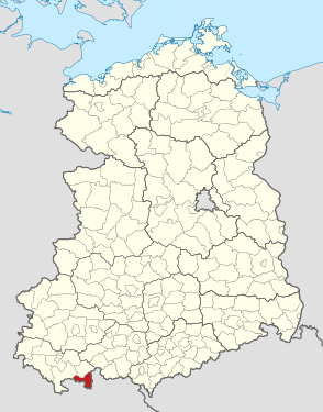  |
|
The Sonneberg district was a district in the Suhl district of the GDR . From 1990 to 1994 it existed as the district of Sonneberg in the state of Thuringia . His area is now in the Sonneberg district in Thuringia. The seat of the district administration was in Sonneberg .
geography
Neighboring areas
The district of Sonneberg bordered in a clockwise direction in the north on the (rural) districts of Neuhaus , Kronach , Coburg and Hildburghausen .
history
The Sonneberg district was formed during the administrative reform of 1952 . He belonged to the Suhl district , which was also formed on July 25, 1952 . It consisted of the larger part of the old district of Sonneberg , the smaller part in the north of the old district came to the district of Neuhaus am Rennweg . The circle Sonnenberg marginalized in the hinterland to 1990 to the county Hildburghausen , in the Oberland to the circle Neuhaus and in the lowlands to the counties Kronach (Bayern) and Coburg (Bayern). With the exception of the northern Oberland around the city of Steinach, the Sonneberg district was completely in the restricted border area of the GDR, in which a state permit, i.e. a pass, was required for visits . Besides Sonneberg and Steinach, Schalkau was the third town in the hinterland in the district.
Despite its border location, the Sonneberg district was highly industrialized. There were large factories in almost every place. Mainly glass , wooden and toys were manufactured , but the district was in full industrial bloom in the period before 1945. The Sonneberg district was the southeasternmost district in the Suhl district and the district with the highest population density. It was shaped in the north by the Thuringian Slate Mountains and in the south by the so-called "Sonneberg Hinterland", a hilly landscape.
There were also places in the Sonneberg district that were so close to the inner-German border that they were cleared and demolished. In Heinersdorf in the Tettau valley , a wall was even built to prevent the residents from fleeing to the west. This happened, among other things, after 400 residents of the place had fled to the west at once.
On May 17, 1990, the district became the district of Sonneberg. From October 3, 1990 the district of Sonneberg belonged to the newly formed state of Thuringia . He got the car sign SON and was united with large parts of the Neuhaus district to form the new Sonneberg district with effect from July 1, 1994 as part of the Thuringian district reform . Sonneberg remained the county seat.
politics
The chairmen of the council of the district of Sonneberg were:
- 1952–1960: Olga Brückner (SED)
- 1960–1969: Otto Sollmann (SED)
- 1969–1979: Karl Greiner (SED)
- 1979–1983: Harry Müller (SED)
- 1983–1989: Gerhard Stier (SED)
- 1989–1990: Gunter Scheler (independent)
After the free local elections in 1990 , a district administrator, Detlef Weise (CDU), was elected from the new district council and held his office until 1994.
License Plate
Motor vehicles (with the exception of motorcycles) and trailers were assigned three-letter distinctive signs starting with the letter pairs OS , OT and OU from around 1974 to the end of 1990 . The last number plate series used for motorcycles was OZ 40-01 to OZ 60-00 .
At the beginning of 1991 the district received the distinctive sign SON .
Individual evidence
- ↑ a b Federal Statistical Office (ed.): Municipalities 1994 and their changes since 01.01.1948 in the new federal states . Metzler-Poeschel, Stuttgart 1995, ISBN 3-8246-0321-7 .
- ^ Norbert Moczarski et al: Thüringisches Staatsarchiv Meiningen. Department of the Regional Economic Archive South Thuringia in Suhl . A brief inventory overview. Ed .: Thuringian State Archives Meiningen. 1st edition. Druckhaus Offizin Hildburghausen, 1994, Development of traditional industrial areas in South Thuringia until 1990, p. 16-24 .
- ↑ Law on the self-administration of municipalities and districts in the GDR (municipal constitution) of May 17, 1990
- ↑ a b Traveling exhibition 150 years of the Sonneberg district. (PDF; 6.8Mb) District of Sonneberg, accessed on July 31, 2019 .
- ↑ Andreas Herzfeld: The history of the German license plate . 4th edition. German Flag Society V., Berlin 2010, ISBN 978-3-935131-11-7 , pp. 302 .
- ↑ Andreas Herzfeld: The history of the German license plate . 4th edition. German Flag Society V., Berlin 2010, ISBN 978-3-935131-11-7 , pp. 554 .
1922–1952: Altenburg | Altenburg (city) | Apolda (city) | Arnstadt | Arnstadt (city) | District Department Camburg | Eisenach | Eisenach (city) | Erfurt | Erfurt (city) | Gera | Gera (city) | Gotha | Gotha (city) | Greiz | Greiz (city) | Heiligenstadt | Hildburghausen | County of Hohenstein | Ilfeld | Jena | Jena (city) | Langensalza | Meiningen | Mulhouse | Mühlhausen (city) | Nordhausen (city) | Rudolstadt | Saalfeld | Schleiz | Schleusingen | Reign of Schmalkalden | Sondershausen | Sonneberg | Stadtroda | Weimar | Weimar (city) | Weissensee | Worbis | Zella-Mehlis (city) | Ziegenrück . 1952–1994: Altenburg | Apolda | Arnstadt | Artern | Bad Salzungen | Eisenach | Eisenberg | Erfurt-Land | Erfurt (city) | Gera-Land | Gera (city) | Gotha | Greiz | Heiligenstadt | Hildburghausen | Ilmenau | Jena-Land | Jena (city) | Langensalza | Lobenstein | Meiningen | Mulhouse | Neuhaus / Rwg. | Nordhausen | Pößneck | Rudolstadt | Saalfeld | Schleiz | Schmalkalden | Schmölln | Sömmerda | Sondershausen | Sonneberg | Stadtroda | Suhl-Land | Suhl (city) | Weimar-Land | Weimar (city) | Worbis | Zeulenroda .