
Altötting district
| coat of arms | Germany map |
|---|---|

|

Coordinates: 48 ° 13 ' N , 12 ° 43' E |
| Basic data | |
| State : | Bavaria |
| Administrative region : | Upper Bavaria |
| Administrative headquarters : | Altötting |
| Area : | 569.35 km 2 |
| Residents: | 111,516 (Dec. 31, 2019) |
| Population density : | 196 inhabitants per km 2 |
| License plate : | AÖ, LF |
| Circle key : | 09 1 71 |
| NUTS : | DE214 |
| Circle structure: | 24 municipalities |
| Address of the district administration: |
Bahnhofstrasse 38 84503 Altötting |
| Website : | |
| District Administrator : | Erwin Schneider ( CSU ) |
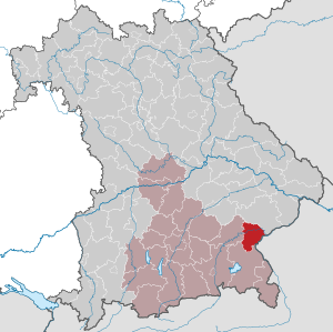
| Location of the Altötting district in Bavaria | |
  |
|

The district of Altötting is located in the Bavarian administrative district of Upper Bavaria . The district town and administrative seat is the town of Altötting , but the most populous town is Burghausen .
geography
location
The area of the Altötting district can be divided into three different landscape areas. In the north, above the Inn valley, the tertiary Isar-Inn hill country extends . This is followed by the Inn valley with an average width of 10 km. In the south follow the moraine hills and the high terrace fields of the Alzplatte with the beginnings of the alpine upland.
The highest point in the district is near Tyrlaching ( 544 m above sea level ), the lowest point on the Innspitz near Haiming ( 346 m above sea level ).
Neighboring areas
The district borders counterclockwise in the north, beginning with the districts of Rottal-Inn , Mühldorf am Inn and Traunstein . In the southeast it borders on Austria .
history
district Court
In the area of today's Altötting district, the Burghausen district court was established in 1803 and the Altötting district court in 1810 . From 1817 both belonged to the Lower Danube District (capital Passau). In the course of the renaming of the former districts of Bavaria in 1837 to the government districts that are still valid today, the area was changed between the Isar and Lower Danube districts and Upper and Lower Bavaria , which brought the Altöttinger area to Upper Bavaria.
District Office
The Altötting district office was formed in 1862 through the merger of the older district courts Altötting and Burghausen.
district
On January 1, 1939, as everywhere in the German Reich, the designation district was introduced. So the district office became the district of Altötting.
On October 1, 1970, the municipality of Mörmoosen in the Mühldorf am Inn district was reorganized into the Altötting district and incorporated into the Tüßling community .
On July 1, 1972, the municipality of Tyrlaching came from the district of Laufen to the district of Altötting as part of the regional reform .
Population development

From 1988 to 2008, the Altötting district gained almost 13,000 inhabitants or grew by around 13%. From 2004 the population development declined slightly. Between 1988 and 2018 the district grew from 95,474 to 111,210 by 15,736 inhabitants or by 16.5%.
The following figures refer to the territorial status on May 25, 1987.
| Population development | ||||||||||||||
|---|---|---|---|---|---|---|---|---|---|---|---|---|---|---|
| year | 1840 | 1900 | 1939 | 1950 | 1961 | 1970 | 1987 | 1991 | 1995 | 2000 | 2005 | 2010 | 2015 | 2017 |
| Residents | 30,869 | 35,172 | 50.219 | 76,369 | 78,095 | 89,934 | 94.216 | 100,258 | 105.914 | 108,268 | 109,227 | 107.711 | 108,485 | 110,338 |
Economy and Infrastructure
In the Future Atlas 2016 , the Altötting district was ranked 156th out of 402 districts, municipal associations and independent cities in Germany, making it one of the regions with a “balanced risk-opportunity mix”.
The Altötting district is home to major parts of the southeast Bavarian chemical triangle . A triangle can be drawn between the cities of Burghausen, Töging and Trostberg, in which internationally important chemical companies operate. Burghausen is both the headquarters of the largest Wacker Chemie AG plant and the petrochemical refinery of OMV Deutschland GmbH. The Gendorf plant is located in Burgkirchen . Various international companies in the chemical industry have settled on the site of the former Hoechst AG.
Tourism plays an important role, especially through pilgrimages in Altötting , visits to the papal birthplace Marktl and Burghausen Castle .
traffic
Outside the area, the district is connected to traffic in the direction of east and north-east Bavaria both by federal highway 20 and federal highway 588 . In the north-south direction, the federal road 299 , which between Erharting and Winhöring has meanwhile been downgraded to the AÖ 35 district road, serves as an important traffic artery. The state road St 2550 (former federal road 12), which runs in a west-east direction, also handles a large part of the supra-regional traffic and has meanwhile been significantly relieved by the A 94 . The latter crosses the district from the town and district boundary at Töging am Inn to Marktl . In the further stretch of road that extends beyond the district boundary, the congested federal highway 12 serves as a connection towards Simbach / Pocking and the A3 . Eight state roads and 33 district roads also serve through traffic in the district .
In 1871 the Royal Bavarian State Railways opened the main line from Munich to Simbach via Neuötting and Marktl as a connection from Bavaria to Austria. The much-visited place of pilgrimage Altötting was connected in 1897 by the Mühldorf – Burghausen local railway . As a connection between Altötting and Neuötting station , the Neuötting – Altötting steam tram went into operation in 1906 . By 1908 the Bavarian State Railways built the main line Mühldorf – Freilassing , which branched off from the line to Burghausen in Tüßling . In 1910, a cross connection was established from their Garching station via Trostberg to Traunstein .
Since the shutdown of the steam tram in 1930, the scope of the rail network has remained unchanged. However, the route and the train station in Burghausen were relocated around 1943.
Today the following four regional train lines run by the Südostbayernbahn cross the district:
- Mühldorf - Neuötting - Simbach
- Mühldorf - Altötting - Burghausen
- Mühldorf - Garching - Freilassing
- Mühldorf - Garching - Traunreut / Traunstein
A partially double-track expansion and the electrification of the Munich – Mühldorf – Freilassing and Tüßling – Burghausen lines are planned and noted as an urgent requirement in the federal transport infrastructure plan.
The freight traffic is mainly operated by DB Cargo . The Burghausen Freight Center went into operation on January 19, 2015.
politics
District administrators
- 1945–1952: Karl Lutz (CSU)
- 1952–1964: Siegmund Scheupl (CSU)
- 1964–1969: Johann Schimmelbauer ( free without party )
- 1970–2000: Seban Dönhuber ( SPD )
- since 2000: Erwin Schneider ( CSU )
The following deputy district councilors were elected by the district council:
- Stefan Jetz (CSU), since 2002
- Horst Krebes (SPD), replaced in 2017 by Hubert Gschwendtner (SPD)
- Konrad Heuwieser ( FW ), since 2008
District council
Election result of the district council 2020:
* Young list in the district of Altötting eV (JL)
Election result of the district assembly 2014 :
Election result of the district assembly 2008 :
Election result of the district council 2002:
Mandate holder from the Altötting district
- Stephan Mayer ( CSU ), member of the German Bundestag (2002–)
- Ingrid Heckner (CSU), Member of the Bavarian State Parliament (2003–2018)
- Martin Huber (CSU), Member of the Bavarian State Parliament (2013-)
- Frank Springer (CSU), member of the District Assembly of Upper Bavaria (2003-2018)
- Gisela Kriegl (CSU), Member of the District Assembly of Upper Bavaria (2018–)
coat of arms
|
|
Blazon : “Split; in front, in blue, the silver octagon of the Altöttingen Chapel of Mercy, floating above it a golden crown of Mary; behind the Bavarian diamonds. "
The coat of arms has been used since 1960. |

Deserved personalities
- Winner of the ring of honor in gold of the Altötting district
- Max Absmeier , prelate
- Benedict XVI. , Pope
- Seban Dönhuber , former district administrator
- Karl Lutz, former mayor of Altötting
- Thomas Rottmüller, long-time district council member (1952–1996)
- Max Saalfrank, Former Mayor of Töging am Inn
Communities
For the formation of the municipalities in the district, see: Municipalities in the district of Altötting


(Residents on December 31, 2019)
|
Other communities
|
Attractions
- Tüßling Castle
- Klebing Castle
- Burghausen Castle
- Parish Church of St. Nikolaus Neuötting
- Kapellplatz Altötting with the Chapel of Grace

Tüßling Castle

Burghausen Castle

Parish Church of St. Nikolaus Neuötting

Altötting, Kapellplatz-Südosteck
.jpg&filetimestamp=20080117184043&)


Protected areas
There are four nature reserves , six landscape protection areas , six FFH areas and at least 28 designated geotopes in the district . (As of August 2016)
See also
- List of nature reserves in the Altötting district
- List of landscape protection areas in the Altötting district
- List of FFH areas in the Altötting district
- List of geotopes in the Altötting district
- List of natural monuments in the Altötting district
License Plate
On July 1, 1956, the district was assigned the distinctive sign AÖ when the vehicle registration number that is still valid today was introduced . It is still issued today. October 14, 2016 due to the characteristics liberalization also the distinguishing sign LF (running) available.
literature
- Karl Huttner: Land between Salzach and Inn . Sixty calendar sheets. With drawings v. Günther Grassmann. Richard Pflaum Verlag, Munich 1957.
- Neue Presse-Verlags GmbH and district council of the district Altötting (Hrsg.): The district Altötting: Das Öttinger and Burghauser country . With contributions from Simon Pittner, Siegfried Schamberger, Dr. Josef Pfennigmann u. a. Neue Presse-Verlag, Passau 1978.
- Oettinger Heimatbund eV (Ed.): Oettinger Land: a local history series of publications for the entire district of Altötting . Altötting 1981-
- Dieter Grypa: Studies at the end of the war and a new beginning in the Altötting district . In: Burghauser Geschichtsblätter 46 . City of Burghausen, Burghausen 1991.
- H. Jochen Dyck, Siegfried Scherrer: The Altötting district: lovable-worth living-worth seeing . Blickpunkt-Wochenbl.-Verl.-Gruppe, Burghausen (et al.) 1992, ISBN 3-923735-02-2 .
- Stefan König: Encounters: Pope Benedict XVI. in the district of Altötting . ars et media, Altötting 2006, ISBN 3-9810956-5-0 .
Web links
- Entry on the coat of arms of the Altötting district in the database of the House of Bavarian History
- Literature from and about Altötting district in the catalog of the German National Library
- Altötting district: Official statistics of the LfStat
Individual evidence
- ↑ "Data 2" sheet, Statistical Report A1200C 202041 Population of the municipalities, districts and administrative districts 1st quarter 2020 (population based on the 2011 census) ( help ).
- ↑ H. Jochen Dyck, Siegfried Scherrer: The Altötting district: lovable-livable-worth seeing . Blickpunkt-Wochenbl.-Verl.-Gruppe, Burghausen (inter alia) 1992: 16.
- ^ Wilhelm Volkert (ed.): Handbook of Bavarian offices, communities and courts 1799–1980 . CH Beck, Munich 1983, ISBN 3-406-09669-7 , p. 434 .
- ^ Wilhelm Volkert (ed.): Handbook of Bavarian offices, communities and courts 1799–1980 . CH Beck, Munich 1983, ISBN 3-406-09669-7 , p. 97 .
- ↑ Future Atlas 2016. Archived from the original on October 2, 2017 ; accessed on March 23, 2018 .
- ↑ Reinhard Wanka, Wolfgang Wiesner: The main line Munich-Simbach and its branch lines . Bufe-Fachbuch-Verlag, Egglham 1996, ISBN 3-922138-59-4 , p. 10, 15 .
- ↑ Reinhard Wanka, Wolfgang Wiesner: The main line Munich-Simbach and its branch lines . Bufe-Fachbuch-Verlag, Egglham 1996, ISBN 3-922138-59-4 , p. 223-225 .
- ^ Altötting district election. Retrieved May 24, 2020 .
- ↑ Entry on the coat of arms of the Altötting district in the database of the House of Bavarian History , accessed on September 4, 2017 .
- ↑ "Data 2" sheet, Statistical Report A1200C 202041 Population of the municipalities, districts and administrative districts 1st quarter 2020 (population based on the 2011 census) ( help ).
- ↑ The old Laufen license plate is now available again. (No longer available online.) Archived from the original on February 1, 2017 ; accessed on February 12, 2018 . Info: The archive link was inserted automatically and has not yet been checked. Please check the original and archive link according to the instructions and then remove this notice.
Districts:
Aichach-Friedberg |
Altötting |
Amberg-Sulzbach |
Ansbach |
Aschaffenburg |
Augsburg |
Bad Kissingen |
Bad Toelz-Wolfratshausen |
Bamberg |
Bayreuth |
Berchtesgadener Land |
Cham |
Coburg |
Dachau |
Deggendorf |
Dillingen on the Danube |
Dingolfing-Landau |
Danube Ries |
Ebersberg |
Eichstätt |
Erding |
Erlangen-Höchstadt |
Forchheim |
Freising |
Freyung-Grafenau |
Fürstenfeldbruck |
Fürth |
Garmisch-Partenkirchen |
Gunzburg |
Hatred Mountains |
Yard |
Kelheim |
Kitzingen |
Kronach |
Kulmbach |
Landsberg am Lech |
Landshut |
Lichtenfels |
Lindau (Lake Constance) |
Main-Spessart |
Miesbach |
Miltenberg |
Mühldorf am Inn |
Munich |
Neuburg-Schrobenhausen |
Neumarkt in the Upper Palatinate |
Neustadt an der Aisch-Bad Windsheim |
Neustadt an der Waldnaab |
Neu-Ulm |
Nuremberg Country |
Oberallgäu |
Ostallgäu |
Passau |
Pfaffenhofen an der Ilm |
Rain |
Regensburg |
Rhön-Grabfeld |
Rosenheim |
Roth |
Rottal-Inn |
Schwandorf |
Schweinfurt |
Starnberg |
Straubing Arch |
Tirschenreuth |
Traunstein |
Unterallgäu |
Weilheim-Schongau |
Weißenburg-Gunzenhausen |
Wunsiedel in the Fichtel Mountains |
Wurzburg
Independent cities:
Amberg |
Ansbach |
Aschaffenburg |
Augsburg |
Bamberg |
Bayreuth |
Coburg |
Erlangen |
Fürth |
Hof (Saale) |
Ingolstadt |
Kaufbeuren |
Kempten (Allgäu) |
Landshut |
Memmingen |
Munich |
Nuremberg |
Passau |
Regensburg |
Rosenheim |
Schwabach |
Schweinfurt |
Straubing |
Willows in the Upper Palatinate |
Wurzburg
Altötting | Burghausen | Burgkirchen an der Alz | Emmerting | Erlbach | Feichten an der Alz | Garching an der Alz | Haiming | Halsbach | Kastl | Kirchweidach | Marktl | Mehring | Neuötting | Perach | Pleiskirchen | Reischach | Stammham | Teising | Töging am Inn | Tüßling | Tyrlaching | Untereukirchen | Winhöring