
Mürlenbach
| coat of arms | Germany map | |
|---|---|---|

|
Coordinates: 50 ° 9 ′ N , 6 ° 36 ′ E |
|
| Basic data | ||
| State : | Rhineland-Palatinate | |
| County : | Vulkaneifel | |
| Association municipality : | Gerolstein | |
| Height : | 323 m above sea level NHN | |
| Area : | 21.64 km 2 | |
| Residents: | 519 (Dec. 31, 2019) | |
| Population density : | 24 inhabitants per km 2 | |
| Postal code : | 54570 | |
| Area code : | 06594 | |
| License plate : | DAU | |
| Community key : | 07 2 33 227 | |
| Association administration address: | Kyllweg 1 54568 Gerolstein |
|
| Website : | ||
| Local Mayor : | Ewald Weidig ( CDU ) | |
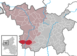
| Location of the local community Mürlenbach in the Vulkaneifel district | ||
  |
||


Mürlenbach in the Vulkaneifel is a municipality in the Vulkaneifel district in Rhineland-Palatinate . It belongs to the Gerolstein community . Mürlenbach is a state-approved resort .
geography
Mürlenbach is located in the Vulkaneifel Nature Park, and partly in the conservation area "Gerolstein and the surrounding area".
Mürlenbach also includes the Etzenberg, Grindelborn, Hanert, Hardt, Haus Hersbach, Im Kreuzchen, Steinich and Weißenseifen residential areas .
history
The Bertradaburg is considered one of the possible birthplaces of Charlemagne ; however, this theory cannot be substantiated. The existence of the castle has only been documented since the 13th century (compare the Mittelrheinische Urkundenbuch ), but archaeological findings speak for the existence of predecessor buildings of the still existing impressive castle complex of undated age.
In and around Mürlenbach, a number of Roman and medieval remains (smaller temples, coin hoards) were found, which are documented in the archive of the Rheinisches Landesmuseum Trier . The favorable location near the old Roman road from Trier to Cologne , at the branching off of a side road to the east, speaks for a certain importance of the place in late antiquity and the early Middle Ages . In all likelihood, these streets were still in use until at least the High Middle Ages.
Whether Mürlenbach already belonged to the Prüm Abbey in the early Middle Ages and could therefore be placed in an indirect proximity to the Carolingian monarchy can hardly be proven either. In any case, in the High Middle Ages, the place and castle belonged to the Prüm Abbey. The castle was important both as a border fortification and as a retreat for the Prüm monastery.
When the abbey became part of the Trier electorate in the 16th century, the castle lost its importance, even though it was initially expanded and provided with artillery bastions. After the secularization of the electorate after the French Revolutionary Wars , the castle complex, which was already partially dilapidated at that time, was sold for use as a quarry.
A fire wreaked havoc on April 21, 1824. 24 houses, 25 barns and stables as well as the church were destroyed or damaged.
Both the parish and the local congregation were a regional center until the 20th century.
As part of the Rhineland-Palatinate functional and territorial reform, Mürlenbach was reclassified together with 14 other communities on November 7, 1970 from the district of Prüm , which was dissolved at the same time, to the district of Daun (since 2007 district Vulkaneifel).
- Population development
The development of the population of Mürlenbach, the values from 1871 to 1987 are based on censuses:
|
|
religion
Most of the residents of Mürlenbach are Christians, the majority of them Roman Catholic. There is a Catholic church in the village, the St. Luzia Church .


In addition to Christians, Jews also lived in Mürlenbach from the second half of the 19th century to the end of the 1930s. Here are their numbers based on the censuses: 12 (1885), 8 (1895), 9 (1905), 4 (1930).
politics
Municipal council
The council in Mürlenbach consists of twelve council members, who in the local elections on May 26, 2019 in a majority vote were elected, and the honorary mayor as chairman. In the elections before 2014, personalized proportional representation took place.
The distribution of seats in the municipal council:
| choice | CDU | FWG | total |
|---|---|---|---|
| 2019 | by majority vote | 12 seats | |
| 2014 | by majority vote | 12 seats | |
| 2009 | 8th | 4th | 12 seats |
| 2004 | 9 | 3 | 12 seats |
coat of arms
|
|
Blazon : “In green, a raised, curved, silver tip, inside a red gatehouse with two towers, partially covering a blue wave shield base. In front a silver lamb with a flag, inside a red cross, in the back a silver dagger turned to the left. " |
Economy and Infrastructure
Rail transport
The Mürlenbach stop is on the Eifel route ( Cologne - Euskirchen - Gerolstein - Trier ). It is a demand stop that is served by the following local rail passenger transport trains:
| line | designation | Line course | Clock frequency |
|---|---|---|---|
| RB 22 | Eifel Express | Cologne Fair / Deutz - Cologne - Euskirchen - Jünkerath - Gerolstein - Mürlenbach - Bitburg-Erdorf - Ehrang - Trier (Cologne Fair / Deutz - Gerolstein asRE 22) | 60 min (in the HVZ amplifier Gerolstein – Trier) |
The tariff of the Verkehrsverbund Region Trier (VRT) applies to all local public transport (ÖPNV ) .
Established businesses
Feluwa Pumpen GmbH has been developing and producing process pumps and wastewater lifting systems in Mürlenbach since 1960 , including the complete pump system for the Berlin Lehrter city train station and the environmental pump technology for Spangdahlem Air Base from Feluwa.
See also
Web links
- Local community Mürlenbach
- To search for cultural assets of the local community Mürlenbach in the database of cultural assets in the Trier region .
- About the Bertradaburg
Individual evidence
- ↑ a b State Statistical Office of Rhineland-Palatinate - population status 2019, districts, municipalities, association communities ( help on this ).
- ↑ a b State Statistical Office Rhineland-Palatinate - regional data
- ↑ State Statistical Office Rhineland-Palatinate (ed.): Official directory of the municipalities and parts of the municipality. Status: January 2018 [ Version 2020 is available. ] . S. 72 (PDF; 2.2 MB).
- ↑ Official municipality directory 2006 ( Memento from December 22, 2017 in the Internet Archive ) (= State Statistical Office Rhineland-Palatinate [Hrsg.]: Statistical volumes . Volume 393 ). Bad Ems March 2006, p. 160, 161 (PDF; 2.6 MB). Info: An up-to-date directory ( 2016 ) is available, but in the section "Territorial changes - Territorial administrative reform" it does not give any population figures.
- ^ The Regional Returning Officer Rhineland-Palatinate: Local elections 2019, city and municipal council elections
- ↑ Deutsche Bahn course book. Retrieved September 25, 2018 .

Arbach | Basberg | Beinhausen | Bereborn | Berenbach | Berlingen | Berndorf | Betteldorf | Birgel | Birresborn | Bleckhausen | Bodenbach | Bongard | Borler | Boxberg | Brockscheid | Brückal | Darscheid | Down | Demerath | Densborn | Deudesfeld | Dockweiler | Dohm-Lammersdorf | Drees | Dreis-Brück | Duppach | Ellscheid | Esch | Feusdorf | Gefell | Gelenberg | Gerolstein | Gillenfeld | Gönnersdorf | Gunderath | Reverberation | Hillesheim | Hinterweiler | Höchstberg | Hohenfels-Essingen | Horperath | Hörscheid | Hörschhausen | Immerath | Jünkerath | Kalenborn scrubbing | Caperich | Katzwinkel | Kelberg | Kerpen (Eifel) | Kerschenbach | Kirchweiler | Kirsbach | Kolverath | Kopp | Kötterichen | Kradenbach | Lirstal | Lissendorf | Mannebach | More | Meisburg | Mosbruch | Mosquitoes | Mürlenbach | Neichen | Nerd | Neroth | Niederstadtfeld | Nitz | Nohn | Oberbettingen | Oberehe-Stroheich | Oberelz | Oberstadtfeld | Ormont | Pelm | Reimerath | Retterath | Reuth | Rockeskyll | Salm | Sarmersbach | Sassen | Saxler | Schalkenmehren | Scheid | Schönbach | Schüller | Protection | Stadtkyll | Steffeln | Steineberg | Steiningen | Strohn | Strotzbüsch | Üdersdorf | Udler | Uersfeld | Ueß | Utzerath | Üxheim | Wallenborn | Walsdorf | Weidenbach | Which council | Wiesbaum | Winkel (Eifel)