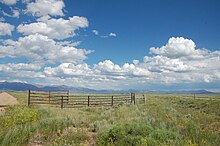
Medicine Bow - Routt National Forest

The Medicine Bow - Routt National Forest is a 11,209 km² national forest in the Rocky Mountains of the states of Colorado and Wyoming in the United States . The park is administered by the United States Forest Service , which is under the Department of Agriculture . It includes the formerly independently administered areas of Medicine Bow National Forest , Routt National Forest and Thunder Basin National Grassland . In 1995 these were merged, the park headquarters is in Laramie . The parks are located at an altitude between 1,800 and 4,300 meters. The Medicine Bow - Routt National Forest can be visited all year round and there is no entry fee.
Medicine Bow National Forest

The Medicine Bow National Forest has a size of approximately 4,439 km² and is located in southeastern Wyoming. It was founded in 1902 as a forest reserve . The name comes from the Indians who used to live in this area and is derived from the ritual acts for healing (medicine) carried out here. Outstanding bows could be made from the mahogany plants that occur in the forests , especially Mountain Mahogany .
The park includes the Medicine Bow Mountains , with their highest elevation, the 3,661 meter high Medicine Bow Peak and the Laramie Mountains with the 3,231 meter high Laramie Peak . Also in the park are the Huston Park , Savage Run and Platte River Wilderness areas and the Vedauwoos , an area with large blocks of granite that are very popular with climbers. Portions of the park are in Carbon County , Albany Counties , Converse Counties , Natrona Counties, and Platte Counties, with local park headquarters in Laramie and Saratoga .
Routt National Forest

The Routt National Forest covers an area of approximately 4,558 km² and is located in northwestern Colorado. The park includes the Steamboat Ski Resort on the slopes of Mount Werner, 3220 meters high . The park, which was opened by Theodore Roosevelt in 1905 , is named after John Long Routt , the first governor of Colorado. The North American continental divide divides the park roughly in the middle. Portions of the park are located in Routt County , Jackson County , Rio Blanco County , Grand County , Moffat County, and Garfield County . Local parking offices are in Steamboat Springs , Walden and Yampa .
Thunder Basin National Grassland
The Thunder Basin National Grassland has a size of approximately 2216 km² and is located in northeastern Wyoming. It covers the area of the Powder River Basin between the Big Horn Mountains and the Black Hills and is characterized by large open pasture landscapes with an arid climate . The grassland is in Weston Counties, Converse Counties , Campbell Counties , Niobrara Counties , and Crook Counties . Large herds of antelopes and over 200 species of birds live in the park . The area is rich in natural resources such as coal, oil, gas, uranium, bentonite and trona . In the past there were many mining areas here, today the mining is limited to coal and bentonite. The Douglas Ranger District's local park headquarters is in Douglas .
Individual evidence
- ↑ Table 6 - NFS Acreage by State, Congressional District and County - United States Forest Service - September 30, 2007.
- ↑ Routt National Forest (Stateparks.com) .
- ↑ Thunder Basin National Grassland
- ↑ Bird Checklists of the United States Thunder Basin National Grassland (USGS)
- ^ Public Lands Information Centers
Web link
Coordinates: 41 ° 30 ′ 0 ″ N , 106 ° 18 ′ 0 ″ W.
