
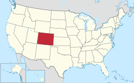
Colorado
| Colorado | |||||
|---|---|---|---|---|---|
| |||||
  | |||||
| Capital: | Denver | ||||
| State motto: | Nile sine numine | ||||
| Official language : | English | ||||
| Surface: | 269,601 km² | ||||
| Residents: | 5,607,154 (2017 estimate) (21 U / km²) | ||||
| Member since: | August 1, 1876 | ||||
| Time zone: |
UTC − 7 ( MST ) UTC − 6 (daylight saving time) |
||||
| The highest point: | 4401 m ( Mount Elbert ) | ||||
| Average Height: | 2073 m | ||||
| Deepest point: | 1021 m Arikaree River | ||||
| Governor : | Jared Polis ( D ) | ||||
| Post / Office / ISO : | CO / Colo. / US CO | ||||
 | |||||
 | |||||


Colorado ( English [ ˌkɑləˈɹɑːdoʊ̯ ] or [ ˌkɑləˈɹæɾoʊ̯ ] ) is a state in the western to central part of the United States of America . As part of the Mountain States traversed by the Rocky Mountains , Colorado is the highest state in the USA with an average altitude of 2073 meters.
The "Century State", Centennial State , emerged in 1876, exactly 100 years after the United States declared independence , from the Colorado Territory , which was founded in the Front Range in 1861 at the height of the gold rush . The capital and economic center is Denver , in whose metropolitan area more than half of the five million inhabitants of Colorado live. Other major cities are Colorado Springs and Fort Collins . The state got its name from the Colorado River , which was so named by the previous Spanish rulers of the area because of the reddish (Spanish: colorado ) mud it carries with it.
geography
The state of Colorado is located in the central to western part of the United States and is enclosed by a total of seven states. The northern neighbor is Wyoming , in the east Colorado meets the Prairie States of Nebraska and Kansas and on the southeastern border Colorado is separated from Texas by the relatively small strip of land of the Oklahoma Panhandle . While the border with New Mexico runs in the south , Colorado has no common border with the state of Arizona in the southwest, but only meets it at its southwestern corner. Along with New Mexico, Arizona and Utah , the western neighbor, Colorado is the so-called " four-corner states " (Four Corners) ; this phenomenon, unique in the United States, was marked with a monument at that point. Along with Wyoming and Utah, Colorado is one of the three states in the USA that have practically no natural state borders, but are almost exclusively defined along lines of longitude and latitude. Colorado extends roughly rectangularly from about 37 ° N to 41 ° N and 102 ° W to 109 ° W.
Colorado is traversed in the central and western part of the state by the mountain ranges of the Southern Rocky Mountains , of which the San Juan Mountains in the southwest, the Sawatch Range in the center and the two eastern foothills of the Rocky Mountains, Front - and Sangre de Cristo Range , belong to the most important mountains. The Colorado Rockies encompass more than 50 peaks with an altitude of more than 4000 meters - including Mount Elbert, the highest mountain in the entire Rocky Mountains at 4401 meters - and enclose some larger valley basins. The approximately 2800 km² South Park Basin is located entirely in Park County and includes a wide grassy landscape between the Front and Mosquito Range. In south-central Colorado, the San Juan Mountains and Sangre de Cristo Range encircle the San Luis Valley . The largest alpine valley basin in the world is no longer counted among the Rocky Mountains, but among the mesa and plains , which are predominantly located in New Mexico .


In the west, the Rocky Mountains mostly end before the state border of Utah and merge into a plateau reaching as far as Arizona - the so-called Colorado Plateau . Within Colorado, these include in the southwest the area from the foothills of the San Juan Mountains to the New Mexican border. From the southwestern corner of the state, the plateau extends along the Utah border to other Rocky Mountains mountain ranges in the east and ends in its northern course at the Uinta Mountains in northwest Colorado. Beyond this mountain range is the southern end of the Wyoming Basin - the steppe landscape that runs through the entire neighboring state of Wyoming to Montana. Colorado's share is limited to the part between the Uinta and Elkhead Mountains in the northwest and the North Platte Basin in the central north of Colorado, which is enclosed by the Park Range , Rabbit Ears Range and Medicine Bow Mountains .
East of the Rocky Mountains begin the Great Plains , a huge steppe landscape that runs through the entire center of the United States and is known as the High Plains within Colorado because of its high altitude here . From the foothills of the Rocky Mountains they drop continuously from around 1900 meters and form the lowest point in Colorado at 1021 meters on the Kansas border - near Arkansas .
Waters
The headwaters of three of the most important North American rivers, the Colorado , Arkansas and Rio Grande, each over 2000 kilometers in length, have their headwaters on the continental watershed that runs through the entire Colorado . The North and South Platte are also important; With the exception of Colorado, which drains into the Pacific, they all arise on the eastern side of the watershed and flow towards the Atlantic .
In and around the Rocky Mountain National Park are a large number of the 2183 natural lakes in Colorado; just outside the park boundary is the Grand Lake (Big Lake) - with a water surface area of just 2.4 square kilometers the largest natural lake already in the state. It is connected by a canal to the two larger reservoirs Shadow Mountain Lake and Lake Granby , which together form the Great Lakes of the Rockies within the Arapaho National Recreation Area . Only the Blue Mesa Reservoir near Gunnison in the central to southwestern part of the country is larger than Lake Granby . The John Martin Reservoir in the south-east of the country is also an important water reservoir for the region there.
climate
In Colorado there are warm, sometimes hot summers and cold, snowy winters (continental climate). In particular, the difference between day and night is sometimes extreme. In summer it can get very cold at night despite high daytime temperatures. The precipitation (approx. 400–500 mm annually) is distributed over the whole year, with a slight overweight in summer, whereby the air with 50% humidity is usually very dry.
history
native people


In AD 400 the western foothills of the Indian Fremont culture reached into eastern Colorado. 1000 years before the arrival of the first whites in Colorado, representatives of the Anasazi culture settled in what is now Mesa Verde National Park in the far southwest of the state , and they erected impressive buildings here, such as the so-called Cliff Palace. In historical times, Cheyenne and Ute Indians lived in the region . In the southwest the area of influence of the Navajo protruded to Colorado, from the southeast also that of the Kiowa .
Discovery and conquest by the Spanish and French
Colorado was probably first explored by the Spanish in the early 17th century. It is disputed whether the Spaniard Francisco Vásquez de Coronado on his expedition from Mexico to what is now Kansas (1540–1542) already grazed the eastern plains of what is now Colorado and was thus the first European on the soil of what is now the state. In this context, Juan de Oñate is also mentioned , who led an expedition from New Mexico to Kansas around 1600. The southeastern part of today's Colorado was only claimed for the Spanish kingdom in 1706 by Juan de Uribarri . The claim to territory collided with the economic interests of the French, although they primarily promoted colonization on the St. Lawrence River (now Canada).
After the defeat in the French and Indian War (1754-1760) against the British Empire , France, with the exception of New Orleans, had to cede all areas west of the Mississippi to Great Britain, which in turn - to compensate for the conquest of Florida - gave the Spanish the central part of North America (which later became Louisiana Territory). This caused tensions between Spain and France, which only ended on October 1, 1800 under the pressure of Napoleon I with the peace of San Ildefonso and the associated reconquest of Central American territories by France. A little later, in 1803, the territory finally fell to the United States through the so-called Louisiana Purchase .
While the western part of today's Colorado - the southern Rocky Mountains and parts of the Colorado plateau - remained undisputed territory of the Spaniards ( New Spain ), the first explorations by the Americans began in the east from 1806. A first dispatch of American soldiers led by Zebulon Pike led in the Pike expedition from Fort Bellefontaine (near Saint Louis ) to the eastern foothills of the Rocky Mountains (Front Range), which were reached by the end of 1806. The exploration focused on the Arkansas catchment area, which - although an official border line was never agreed between France and Spain until the Louisiana Purchase - was viewed by the Americans as the southern border with New Spain. It was not officially established until 1819 in the so-called Adams-Onís Treaty , in which the western border was agreed in addition to Arkansas in the south with the continental divide . This was followed by the second major expedition in 1820 under the direction of Stephen H. Long , which focused on the course of the South Platte and the region around present-day Denver .
First settlement by Europeans
Although after Pikes and Long's first explorations in the years that followed, more and more fur hunters advanced into what is now Colorado, a larger settlement only began in the 1830s with the construction of Bent's Fort . The fort on Arkansas (near today's La Junta ) built by William and Charles Bent in 1833 quickly became an important trading post between the white and indigenous people on the Santa Fe Trail . In the meantime, New Mexican settlers settled in the San Luis Valley between the San Juan Mountains and the Sangre de Cristo Range and lived from agriculture. With San Luis they founded the first permanent settlement in what would later become Colorado on June 21, 1851.
Meanwhile, from 1850 the political division of the land acquired in the Louisiana Purchase began in the east as well as the areas from the Rocky Mountains to the Pacific coast that were newly gained after the war with Mexico (1846–1848). The so-called Kansas-Nebraska Act laid down the border between the territories of Nebraska and Kansas . The latter went beyond today's western border and took up most of the High Plains between South Platte and Arkansas River up to the Front Range. The Utah Territory , founded in 1850, joined in the mountains , while the remaining areas of today's Colorado were parts of Nebraska (northeast) and New Mexico (south). The Colorado Territory, on the other hand, was not created until 1861 with the gold rush in Pikes Peak Country .
Gold rush and silver boom
While relations between whites and Indians - after initial reservations - in the region of the High Plains were predominantly friendly to date, this changed from the early 1850s, when reports of gold discoveries in California led to ever-increasing settler flows through the Great Plains and the Rocky Mountains led. When gold was first found at the confluence of South Platte and Cherry Creek (now Denver) in June 1858 and prospectors founded the first larger settlements on the river and in the surrounding mountains, tensions between the white and indigenous population increased. The number of mining camps grew steadily in the mountains, and the region around Black Hawk , Central City , Nevadaville and Idaho Springs became a center of the gold rush around 1860.
The greatest growth in the region, which was still part of Kansas at the time, was recorded in Denver City, founded in 1858, which two years later incorporated the neighboring city of Auraria and now had around 6,000 inhabitants. The rapidly growing population drove plans to establish the region as an independent territory. This finally happened on February 28, 1861, when US President James Buchanan signed a corresponding law in the US Congress and appointed William Gilpin as the first governor. The young Colorado Territory was divided into 17 districts and had around 25,000 inhabitants when it was founded; The capital was initially Colorado City . However, Denver City, which was only renamed "Denver" in 1865, remained more important, even though the city had to be rebuilt after a major fire in 1863. In Golden, which replaced Colorado City as the territory's capital in 1862, Denver was designated the new capital of Colorado in 1867. Although Cherry Creek was not the gold vein it had hoped for, it turned out pretty quickly, Denver benefited from the wealth of the nearby towns in the Front Range. At the foothills of the Rocky Mountains, the capital consolidated its central position with the consistent expansion of the rail network in the early 1870s. The first milestones were the connection to the Kansas Pacific Railway , which expanded its rail network from Kansas City to Denver in 1870 , and the construction of the Denver and Pacific Railroad , which connected to the Union Pacific Railroad in Cheyenne (Wyoming) . Denver's connection to southwest Colorado followed in 1871 with the construction of the Denver & Rio Grande Railway . In 1872 the Colorado Central Railroad completed the route leading to the neighboring gold rush towns of Black Hawk and Central City.
In 1879 the silver boom broke out in Colorado and Leadville and Aspen became the most important mining towns during this period. Their development was supported by the further expansion of the Denver & Rio Grande Railway , which continued its network in the 1870s from Pueblo through the Royal Gorge towards Leadville and finally reached the city in 1881. The economically emerging Colorado had long since achieved its statehood by this time. While many initially had concerns about higher taxes and excessive interference on the part of Washington , the Colorado Territory joined the United States as the 38th state on August 1, 1876, while maintaining its previous borders.
Driving out the Indians
The establishment of the Colorado Territory in 1861 and the rapidly increasing settlement on Cherry Creek was an affront to the Cheyenne and Arapaho , to whom the area around what would later become Denver was awarded in the Treaty of Fort Laramie (1851). Their resettlement in the Arkansas river valleys sparked backlash among the indigenous people, ranging from stagecoach robberies to the murder of isolated settlers. In an unprecedented retaliatory attack on November 29, 1864 , troops of the Third Colorado Cavalry, under Commander John M. Chivington , penetrated an Indian village and murdered 133 men, women and children. The cruel actions of the US military in that Sand Creek massacre briefly sensitized the white population to the interests of the Indians, but also stood in the way of peaceful coexistence. The ensuing armed conflict lasted about five years and ended after the battles of Beecher Island (September 1868; near present-day Wray ) and Summit Springs (July 1869) with the surrender of Cheyenne and Arapaho, who recently formed an alliance against the with some other Indian tribes Whites had formed. As early as 1867, a large-scale resettlement of the Indians from Colorado's Plains to reservations in Oklahoma had begun, which in 1874 was considered largely completed.
The Ute Indians , who live in the mountains and have not been fundamentally hostile to the US government to date, were also subjected to repression after gold and silver discoveries from the 1870s onwards. In 1880 they were transferred to a small reservation in the Mesa region in the Border area to New Mexico, sent.
20th and 21st centuries
Colorado was hit hard by the economic crisis that began in 1893 ( panic of 1893 ; decline in the value of silver). In Denver, twelve banks had to be closed suddenly, and countless businesses had to give up. Ambitious plans of the railroad companies were halted and the closure of many mines caused unemployment to rise rapidly. Many former mining towns degenerated into ghost towns in the 20th century , while better-developed towns found new sources of income in tourism. Aspen, Breckenridge and Vail in central Colorado and Telluride in southwestern Colorado have become popular winter sports locations. With the establishment of the Rocky Mountain National Park in 1915, the first major tourist attraction came into being in the Denver catchment area. In the state capital itself, under Mayor Robert W. Speer, a systematic upgrading of the cityscape based on the model of the City Beautiful movement began shortly after the turn of the century . The beautification measures, which lasted almost 15 years, served not least to moralize those Denverans who lived in the state capital under very poor conditions.
In 1977 the first Special Olympics Winter Games took place in Steamboat Springs .
On 20 April 1999 occurred near Littleton the Columbine High School massacre , in which 15 people died and 24 others were injured. The act caused a worldwide sensation, sparked numerous debates about the possible causes of youth violence and is considered a turning point in the culture of the United States due to its far-reaching consequences. The city of Aurora hit international headlines on July 12, 2012 when 12 people were shot dead and 58 others injured in the Aurora rampage during a theatrical screening of The Dark Knight Rises .
In the summer of 2002, Colorado was hit by the most devastating forest fire in the state's history when an illegal campfire in Pike National Forest started what was known as the Hayman Fire . The fire destroyed around 55,000 hectares of forest and approached the Denver area so threateningly that individual suburbs had to be briefly evacuated. A completely different natural disaster finally occurred in December 2006 when the state was caught in a violent blizzard just before the Christmas holidays . The main interstate highways had to be temporarily closed and brought public life in the greater Denver area to a standstill. One of the worst snowstorms in the Front Range region claimed four lives in Colorado.
population
| Population development | |||
|---|---|---|---|
| Census | Residents | ± in% | |
| 1860 | 34,277 | - | |
| 1870 | 39,864 | 16.3% | |
| 1880 | 194,327 | 387.5% | |
| 1890 | 413.249 | 112.7% | |
| 1900 | 539,700 | 30.6% | |
| 1910 | 799.024 | 48% | |
| 1920 | 939,629 | 17.6% | |
| 1930 | 1,035,791 | 10.2% | |
| 1940 | 1,123,296 | 8.4% | |
| 1950 | 1,325,089 | 18% | |
| 1960 | 1,753,947 | 32.4% | |
| 1970 | 2,207,259 | 25.8% | |
| 1980 | 2,889,964 | 30.9% | |
| 1990 | 3,294,394 | 14% | |
| 2000 | 4,301,262 | 30.6% | |
| 2010 | 5,029,196 | 16.9% | |
| 2017 estimate | 5,607,154 | 11.5% | |
| Before 1900
1900-1990 2000 |
|||

According to the 2010 Census, Colorado has 5,029,196 inhabitants, of which 81.3% are white , 4% are black or African-American , 2.8% are Asian-Americans and 1.1% are Indians , and others are 7.2%. 20.7% describe themselves as Hispanics . In 2017 the population was estimated at 5,607,154.
With a population growth of around 8.4% (USA: 5.3%) from the census in April 2000 to July 2005, Colorado was above the national average. It is expected to have more than seven million inhabitants by 2030.
The Division of Local Government (DOLA) expects an above-average development , particularly from the Douglas and El Paso districts south of Denver . Douglas County's population has more than quadrupled since the 1990 census (population 60,391) and is projected to expand to roughly half a million by around 2030. The El Paso County surrounding Colorado Springs will meanwhile have a little less than a million inhabitants and make up the most populous district of Colorado, according to DOLA forecasts. Assuming that Denver will not be united with neighboring cities within its metropolitan area, today's state capital would no longer be the largest city in the state.
In the west, the districts in the catchment area of I-70 are predicted to develop well - especially Garfield and Mesa around the cities of Glenwood Springs and Grand Junction . In the east of the country, however, there will be no changes worth mentioning; in the southeastern part - apart from the small towns on Arkansas near the John Martin Reservoir - a decline in population is even expected.
ancestry
The 2000 Census shows that people of German origin make up the largest group within the Colorado population with 22%, followed by Mexican Americans (18%) and Irish and English people with 12% each.
languages
The official language of Colorado is (American) English , which is also spoken by around 85% of the population. The statistical analysis of the census from 2000 showed that a large part of the population speaks Spanish, especially in the south of Colorado, which is partly strongly Mexican. In the district of Costilla they even make up the majority with a share of around 57%, but also in the districts of Alamosa , Conejos , Lake , Rio Grande and Saguache at least a quarter of the residents speak Spanish in their family environment. This makes it the second most widely spoken language in Colorado after English - with around 420,000 speakers out of a total of four million (over 5 years old) in the state. In addition, less than one percent each speak German or French.
Religions
In Colorado, 65% of the population is Christian. 44% of the people belong to Protestant denominations, of which 23% of the faithful belong to evangelical and 19% to mainline churches. 19% of the population are Roman Catholic . The religious communities with the largest number of members in Colorado in 2000 were the Roman Catholic Church with 752,505, the Church of Jesus Christ of Latter-day Saints (Mormons) with 92,326 and the Southern Baptist Convention with 85,083 followers.
Cities

Colorado's largest city with around 600,000 inhabitants is the state capital, Denver, which is also the economic and cultural center of the state. Around 2.5 million people live in Denver's catchment area ( metropolitan region Denver-Aurora ), which are distributed among other things to the other major cities of Westminster , Arvada , Aurora , Lakewood and Centennial . The rest of the country's major cities are also located along a north-south line along the Front Range , of which the second largest, Colorado Springs Air Force Base , is the most important.
With the exception of Grand Junction (around 58,000 inhabitants) there are only small towns in the western part of Colorado , of which Durango , the mountain towns of Silverton and Ouray and the winter sports resort of Aspen occupy key tourist positions. Cripple Creek and the two neighboring cities of Black Hawk and Central City have seen an economic boom since gambling was legalized in 1991. In contrast, many small towns in the eastern plains are steadily declining , where in the catchment areas of Arkansas and South Platte River, at most, Fort Morgan , Sterling , La Junta and Lamar (each with around 8,000-10,000 inhabitants) are of some importance. At the same time, the number of inhabitants is steadily declining in these cities too.

politics


The Colorado Constitution, like the majority of the other US states, is based on three powers: the legislature ( legislation ), the executive ( government ), and the judiciary ( jurisdiction ). The executive power is exercised by a governor elected every four years , whose government work is limited to a maximum of two terms of office. Accordingly, the Democrat Bill Ritter , who was elected to office in 2006, could have run again in 2010, but did not do so. Successor was with John Hickenlooper , the former mayor of Denver , again a Democrat. Hickenlooper completed two full terms and was therefore no longer allowed to run for office in 2018. Jared Polis was elected to succeed him.
The highest body of the legislature in Colorado is the General Assembly ( General Assembly ), a bicameral parliament, which is composed of the House of Representatives and the Senate . The House of Representatives has 65 members, elected every two years, and currently made up of 37 Democrats and 27 Republicans, plus one independent member. The Democrats also dominate the Senate with a majority of 8:15 p.m. over the Republicans, whose members are re-elected every four years.
Bills must go through both houses before they can be presented to the governor for signature. If the latter veto the draft, it must be passed by both the Senate and the House of Representatives with a two-thirds majority. In this case, the law goes into effect, bypassing the governor.
The highest authority of the judiciary is the Supreme Court ( Supreme Court ) of Colorado, the Presiding Judge ( Chief Justice is appointed by the Governor -) - with a maximum term of ten years. The court of appeal stands between this and the first instance district courts. The governor also decides on their appointments.
Legalization of marijuana
In November 2012, a majority of a referendum voted to legalize the cultivation, sale and possession of marijuana in small quantities. Along with Washington State, Colorado is the first state in the USA to allow cannabis as a stimulant. The total revenue generated from the sale of cannabis and cannabis products was $ 996 million in 2015.
Abolition of the death penalty
Only one murderer has been executed since the death penalty was reinstated. In 2013 the then governor, John Hickenlooper, imposed a moratorium (postponement). The current governor, Jared Polis, continues this and signed a law on March 23, 2020 that abolishes the death penalty for crimes committed on or after July 1, 2020. This makes Colorado the 22nd US state to abolish the death penalty. He commuted the death sentences of the three inmates currently on death row to life imprisonment.
Political structure

After the establishment of the Colorado Territory on February 28, 1861, leading representatives of the legislature decided at a meeting on September 9 of the same year the administrative subdivision of Colorado into 17 districts ( counties ) as well as an Indian reservation for Cheyenne and Arapaho in the east of the country, independent of these Country. The Rocky Mountains were then dominated by the neighboring districts of Summit ( "summit" , 45,268 km²) and Lake ( "lake" ), each about the size of the Netherlands and a large part of the Rocky Mountains in Colorado and the Colorado plateau. They still exist in central Colorado today, but have lost over 95% of their original territory that stretched to the Utah border.
To the east, in the Plains plateau, the districts of Weld , Arapahoe , Douglas and Huerfano occupied the area from north to south as far as the border with Kansas . They also still exist by name today, but have lost so much of their eastern territory that they are now in central Colorado. There, the borders of Gilpin (named after the first Colorado governor), Clear Creek , Park , Boulder and Jefferson have barely changed since their inception. Only Denver (1902) and Broomfield (2001) declared themselves to be independent city districts ( City & County ). Broomfield's independence ensured the first re-establishment of a county since 1913 and is now the smallest district in Colorado. The state now consists of 64 counties.
Federal politics
Colorado, which used to be one of the typical Republican-friendly states in the Rocky Mountains , has developed into a swing state with the increasing urbanization of Denver . The area of Colorado Springs , home to some giant Churches ( mega-churches ) and one of the most conservative cities in the entire country, is the main source of Republican strength. The Denver area, on the other hand, is democratically dominated. In the 2004 presidential election, Republican George W. Bush beat Democratic challenger John Kerry by less than five percentage points. In the 2008 and 2012 elections , however, the Democrat Barack Obama was able to narrowly prevail. In 2016, the Democratic candidate Hillary Clinton won the state ahead of the Republican Donald Trump , and in the 2018 elections the Democrats won, in particular, non-party voters by clear majorities. As of 2019, the Democrats have provided all state officials except Senator Cory Gardner , who is considered one of the most vulnerable Republican elected officials in the upcoming 2020 Senate election .
congress
| year | Democrats | republican |
|---|---|---|
| 2016 | 48.16% 1,338,870 | 43.25% 1,202,484 |
| 2012 | 51.45% 1,323,102 | 46.09% 1,185,243 |
| 2008 | 53.66% 1,288,633 | 44.71% 1,073,629 |
| 2004 | 47.02% 1,001,732 | 51.69% 1,101,255 |
| 2000 | 42.39% 738,227 | 50.75% 883,745 |
| 1996 | 44.43% 671,152 | 45.80% 691,848 |
| 1992 | 40.13% 629,681 | 35.87% 562,850 |
| 1988 | 45.28% 621,453 | 53.06% 728,177 |
| 1984 | 35.12% 454,974 | 63.44% 821,818 |
| 1980 | 31.07% 367,973 | 55.07% 652,264 |
| 1976 | 42.58% 460,353 | 54.05% 584,367 |
| 1972 | 34.59% 329,980 | 62.61% 597,189 |
| 1968 | 41.32% 335,174 | 50.46% 409,345 |
| 1964 | 38.19% 296,767 | 61.27% 476,024 |
| 1960 | 44.91% 330,629 | 54.63% 402,242 |
In the Senate Colorado is currently represented by
- Senior Senator Michael Bennet of the Democrats
- Junior Senator Cory Gardner of the Republicans
(The senior of the two state senators is referred to as a "senior" and the other as a "junior.")
House of Representatives
In the House of Representatives Colorado is currently represented by the following Members:
| Constituency | Official | |
|---|---|---|
| 1. | Diana DeGette ( Democrats ) | |
| 2. | Joe Neguse (Democrats) | |
| 3. | Scott Tipton ( Republican ) | |
| 4th | Ken Buck (Republican) | |
| 5. | Doug Lamborn (Republican) | |
| 6th | Jason Crow (Democrats) | |
| 7th | Ed Perlmutter (Democrats) | |
Culture and sights
National parks
The NPS operates four national parks in Colorado, of which Mesa Verde National Park is a World Heritage Site in the United States (as of September 30, 2017).
| National park | location | view |
|---|---|---|
Black Canyon of the Gunnison National Park
|

|

|
Great Sand Dunes National Park
|
|

|
Mesa Verde National Park
Commons : Mesa Verde National Park - Pictures
|
|

|
Rocky Mountain National Park
Commons : Rocky Mountain National Park - Pictures
|
|

|
National monuments

- Browns Canyon National Monument
- Canyons of the Ancients National Monument
- Chimney Rock National Monument
- Colorado National Monument
- Dinosaur National Monument
- Florissant Fossil Beds National Monument
- Hovenweep National Monument
- Yucca House National Monument
National Forest
- Arapaho National Forest
- Grand Mesa National Forest
- Gunnison National Forest
- Pike National Forest
- Rio Grande National Forest
- Roosevelt National Forest
- Routt National Forest
- San Isabel National Forest
- San Juan National Forest
- Uncompahgre National Forest
- White River National Forest
Other natural monuments
The NPS identifies a total of 15 National Natural Landmarks and one National Recreation Area for Colorado , the Curecanti National Recreation Area (as of September 30, 2017).
Cultural monuments

The NPS operates two National Historic Sites and four National Historic Trails in Colorado as of September 30, 2017:
- Bent's Old Fort National Historic Site
- Sand Creek Massacre National Historic Site
- California Trail
- Old Spanish Trail
- Pony Express
- Santa Fe Trail
There are also 15 National Historic Landmarks and 1,551 buildings and sites in Colorado that are listed on the National Register of Historic Places (as of September 30, 2017).
Economy and Infrastructure
Colorado is one of the most economically successful states in the USA. The real gross domestic product per capita GDP - the most important indicator of prosperity - was 58,422 US dollars in 2016 (national average of the 50 US states: USD 57,118; national ranking: 17). The unemployment rate was 2.9% in November 2017 (national average: 4.1%).
Agriculture
In the mountains mainly is sheep , cattle and fattening cattle operation. Corn , wheat , potatoes , sugar beets , alfalfa and fruit are grown . Also viticulture is operated in Colorado. Since the consumption and cultivation of marijuana was legalized in 2014, more and more hemp has been grown since then .
Industry and service
In the second half of the 20th century, the industrial and service sectors in particular developed. The Colorado economy is fanned out on a wide spectrum. Particularly noteworthy is the density of companies in the field of scientific research and the high-tech industry. Colorado has many universities.
Natural resources
Colorado is the largest molybdenum producer on earth. Colorado has large amounts of unexploited oil shale , but Colorado is particularly rich in shale gas . However, this is less profitable or more complex to mine and transport. The problem is exacerbated by the fact that the USA imported natural gas from Canada in the meantime, but became by far the largest producer in the world due to the shale gas boom with just over 20% of global natural gas production in 2016. Some of the largest oil and gas fields lie in Colorado. In the meantime, these can be exploited by new and cheaper conveyor technologies.
The first major project is the Niobrara field, which contains both large amounts of shale gas and shale oil and is still in the expansion phase. Because of its size, the field spans four states, South Dakota , Wyoming, and Nebraska. However, most of the production takes place in the northwest of the field in Colorado. Thanks to massive efforts, the field now produces 287,000 barrels of crude oil and 4.6 billion cubic feet of natural gas (around 130 million cubic meters of natural gas) every day.
traffic
Streets

The road network of Colorado covers a length of around 140,000 kilometers, of which almost 15,000 have been expanded for long-distance traffic. These roads include, in particular, the Interstate Highways - intersection-free, German Autobahn-equivalent expressways that connect the most important centers of the state over a length of 1,535 kilometers.
By far the most important traffic junction in Colorado is the highway ring around the greater Denver area, from which interstate highways start in five directions. For the I-76 , Denver is the starting point of a freeway running through Nebraska towards Chicago and the Great Lakes . The I-25 runs in a north-south direction and is the fastest connection between the major cities along the Front Range . It leads to the north to the interchange in Wyoming's state capital Cheyenne with connections to Salt Lake City , Seattle and Canada . In the south it leads to Albuquerque in New Mexico and then to Mexico . The I-70 , however, connects Colorado to the east and west coasts and meanders west of Denver through the Rocky Mountains. Due to the winding route, a maximum speed of 65 miles per hour applies on this mountain stretch - in contrast to the general speed limit (75 miles / hour) on Colorado's highways.
The most important highways in the state are US Highways 40 , 50 , 160 , 385 and 550 , which are the most important highways outside the motorway network and provide connections to the interstates . In the west they mostly lead through the mountains and are often designated as National Scenic Byways , particularly scenic roads; including the San Juan Skyway (with its Million Dollar Highway ), the Top of the Rockies and the Dinosaur Diamond Prehistoric Highway . In addition to Oregon , Colorado has most of the National Scenic Byways .
railroad

The state of Colorado has a 4800-kilometer-long rail network that covers most of the state and is not insignificant for freight transport. In contrast, it does not play a major role in passenger transport. Colorado is served daily by only two Amtrak long-distance trains that connect Chicago with California. The California Zephyr travels through the northern part of the country on its way to and from San Francisco , where it serves the cities of Fort Morgan , Denver, Winter Park , Granby , Glenwood Springs and Grand Junction . The Southwest Chief drives through the southwest corner of Colorado on his way from Chicago to Los Angeles , where he stops in the small towns of Lamar , La Junta and Trinidad . Both routes are not linked to one another and along the Front Range not a single large city is connected to any other by rail. With the implementation of the FasTracks tram project , at least the cities within the greater Denver area are to be connected to one another by rail in the foreseeable future.
Colorado also has some nostalgic steam trains from the 1870s and 1880s that are now in operation as museum trains. The most important railways for tourism include the Durango and Silverton Narrow Gauge Railroad in the San Juan Mountains and the Cumbres and Toltec Scenic Railroad along the Colorado-New Mexico border. Other tourist trains run on the Georgetown Loop Railroad in Georgetown and through the gorge below the Royal Gorge Bridge at Cañon City .
air traffic

The Denver International Airport , in terms of area the largest airport of the United States, aviation hub of the airline United Airlines . Colorado Springs is also connected to international air traffic with direct flights to the hubs in Los Angeles, Dallas and Minneapolis , while Grand Junction, Gunnison , Durango and Aspen in particular are important regional airports in the mountain region - with seasonal connections to long-distance air traffic.
education
The largest state universities include the three locations of the University of Colorado System (with the main location in Boulder ), as well as the Colorado State University , the Metropolitan State College of Denver and the University of Northern Colorado . The best known private colleges in Colorado are the University of Denver and Regis University . Other colleges are included in the list of universities in Colorado .
See also
- List of entries on the National Register of Historic Places in Colorado
- List of National Historic Landmarks in Colorado
literature
- Carl Ubbelohde, Maxine Benson, Duane A. Smith: A Colorado History. Ninth edition. Pruett, Boulder 2006, ISBN 0-87108-942-4 .
- Sandra J. Christian: Colorado. Capstone, Mankato 2003, ISBN 0-7368-1574-0 .
- David Muench, Marc Muench: Colorado: Portrait of a State. Graphic Arts, Portland 2001, ISBN 978-1-5586-8847-6 .
- Marshall Sprague: Colorado: A History. WW Norton, New York 1984, ISBN 0-393-30138-9 .
Web links
- Official Homepage of Colorado (English)
- Official tourism website of Colorado (multilingual, including German)
Individual evidence
- ↑ http://www.census.gov/population/www/censusdata/density.html
- ^ US Census Bureau _ Census of Population and Housing . Retrieved February 28, 2011
- ↑ Extract from Census.gov . Retrieved February 28, 2011
- ↑ Excerpt from factfinder.census.gov.Retrieved February 28, 2011
- ↑ factfinder.census.gov
- ↑ USA: States and Major Cities - Population Statistics, Maps, Charts, Weather and Web Information. Accessed March 19, 2018 (English).
- ↑ Archived copy ( Memento from September 6, 2008 in the Internet Archive )
- ↑ Referendums on marijuana: Legalize it! The US states Colorado and Washington want to legalize the cultivation and possession of marijuana (Spiegel-online)
- ↑ Colorado marijuana sales skyrocket to $ 996M in 2015
- ↑ Colorado Abolishes the Death Penalty (March 24, 2020)
- ^ Nic Garcia: Colorado Republicans' conundrum: Donald Trump and the unaffiliated voters who loathe him. In: Denver Post , November 11, 2018.
- ^ David Leip: Dave Leip's Atlas of US Presidential Elections. Retrieved November 28, 2018 .
- ^ Colorado. In: nps.gov. Retrieved November 16, 2018.
- ^ Colorado. In: nps.gov. Retrieved November 16, 2018.
- ^ Colorado. In: nps.gov. Retrieved November 16, 2018.
- ^ US Department of Commerce, BEA, Bureau of Economic Analysis: Bureau of Economic Analysis. Retrieved August 27, 2017 (American English).
- ^ Unemployment Rates for States. Retrieved January 8, 2018 .
- ↑ Johannes Kuhn, Beate Wild: Cannabis in the USA - Kiffen career opportunity. In: Süddeutsche Zeitung. November 12, 2015, accessed April 7, 2016 .
- ↑ The 10 biggest shale plays in the US
States:
Alabama |
Alaska |
Arizona |
Arkansas |
Colorado |
Connecticut |
Delaware |
Florida |
Georgia |
Hawaii |
Idaho |
Illinois |
Indiana |
Iowa |
California |
Kansas |
Kentucky |
Louisiana |
Maine |
Maryland |
Massachusetts |
Michigan |
Minnesota |
Mississippi |
Missouri |
Montana |
Nebraska |
Nevada |
New Hampshire |
New Jersey |
New Mexico |
New York |
North Carolina |
North Dakota |
Ohio |
Oklahoma |
Oregon |
Pennsylvania |
Rhode Island |
South Carolina |
South Dakota |
Tennessee |
Texas |
Utah |
Vermont |
Virginia |
Washington |
West Virginia |
Wisconsin |
Wyoming
Federal District:
Washington, DC
External Areas:
American Samoa |
American Virgin Islands |
Baker Island |
Guam |
Howland Island |
Jarvis Island |
Johnston Atoll |
Kingman attack |
Midway Islands |
Navassa |
Northern Mariana Islands |
Palmyra Atoll |
Puerto Rico |
Wake up
List of counties in Colorado
Adams |
Alamosa |
Arapahoe |
Archuleta |
Baca |
Bent |
Boulder |
Broomfield |
Chaffee |
Cheyenne |
Clear Creek |
Conejos |
Costilla |
Crowley |
Custer |
Delta |
Denver |
Dolores |
Douglas |
Eagle |
El Paso |
Elbert |
Fremont |
Garfield |
Gilpin |
Grand |
Gunnison |
Hinsdale |
Huerfano |
Jackson |
Jefferson |
Kiowa |
Kit Carson |
La Plata |
Lake |
Larimer |
Las Animas |
Lincoln |
Logan |
Mesa |
Mineral |
Moffat |
Montezuma |
Montrose |
Morgan |
Otero |
Ouray |
Park |
Phillips |
Pitkin |
Prowers |
Pueblo |
Rio Blanco |
Rio Grande |
Routt |
Saguache |
San Juan |
San Miguel |
Sedgwick |
Summit |
Plate |
Washington |
Weld |
Yuma
Coordinates: 39 ° N , 106 ° W