Reichenhaller Burgenweg
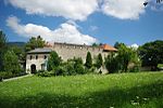
The Reichenhaller Burgenweg (also: Burgenweg Bad Reichenhall ) is a 30 km long hiking trail in the Upper Bavarian town of Bad Reichenhall .
The hiking trail leads to palaces, castles, castle ruins and castle stables in Bad Reichenhall and the surrounding communities Bayerisch Gmain , Bischofswiesen , Großgmain and Piding .
course
The Burgenweg follows existing hiking trails in the Bad Reichenhall valley basin, including the brine pipeline path along the route of the brine pipeline from Bad Reichenhall to Traunstein . The Burgenweg shares part of the way with the Salzalpensteig .
The starting point for the hike on the Burgenweg is trail center 2 at Marzoll Castle in the district of the same name . From there, the route crosses the border with Austria, leads over Buchhöhstrasse to Latschenwirt and on over Tannenwinkel and Bruchhäuslstrasse to Plainburg . Via Wolfschwang and the western foothills of the Untersberg , you continue to Hallthurm , where the remains of the dam with fortified tower and the Althaus and Hagenfels castle stables are located. In the direction of Bayerisch Gmain , the Burgenweg runs parallel to the railway line as far as Lattenbergstrasse to Oberhausen Castle . The next stops are the Hallburg on the Streitbichl and Gruttenstein Castle north of the B 20 . The path then follows the city wall to the Powder Tower and the Peter and Paul Tower .
After crossing the listed Luitpold Bridge , the path continues on the old Thumseestrasse to Kirchberg-Schlössl . Above the Schlössl was on the so-called Doktorberg the Castle Kirchberg , which today only as ground monument remains longer exists, and visible from the not survive. The Burgstall is located in impassable terrain; this is privately owned and not accessible to the public. After a few hundred meters, the Burgenweg branches off behind the underwater canal of the historic Saalach power plant from Thumseestrasse in a southerly direction into the forest and leads past Vager Castle Stables . Until it was discovered in 2002, this castle stable was suspected to be in the area of Garnei- and Sieben-Palfen-Weg. Like Kirchberg Castle, Vager Castle Stables are located in impassable terrain and are not open to the public. Due to the exposed location on a rock spur, there is also a risk of falling. From Vager it goes past the Amalienruhe to the toll to Karlstein and to the Amerang tower ruins . These two castles are also in inaccessible terrain, and there is a high risk of falling, especially at the Amerang ruins. The trail follows the Soleleitungsweg, passing the former Brunnhaus Fager until Seemösl east of Thumsees .
From the Thumsee the path leads above the state road 2101 in an easterly direction to Schmalschlägerstraße , until the footpath branches off to the Karlstein castle ruins . From Schmalschlägerstraße the Burgenweg continues towards the Bronze Age settlements in Langackertal and across the Nonner Unterland, past the Nonner Kircherl , the Strailachweg north of the Saalach and over Staufenbrücke to the Mauthaus in the Piding district of Mauthausen . The last stop on the Burgenweg is Staufeneck Castle , also in Piding. From there it goes over the Pidinger Au, the Saalach, the Marzoller Au and the former Marzoller district of Türk back to the starting point at Marzoll Castle.
Buildings
There are 17 buildings on the Reichenhaller Burgenweg , which are numbered consecutively, but not all of them are directly on the hiking route. The castle stables are mostly in impassable terrain, and there is often a risk of falling. At these stations there are large information boards on the hiking trail with important information about the structure.
There are many other historical buildings along the route, including in the list of architectural monuments in Bad Reichenhall or the list of ground monuments in Bad Reichenhall . Other notable buildings on or near the castle path, the parish church of St. Valentine , the Old Salt , the ensemble Upper Town , the Luitpoldbrücke that Saalach power plant , the Amalie rest , the ball Bachbauer with beer garden and restaurant, the Sanctuary of San Pancrazio and the Nonner Church .
| Serial No. | Surname | Type | Status | built | Height above NHN | location | Public access | picture |
|---|---|---|---|---|---|---|---|---|
| 1 | Karlstein castle ruins | Summit castle | Castle ruins | before 1150 | 615 m | ▼ | anytime, free admission |

|
| 2 | Amerang tower ruins | Rock castle | Most of the castle ruins have been removed |
1140-1180 | 570 m | ▼ | impassable terrain, no public access |

|
| 3rd | Karlstein toll | Rock castle | departed | High Middle Ages | 530 m | ▼ | impassable terrain, no public access |

|
| 4th | Burgstall Vager | Hilltop castle | departed | around 1177 | 535 m | ▼ | impassable terrain, no public access |

|
| 5 | Burgstall Kirchberg | Hilltop castle | departed | first half of the 12th century | 475 m | ▼ | impassable terrain, no public access |

|
| 6th | Kirchberg-Schlössl | baroque building | refurbished | 16th Century | 471 m | ▼ | Restaurant on the ground floor |

|
| 7th | City wall (Bad Reichenhall) | city wall | partially preserved | from 1220 | 470-514 m | the remains of the wall are mostly in public space |

|
|
| 8th | Gruttenstein Castle | Hilltop castle | inhabited | from 1218 | 500 m | ▼ | Privately owned, partly open for events such as Advent markets |

|
| 9 | Hallburg | Hilltop castle | departed | 1144 | 550 m | ▼ | impassable terrain, no public access |

|
| 10 | Oberhausen Castle | lock | inhabited | 1567 | 545 m | ▼ | Private property |

|
| 11 | Burgstall Hagenfels | Hilltop castle | departed | around 1370 | 765 m | ▼ | impassable terrain, no public access | |
| 12th | Burgstall Althaus | Hilltop castle | departed | Late Middle Ages | 740 m | ▼ | impassable terrain, no public access | |
| 13th | Hallthurm dam | dam | mostly gone | middle Ages | ▼ | Tower cannot be visited Remnants of the dam are clearly visible in the area |

|
|
| 14th | Plainburg | Hilltop castle | Castle ruins | from around 1100 | 595 m | ▼ | anytime, free admission |

|
| 15th | Marzoll Castle | Renaissance palace | refurbished | 16th Century | 480 m | ▼ | Visits and guided tours at fixed times |

|
| 16 | Staufeneck Castle | Hilltop castle | temporarily inhabited | from 1240 | 515 m | ▼ | Privately owned, currently no tours |

|
| 17th | Toll house | former toll house | inhabited | Renewed 17th century in 1842 |
460 m | ▼ | Private property |

|
History of the Castle Path
The Burgenweg was laid out between 2001 and 2004 by members of the Reichenhall Local History Association under the direction of the city archivist and association chairman Johannes Lang . For this purpose, archaeological excavations were carried out at various castle stables such as Kirchberg Castle and the Amerang tower ruins . In the course of this work, the Burgstall Vager was discovered, the location of which was previously unknown.
Individual evidence
- ↑ Reichenhaller Burgenweg on heimatkundeverein-reichenhall.de, accessed on March 21, 2021
literature
- Johannes Lang : Reichenhaller Burgenweg - guide to the castles and palaces in the Reichenhaller area . Published by the Association for Local History Bad Reichenhall and Surroundings e. V., Bad Reichenhall 2004
Web links
- Heimatkundeverein Reichenhall eV , publisher of the brochure on the Reichenhaller Burgenweg
- Burgenweg on bad-reichenhall.de
- Castle trail with a detailed map on regio.outdooractive.com


