Saint-Jorioz
| Saint-Jorioz | ||
|---|---|---|

|
|
|
| region | Auvergne-Rhône-Alpes | |
| Department | Haute-Savoie | |
| Arrondissement | Annecy | |
| Canton | Seynod | |
| Community association | Grand Annecy | |
| Coordinates | 45 ° 50 ′ N , 6 ° 10 ′ E | |
| height | 443-1,657 m | |
| surface | 21.12 km 2 | |
| Residents | 5,738 (January 1, 2017) | |
| Population density | 272 inhabitants / km 2 | |
| Post Code | 74410 | |
| INSEE code | 74242 | |
| Website | www.saint-jorioz.fr | |
Saint-Jorioz a French commune in the department of Haute-Savoie in the region of Auvergne Rhône-Alpes .
geography
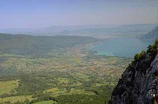
Saint-Jorioz is located at 465 m , about eight kilometers south-southeast of the city of Annecy (as the crow flies). The village extends west of Lac d'Annecy on an alluvial plain on the Laudon brook, at the eastern foot of Semnoz, which is part of the Bauges massif . The community is located within the Massif des Bauges Regional Nature Park .
The area of the 21.12 km² large municipal area includes a section on the west bank of Lake Annecy. The main settlement area is occupied by the approximately 2 km wide and 4 km long alluvial plain, which the Laudon and some side streams have raised over time at the confluence with the Lac d'Annecy. To the south, the community area extends into the broad valley of the Pays du Laudon . It is bounded in the east by the rugged rock ridge of the Roc des Bœufs (up to 1200 m ) and in the west by the ridge of the Semnoz . The slope and the ridge area of the Semnoz are densely forested, and below the summit of the Crêt du Châtillon , the highest point of Saint-Jorioz is reached at 1652 m .
In addition to the actual town center, Saint-Jorioz also includes several settlements, hamlets and farms, including:
- Sales ( 452 m ) on the alluvial plain west of the Laudon
- La Vieille Église ( 450 m ) on the alluvial plain at the mouth of the Laudon
- Filly ( 465 m ) on the southern edge of the plain
- Villard ( 480 m ) on the southern edge of the plain
- Épagny ( 480 m ) at the eastern foot of the Semnoz
- Gindre ( 495 m ) at the entrance of the Laudon into the plain, at the eastern foot of the Semnoz
- Machevaz ( 620 m ) on the lower eastern slope of Semnoz
- Entredozon ( 600 m ) on Laudon, at the eastern foot of the Semnoz
Neighboring municipalities of Saint-Jorioz are Sévrier and Menthon-Saint-Bernard in the north, Talloires-Montmin and Duingt in the east, Saint-Eustache in the south and Viuz-la-Chiésaz and Quintal in the west.
history
The lakeshore near Saint-Jorioz was already settled in the Neolithic . The Macelum settlement was located here in Roman times .
Probably in the 9th century a monk named Jore founded a small priory, which was first mentioned in the 11th century. Therefore the place was renamed from Macelum to Saint-Jeore , from which the current place name developed via Saint-Joroz .
Population development
| year | 1962 | 1968 | 1975 | 1982 | 1990 | 1999 | 2005 |
|---|---|---|---|---|---|---|---|
| Residents | 1,360 | 1,831 | 2,446 | 3,344 | 4.178 | 5,002 | 5,638 |
With 5738 inhabitants (as of January 1, 2017), Saint-Jorioz is one of the larger municipalities in the Haute-Savoie department. In the course of the 19th and 20th centuries, the population decreased continuously due to strong emigration (in 1861, Saint-Jorioz still had 1,585 inhabitants). Since the beginning of the 1950s, thanks to the attractive residential area and the proximity to Annecy, there has been a marked increase in population. Outside the old town center, numerous new buildings, single-family houses and villas were built.
Attractions
The current parish church was consecrated in 1885. Saint-Jorioz has two castles, but they cannot be visited. The Château de Villard-Chabod originally dates back to the 12th century, but was redesigned several times in later times. The Château de Noiret presents itself as a defiant building. The mill du Noiret was built in 1644; it is to be restored and made accessible to the public. The Musée du Pays de Laudon (local history museum) is located in an old farmhouse.
Economy and Infrastructure
Until the 20th century, Saint-Jorioz was a predominantly agricultural village. For a long time, a brick factory was the town's most important industrial enterprise. Today there are various small and medium-sized businesses. Many workers are commuters who work in the Annecy area. Thanks to its beautiful location on the lake, Saint-Jorioz has developed into a holiday resort in recent decades. Day tourism also plays an important role.
The place is well developed in terms of traffic. It is on the main N508 road from Annecy to Albertville . There are other road connections with Leschaux and Saint-Eustache. The closest connection to the A41 motorway is around 14 km away. Saint-Jorioz owned a station on the Annecy-Albertville railway line, which was closed in 1964.
Web links

