Schwabing-Freimann
|
Schwabing-Freimann
State capital Munich
Coordinates: 48 ° 10 ′ 50 ″ N , 11 ° 36 ′ 10 ″ E
|
|
|---|---|
| Area : | 25.67 km² |
| Residents : | 78,657 (Dec. 31, 2019) |
| Population density : | 3,064 inhabitants / km² |
| Postcodes : | 80538, 80801, 80802, 80803, 80804, 80805, 80807, 80939 |
| Area code : | 089 |
|
Location of the city district 12 in Munich
|
|
Schwabing-Freimann is the city district 12 of the Bavarian capital Munich .
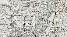
The city district consists of the eastern areas of the former city of Schwabing , the former municipality of Freimann and its districts, and Fröttmaning , which belonged to the former municipality of Garching near Munich until it was incorporated . Since the reorganization of the city districts in 1992, the city district has been one of those that are characterized by great differences in structure and cityscape. The western part of Schwabing, built around 1900, forms the Schwabing-West district .
Location and district parts
The district of Schwabing-Freimann is located in the north of Munich to the left of the Isar . In the south it is bordered by the Siegestor , which stands roughly on the former border between the cities of Munich and Schwabing, in the north by today's Munich city limits, and in the east by the Isar. In the west, the border runs from the south along Friedrich-, Viktoria-, Simmern- and Isoldenstraße and then between Am Hart and Freimann for the most part along Leopold- and Ingolstädter Straße.
Schwabing-Freimann borders (counterclockwise) on the districts of Milbertshofen-Am Hart and Schwabing-West in the west, the districts of Maxvorstadt and Altstadt-Lehel in the south, the district of Bogenhausen and the communities of Unterföhring and Ismaning in the east on the other bank of the Isar and the city Garching near Munich and the municipality of Oberschleißheim in the north.
The eight districts of Schwabing-Freimann received their limits in 1996 (like all other districts of Munich), which are primarily used to provide statistical information. For better orientation, they were given their names by the Munich Statistical Office, but these do not always correspond to historical circumstances. So the district part Obere Isarau was named after the river lowlands of the Isar, although the historical center of Freimann is located in this part and thus also the urban areas that the local residents know as Freimann. In contrast, the Euro-Industriepark is located in the Freimann district , although it was laid out on the site of the former Neufreimann. Settlement areas that only emerged in the 1930s (e.g. pine gardens ) are also referred to by Freimann as Neufreimann due to their relatively late construction; they are also located in the Freimann district. The largest area of the district (located south of Domagkstrasse), which was given the name Neufreimann, has belonged to what was then Schwabing since 1808; the hamlet of Neuschwabing was also located here (see below). The Neufreimann settlement at that time was only partially located in this part of the city district, but mostly it was in the districts of Freimann and Alte Heide - Hirschau .
Schwabing

Schwabing was first mentioned in a document as Suuapinga in 782 . The name comes from Swapo and means settlement of a Swabian . With the first community edict in 1808, Schwabing gave its name to the new (tax) community Schwabing, which from then on also included the settlements of Biederstein, Hirschau, Neuschwabing, Riesenfeld and Tivoli. The community was elevated to a city in 1886 and incorporated into Munich in 1890. As early as 1909, the then new development areas in the west of the former Schwabing urban area were separated from the Schwabing district and became a separate district of Schwabing-West . Around 1890 a new urban development center was built on Feilitzschplatz, today's Münchner Freiheit , with the Evangelical Lutheran Church of the Redeemer as a northern end, which soon developed into the pulsating center of Schwabing. By 1940 that part of Schwabing that belongs to the city district had received its present form. Since the year 2000, for example, new residential quarters such as Parkstadt Schwabing or Domagkpark (see below), which - located on former commercial and barracks areas on the border with Freimann - were counted in the public consciousness until the areas were rededicated to the industrialist Neufreimann.
Old heather
In 1918, the local industrial companies Krauss-Maffei and BMW, together with the Deutsche Reichsbahn, founded the common non-profit housing association Alte Haide in the spelling popular at the time in order to build living space close to their business premises. According to plans by Theodor Fischer , the workers' quarter west of the Nordfriedhof on today's Ungererstrasse was built between 1919 and 1928. In 1920 the name Alte Heide was added to the address book of the city of Munich in the correct spelling today. The connection in public transport takes place via the underground station of the U6 Alte Heide . To the north of Domagkstrasse is the New Israelite Cemetery of the Israelite Community of Munich and Upper Bavaria .
Aumeister
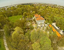
After the establishment of the English Garden , the Aujägermeister's house was relocated from Lehel to the northern edge of the Hirschau . 1810/11 of Hofmaurermeister erected Joseph Deiglmayr a new farm building on the site of a former wooden garden maintenance building, which today Aumeister is called. After the forest and forester not only had to look after the game in this part of the Isar floodplain, but also had to entertain the participants in the court hunts , the foreman was visited by day trippers even before the hunt in the Hirschau was abandoned. This is how a popular inn with an adjoining beer garden developed , which is still frequented by day trippers. The Aumeister is located in the Hirschau east of the student town and directly south of the Föhringer Ring. The Aumeister became part of the Schwabing community in 1818 and, together with the city of Schwabing, was incorporated into the royal capital and residence of Munich on November 20, 1890.
Biederstein
Biederstein was first mentioned in a document on October 17, 1784 as Biederstein . The name of the located on what is now Biedersteiner street location means something like stout castle as stone as a common name for castle , castle can be detected and worthies as good , brave , honest - similar to Biedermann , Biedermaier . Since the first community edict in 1808, part of the (tax) community Schwabing, Biederstein was incorporated into Munich together with the city of Schwabing on November 20, 1890. The Kleinhesseloher See and the Biederstein dormitory are located in the Biederstein district .
Domagkpark
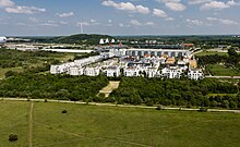
The Domagkpark district was built from 2013 to 2020 after most of the buildings of the former radio barracks were demolished. The area has belonged to the Schwabing district since 1907 and was part of the then Freimann community from 1808 to 1907 . It got its name because of its location on Domagkstrasse . The area has been called Domagkgelände since the Bundeswehr shut down the barracks in 1993 and the federal government rented the building for various temporary uses. In Domagkpark there are 1,600 apartments for around 4,000 people, shops, cafes, restaurants, day-care centers, hotels, two student residences, a primary school and sports facilities around a large park. The Domagkateliers artists' colony is located in one of the former barracks buildings . The center of the district is the Bauhausplatz. There is also the tram station is Schwabing north of the tram line 23 , which the new urban district with the Münchner Freiheit joins.
Emilienhof
From 1952 to 1958, the construction company Karl Stöhr built a residential complex north of the Alte Heide housing estate between Dietersheimer Straße, Wandletstraße, Domagkstraße and Garchinger Straße and named it after his wife and daughter of the same name, Emilie. Following the customs of the time, the residential complex name ends with "-hof". The area has belonged to the Schwabing tax (community) since the first municipal edict in 1808 and was therefore already in the Schwabing district when it was first built.
Hirschau
The name Hirschau appears for the first time on a city map from 1808 as Hirschau and is derived from the Hirschen , which refers to the abundance of game in the Isar floodplains to the left of the Isar north of Munich. On his map from 1613 Vollckmer shows deer grazing on the site of the later English Garden . Alternately also called Hirschanger , as shown on a map from 1712, the area, which was created in the years 1798 to 1804 as a continuation of the English Garden up to the Aumeister, has been exclusively called Hirschau since 1808 . From 1818 part of the municipality of Schwabing, the Hirschau was incorporated into Munich on November 20, 1890 together with the city of Schwabing.
Mitterschwabing
The secret council , treasurer and chief hunter Johann Theodor von Waldkirch acquired a summer house with a garden in the village of Schwabing , which was opened on January 22nd, 1774 by Elector Max III. Joseph was raised to the privilege of noble seat in Mitter-Schwäbing ; this is also the first documentary mention. After the philosopher Franz von Baader took over the castle that was located at the corner of today's Leopoldstrasse and Feilitzschstrasse , it was also called the Baaderschlösschen . In 1874 Ludwig Petuel bought the manor house, and in 1877 he built the Schwabinger brewery right next to it . In 1889 the castle was torn down and replaced by a new building with a large hall. Legendary bohemian artist festivals such as For example, the “Schwabinger Bauernkirta” organized by the Academy of Fine Arts , the most famous artist and student festival at Munich Carnival, takes place. The first workers' strikes were called in the Schwabing brewery in January 1918 under the leadership of Kurt Eisner , and later the “red troops” found bases here. After the First World War, the “Schwabylon Feste” was a continuation of the previous era. After the Second World War, the partially destroyed building was first renovated. In 1964, a black, around 50 m high, eleven-story department store was built by Hertie in its place , which was demolished in 1992. The term Mitterschwabing for the district that was built on the 40- day farm is hardly used today. Mitterschwabing has been part of the (tax) community Schwabing since the first community edict in 1808 and was incorporated into Munich together with the city of Schwabing on November 20, 1890.
Neufeld
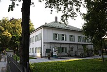
The property of Count Joseph von Lodron was raised to a knight's seat by Elector Karl Theodor in 1789 and in 1793, under the name Neufeld, it was given a lower jurisdiction over three associated properties and mentioned in a document under these names. In 1802, Court Marshal Ludwig von Gohren acquired the knight's seat and it still exists today. The knight's seat at today's Biedersteiner Straße 21 has since been named Gohren-Schlössl after him . The name Neufeld is hardly used today. 1808 Part of the Schwabing tax community, Neufeld was incorporated into Munich on November 20, 1890 together with the city of Schwabing.
Neuschwabing
When the Schwabing tax district was founded in 1808 and the municipal boundaries of Schwabing were established, the hamlet of Neuschwabing was already mentioned in the cadastre . At that time there were seven houses along what is now Leopoldstrasse, starting at the intersection of Griegstrasse and then continuing north to today's Domagkstrasse . The incorporation of Schwabing into Munich in 1890 meant that Neuschwabing was now on the outskirts. This is also the reason why there was a customs house on what was then Ingolstädter Landstrasse until the 1950s (today the parcel at Leopoldstrasse 246). The name Neuschwabing for the area on both sides of today's Leopoldstrasse between Griegstrasse in the south and Milbertshofener Strasse / Domagkstrasse in the north is rarely used today. Since the reorganization of the city districts, the part of Neuschwabing west of today's Ingolstädter Straße has belonged to the city district 11 Milbertshofen-Am Hart . Since the first community edict in 1808, part of the (tax) community Schwabing, it was incorporated into the royal capital and residence of Munich together with the city of Schwabing on November 20, 1890.
Parkstadt Schwabing

As part of the "social righteous land use" of urban policy is since 2000 the former, 40.5 hectare industrial area between Schenkendorfstraße in the south, the A9 to Nuremberg in the east, Domagkstrasse in the north and the abandoned freight rail line to the former goods station Schwabing by Plans by the architects André Perret and the landscape architect Rainer Schmidt redesigned a new district that will have an office, hotel and business center with around 12,000 jobs in the service and commercial sector as well as a residential area with 1,500 residential units, 500 of which are in social housing . Following the model of the Munich settlement perspective “compact-urban-green”, the Parkstadt Schwabing has a 650-meter-long park strip as its centerpiece, which is called the Central Park . The area that was previously counted as Freimann in the public consciousness, although Domagkstraße roughly marked the border between the then city of Schwabing and the then municipality of Freimann, will be completely reorganized, previous streets such as Duisburger Straße, Krefelder Straße, Ruhrortstraße and Magdeburger Roads were built over or relocated. The name probably goes back to the "Project Advisory Board Parkstadt Schwabing". The connection to local public transport is via the U6 with the Nordfriedhof and Alte Heide underground stations . Since December 2009 tram line 23 has been connecting Parkstadt over the Schenkendorf Bridge with Münchner Freiheit in the south and the urban development area Domagkpark on the site of the former radio barracks in the north. Also in Parkstadt are the Skyline Tower on the corner of Domagkstraße and Walter-Gropius-Straße, as well as the Highlight Towers on Mies-van-der-Rohe-Straße as well as the administration of Commerzbank and a branch of the Deutsche Bundesbank (the former state central bank ) on Leopoldstrasse.
Schwabinger Gate
The new district was built from 2013 to 2017 on the former site of a metro wholesale market and the first Munich Holiday Inn hotel, as well as part of the former Munich-Schwabing freight station , which was closed in 1987. It consists of nine buildings, three of which are fourteen stories high. There are apartments (including cooperative living), shops, restaurants, offices and a luxury hotel there.
Suresnes
On May 5, 1718, the date of the first documentary mention, Elector Max Emanuel elevated his secret and cabinet secretary Ignaz von Wilhelm to a noble seat under the name Sourenne and at the same time gave it a lower jurisdiction . Over time, the name Sourenne changed to Suresnes . The Suresnes Castle is now part of the Catholic Academy at the Werneckstraße. Since the first community edict in 1808 part of the tax community Schwabing, Suresnes was incorporated into Munich together with the city of Schwabing on November 20, 1890.
Freimann
Freimann was first mentioned in documents as ad Frienmannun in 948/957 . The name means To the free men . Under Free men , even free men or Barschalken called, people were understood to be personally free, with the ground but were subject to forced labor. The old town center is located at the old village church of St. Nikolaus , Heinrich-Groh-Straße 11, which formerly owned the patronage of St. Margaret.
With the first community edict in 1808, Freimann with the districts Kulturheim and Lappen became a (tax) community, with the second community edict in 1818 the community finally became independent. The Friedrich Krupp AG , built in 1916 in Freimann the Bavarian artillery works ; this plant was liquidated after the First World War. The Deutsche Reichsbahn set up the Freimann Reichsbahn repair shop on this site from 1927 to 1931 and at the same time built a large housing estate next to it. Other industrial companies settled in Freimann.
On October 1, 1931, Freimann was incorporated into the state capital of Munich. Then in 1932 the Reichkleinsiedlung Freimann was built on Kulturheimstrasse between Freisinger Landstrasse and the Schleissheim Canal , which was inaugurated on July 31, 1933. To the west of the old town center, on Lilienthalallee , is the MOC Munich Event Center , designed by US architect Helmut Jahn and operated by Messe München GmbH, the Zenith event hall and Motorworld Munich .
Meadow settlement
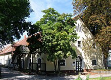
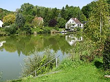
In Großlappen, north of the Großlappen waste recycling plant and located on the B 11 , Georg Röck, representative and former operations manager of the "Biohum-Werk München-Großlappen", planned to set up a company that wanted to use the sewage sludge from Großlappen for fertilization purposes. So he bought a 2 hectare property in Fröttmaning. However, the state capital refused him the building permit, which is why Röck then parceled out the land he had already acquired and resold the individual plots in 1948 to settlers willing to build. The meadow settlement, which consists of sixty-two one and two-family houses and was built like an old Bavarian village around a pond and a playground and football field, is therefore also called the Röck settlement.
Euro industrial park
The Euro-Industriepark, one of the largest industrial parks in Neufreimann, was founded in 1963 by Anton Ditt, the owner of Euro-Boden GmbH , on the premises of the Deutsche Bundesbahn . In 1968 the industrial park, in which 40 companies were located at the time of its establishment, was ceremoniously opened. Even today (2012) it is one of the largest industrial areas in Munich and is largely characterized by pick-up wholesale markets ; there are several brothels in its periphery.
Floriansmühle
The Floriansmühle was originally an agricultural operation on the Mühlbach in Kultursheim, where Johann Nepomuk Kiblbeck registered a grinding mill in 1895. After Karl Kaltenbach opened a privately run public family pool in 1932 , the name Floriansmühle established itself as a field name. The bath has been closed since the late 1980s. Since the first community edict in 1808, Floriansmühle belonged as part of Kultursheim to the (tax) community of Freimann and was incorporated into the state capital of Munich on October 1, 1931, together with the community of Freimann.
Freimanner Heide
The name Freimanner Heide refers to the heath landscape spread out around Freimann. A settlement was built on Heidemannstrasse in 1984, which initially had no official name. In order to find a name, value was placed on the participation of the citizens. This proposed the name Freimanner Heide at a citizens' meeting of the then 22nd district of Schwabing-Freimann , which the administrative committee of the city council decided on September 20, 1988. The plenary meeting of the city council confirmed the resolution proposed by the administrative committee on September 28, 1988. The foundation stone of the two-thirds completed settlement at that time could therefore be laid on June 27, 1985. Unaffected by this official place name, the settlement is mainly used by architects and architectural historians under the private project names Gartenstadt Heidemannstrasse or Siedlung Heidemannstrasse . The ADAC also names parts of the settlement on its map of Munich as Fröttmaninger Heide (not to be confused with the earlier (and now to the west) Panzerwiese , which today represents the area of Fröttmaninger Heide protected by the Fauna-Flora-Habitat Directive of the European Union ) .
Fröttmaning
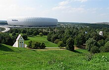
The district of Schwabing-Freimann now also includes the area of the village of Fröttmaning , which was originally part of the municipality of Garching near Munich . Only the Holy Cross Church remains of the village itself , the manors were demolished for the construction of the Munich-North motorway junction and for the filling of the Fröttmaninger Berg . The Allianz Arena and the Islamic Center Munich are located in the Fröttmaning area ; the only residential area is the Auensiedlung .
Haidpark
The Haidpark is a residential area south of the Fröttmaninger Heide, which was built from 2008 to 2011. It is located at the Fröttmaning underground station .
Pine garden
Today's Kieferngarten district emerged from the merger of three settlers. It is named after the Siedlergemeinschaft München-Nord eV, founded in September 1946. V., which has called itself the “Kieferngarten Siedlervereinigung Kieferngarten” since March 1949 and finally renamed itself in September 1952 to the Kieferngarten Settlers Association . From 1947 onwards, they built a wild settlement on the former shooting range north of Heidemannstrasse, which the city council called shooting range settlements (in the plural). In 1950 an access road was laid out and named Kieferngartenstrasse , although it initially remained undeveloped. At the same time, another (partially) wild settlement was built, which the city council designated in 1950 as the Freimann garden settlement . The city council subsequently approved these "black buildings" in 1952. Three settlements were active in the mid-1950s: the Munich North / West settlements , which built their Grusonsiedlung , named after Grusonstrasse, as well as the Kiefergarten and Munich North / East settlements , which became settlers on March 1, 1956 Pine garden Munich-Freimann e. V. merged. These three settlements were grouped under the name of Kiefergarten from the end of the 1950s . In addition, the makeshift housing estate and the Großkopf-Siedlung , named after Johann Großkopf, the brewery worker and later chairman of the Munich-North settlements, are integrated into the Kiefergarten district. The former terminus of the first Munich subway line 6 was named "Kiefergarten" by the main committee of the city council on March 19, 1968. At the end of 2006, the Bundeswehr sold the northern areas of the Fürst-Wrede barracks to FC Bayern e. V. , who, after completion of the construction control procedure, would like to create better sports opportunities for his amateurs. Four sports halls are planned (one of them with a capacity of 5000, the others with a capacity of between 200 and 500 spectators), seven soccer fields, two basketball courts, an archery range, a track & field, and a mountain bike course. There will also be a clubhouse and a car park with 400 parking spaces. St. Katharina von Siena is in the horse street 2A , in the Carl-Orff-Bogen the hope church .
Culture home
Culture home was first mentioned in 1808 as a culture home . The name is derived from the cultivation efforts of the farmers in this meadow landscape of the Isar . The Garching Mühlbach flows west of the settlement, separating it from Freimann. Floriansmühle has become an independent district since 1932 and was separated from the former cultural center. In 1952, the city council of the state capital Munich decided to delete the genitive s because, in its opinion, it was grammatically not justifiable. Today the Kulturheim studios of Bavarian TV are located, northeast of the village is the ECC congress center . Since the first community edict in 1808, Kulturheim was part of the (tax) community of Freimann and was incorporated into the state capital of Munich on October 1, 1931 as part of the community of Freimann.
Rag
The village of Lappen, which is divided into the districts of Großlappen and Kleinlappen , was first mentioned as Louppen in a document dated from around 1167 to around 1170/71 . The origin of the name is controversial: At the moment, a derivation from Labach , which means "swampy area", is assumed to be the most likely possibility . A derivation of loub , which means deciduous forest , cannot be excluded. Lappen is home to numerous urban infrastructure facilities, such as the Munich I wastewater treatment plant , which takes up most of the Großlappens, and the garbage dump , which is now known as Fröttmaninger Berg, to a lesser extent on Lappener, but mostly on Fröttmaninger Grund. At Gut Großlappen, among other things, industrial alcohol is distilled in the estate's own distillery. Today, in the public consciousness, the flap is no longer perceived as a whole, but rather in its subdivisions large and small flaps. With the first municipal edict in 1808, Lappen became part of the (tax) municipality of Freimann and, together with the municipality of Freimann, was incorporated into the state capital of Munich on October 1, 1931.
Neufreimann
In 1800 four farmers from Waldsassen in the Upper Palatinate bought the then electoral estate of St. Georgenschwaig in Milbertshofen, which also included grazing rights on Freimanner property. From 1820, more day laborers from the Upper Palatinate followed and built their houses along today's Ingolstädter Strasse, starting around today's Domagkstrasse and then continuing north to around Hürnbeckstrasse. Affiliation to Freimann developed slowly, in 1849 a municipal representative from Neufreimann is mentioned for the first time and since the 1870s there has always been a representative from Neufreimann on the municipal committee. In addition to dairy farming, the residents mainly cultivated fields and horticulture for the Munich Viktualienmarkt. Large companies also settled here, such as an aluminum factory in 1855 and a horsehair spinning mill from 1885, which continued into the 1950s. Josef-Raps-Straße in Freimann-Süd (settlement south of the student town of Freimann ) is named after a respected Neufreimanner citizen who temporarily took over the management of the local administration of Freimann. After the end of World War II , the US military administration confiscated houses in the Kaltherberg workers' settlement west of what is now the Euro-Industriepark between 1946 and 1949 and set up a DP camp there to accommodate so-called displaced persons (DP). Although the Kaltherberg settlement belonged to Milbertshofen , the camp was called DP camp Neu-Freimann . From 1960 Neufreimann was used as a synonym for the then newly created industrial areas around Domagkstrasse and Frankfurter Ring, the largest of which was the Euro-Industriepark (see below). The areas south of Domagkstrasse had belonged to Schwabing since 1808 (establishment of the Schwabing tax district) and a large part of the areas south of the railway line of the north ring since 1907. Today, the residential areas north of Heidemannstrasse (such as the pine garden ) are also known as Neufreimann . In contrast, since the construction of the new residential and commercial districts Parkstadt Schwabing and Domagkpark , the former commercial areas around Domagkstrasse are no longer incorrectly counted as Neufreimann. Since the reorganization of the city districts in 1992, the area west of Ingolstädter Strasse and the Kaltherberg settlement east of Ingolstädter Strasse belong to the city district 11 Milbertshofen-Am Hart . Part of the early settlement areas is still in the Freimann district . Neufreimann had been part of the (tax) community of Freimann since the first community edict in 1808 and was incorporated into the state capital of Munich on October 1, 1931, together with the community of Freimann.
Neuherberg
On March 13, 1934, the city council decided to build a small settlement north of the Am Hart settlement and gave it the official name of a new hostel . The area is located in the Freimann district , which was incorporated into the city of Munich as early as 1931. The Reich Ministry of Post and the General Directorate of the State Archives raised objections to the naming of the settlement, as they feared confusion with the historical district of the same name Neuherberg in the municipality of Oberschleißheim, which was further north of the planning area. Thus, the Reich Governor for Bavaria did not approve the naming. The settlement was completed under the provisional name Neuherberge in 1936, the settlement agreements were handed over on August 27, 1936, the settlement remained officially nameless. The name Neuherberg was only approved after the Second World War , after the reconstruction department of the state capital Munich determined that the approval process by the Reich governor had become obsolete.
Student town of Freimann
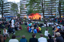
With a city council resolution of March 25, 1965, the construction of several dormitories on Ungererstraße was initiated for the steadily increasing number of students matriculated at Munich universities . The student city, which has grown over the years, has 2478 places to live in 14 houses, making it the largest student settlement in Germany . The student city is connected to the transport network of the Munich Transport and Tariff Association (MVV) with the underground station of the same name on the U6 . It is conveniently located on the A 9 Munich– Berlin , junction Frankfurter Ring (75).
Social structure
The social structure in the urban district is homogeneous : After Freimann has very large commercial areas despite individual rededications and the population density in Schwabing is significantly higher, the social structure of the urban district as a whole is dominated by Schwabing. The level of education and the proportion of academics are high compared to other cities. Three quarters of those in employment are employed, civil servants and self-employed. While Schwabing is clearly middle-class oriented, Freimann is mainly characterized by workers and employees in the lower wage groups.
Almost 58 percent of the households in the district are one-person households, the majority of which are located in Schwabing, also because of the population density. Children live in 15 percent of households, and they tend to be more likely to be found in Freimann, as there are large residential complexes in addition to single-family houses. The proportion of families with children has increased, especially due to the large residential complexes such as the one in Freimanner Heide on Heidemannstrasse . 27 percent of the households in the district are childless multi-person households that are evenly distributed between Schwabing and Freimann. The focus with regard to the age distribution in the city district is on the 20 to 30 year olds and the 50 to 60 year olds, whereby no particular differences can be found between Schwabing and Freimann. At around 27 percent, the proportion of foreigners is slightly above the city-wide level.
Industry and commerce
The picture is also inhomogeneous in terms of the structure of the industrial and commercial areas. While the manufacturing industry is traditionally to be found in Freimann, Schwabing is clearly shaped by the service sector in its job structure . After a continuous downsizing of jobs in the manufacturing industry, only about a fifth of the jobs in the city district are now in the manufacturing and construction industries. The commercial areas are mainly located in Freimann, namely in the Euro-Industriepark and the commercial areas Freimanner Hölzl and Fröttmaninger Heide . In the meantime, a change in the workplace structure towards the service sector can also be observed in Freimann. The majority of the newly built administration and office complexes have significantly increased the number of jobs there. Nevertheless, the main focus of the service sector can be found in Schwabing. The focus here is on banks , insurance companies , administrations and publishers .
traffic
Three large streets connect the two districts of Schwabing and Freimann in a south-north direction: on the one hand the A9 Munich - Nuremberg, which begins at Schenkendorfstrasse and has junctions in Freimann and Fröttmaning; the Leopold Street / Ingolstadt street, then Ungererstraße . Its continuation to the north is first called Situlistraße and then Freisinger Landstraße . To the north of the Mittlerer Ring , Leopoldstrasse and Ungererstrasse form sections of the B 13 and B 11, respectively. The most important east-west axes in Schwabing are the Dietlindenstrasse - Potsdamer Strasse - Rheinstrasse (further towards Schwabing-West), the Mittlere Ring (Isarring - Schenkendorfstraße - Petuelring, further to Schwabing-West and Milbertshofen) and Domagkstraße (further to Milbertshofen). The most important east-west connections in Freimann are the Frankfurter Ring and Heidemannstraße, which lead to the Milbertshofen-Am Hart district .
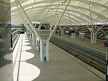
The most efficient south-north axis of local public transport is the underground line 6 , which runs above ground after the Alte Heide underground station to Garching-Hochbrück . At the Münchner Freiheit subway junction , the U3 branches off the U6 westwards in the direction of the Olympiazentrum , and several bus routes run from here to the west and north and through the English Garden to Bogenhausen. The tram line 23 has been running to Parkstadt Schwabing and Frankfurter Ring since December 2009. You can change to other bus lines, which serve areas on both sides, but mainly west of the U6, at the Dietlindenstraße, Alte Heide, Studentenstadt and Kieferngarten underground stations.
The Munich Nordring , which is exclusively used for freight traffic and where the Munich-Freimann freight station is located, runs through the city district . From 1901 to 1987, the Munich-Schwabing freight station was located in Schwabing east of Leopoldstrasse and was connected to Freimann station via a connecting line. Numerous siding connected the Schwabing hospital and the JA Maffei locomotive factory in Hirschau to Schwabing station. In 2019, planning began for a new S-Bahn line that is to run on the existing tracks on the Nordring as early as 2026. As part of the expansion of the line for passenger traffic, the extent to which the S-Bahn line can be connected to tram line 23 is to be checked. The previous planning of the required tram bridge structure by SWM has not yet taken into account the S-Bahn, but the results of a feasibility study for linking the two modes of transport should be included in the planning as early as possible.
Culture, religion and education
- Attractions
- Allianz Arena , Fröttmaninger Heide
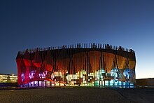
- Showpalast Munich , Fröttmaning
- Zenith event hall
- Motorworld , Freimann
- Institutions
- Institutes of the Ludwig Maximilians University in Schwabing
- Bavarian television studios in Kulturheim, Freimann
- Munich Order Center (M, O, C,) of Messe München in Freimann
- Technical base of the Munich subway in Fröttmaning
- Max Planck Institute for Physics on Föhringer Ring north of the student town of Freimann
- Administrative facilities such as the military area command IV in the Fürst-Wrede barracks in Neuherberg
- Motorway maintenance depot Munich-North, Freimann
- Mohrvilla, Freimann
- Heidehaus on the Fröttmaninger Heide
- schools
- Montessori Technical College Munich
- St. George's - The British International School Munich , Heidemannstrasse 182
- Maximiliansgymnasium , Schwabing
- Oskar-von-Miller-Gymnasium , Schwabing
- Gisela-Gymnasium , Schwabing
- Churches
- St. Nicholas , Freimann
- Parish Church of St. Ursula , Schwabing
- Church of the Redeemer , Schwabing
- Michaelskirche, Grusonsiedlung, Freimann
- Catholic Church of All Saints, Alte Heide
- Nicodemus Church, Alte Heide
- Holy Cross, Fröttmaning
- Greek Orthodox Metropolis - All Saints Church, Alte Heide
- Mosque of the Islamic Center in Munich , which was inaugurated in 1973
Architectural monuments
- List of architectural monuments in Munich / Schwabing
- List of architectural monuments in Munich / Freimann
Sports
- FC Bayern Campus , the new performance center of FC Bayern Munich for the youth sector, Neuherberg
- ESV München-Freimann, railway sports club in Freimann
- FC Schwabing
statistics

(As of December 31, residents with main residence)
| year | Residents | including foreigners | Inhabitants per km² |
|---|---|---|---|
| 2000 | 57,631 | 12,659 (22.0%) | 2,246 |
| 2001 | 59,392 | 13,537 (22.8%) | 2,314 |
| 2002 | 60,060 | 13,840 (23.0%) | 2,340 |
| 2003 | 60.215 | 14,241 (23.7%) | 2,346 |
| 2004 | 59,602 | 13,996 (23.5%) | 2,322 |
| 2005 | 59,766 | 14,068 (23.5%) | 2,329 |
| 2006 | 62,430 | 14,288 (22.9%) | 2,432 |
| 2007 | 63,832 | 14,542 (22.8%) | 2,487 |
| 2008 | 64,350 | 14,581 (22.7%) | 2,507 |
| 2009 | 63,720 | 14,013 (22.0%) | 2,482 |
| 2010 | 65,158 | 14,672 (22.5%) | 2,538 |
| 2011 | 66,706 | 15,521 (23.3%) | 2,599 |
| 2012 | 68,530 | 16,605 (24.2%) | 2,670 |
| 2013 | 69,676 | 17,687 (25.4%) | 2.714 |
| 2014 | 71,802 | 19,608 (27.3%) | 2,797 |
| 2015 | 75.020 | 22,068 (29.4%) | 2,922 |
| 2016 | 77,188 | 23,176 (30.0%) | 3,007 |
| 2017 | 76,341 | 21,980 (28.8%) | 2,974 |
| 2018 | 77,936 | 22,867 (29.3%) | 3,036 |
| 2019 | 78,657 | 23,309 (29.6%) | 3,064 |
Source with further data
politics
The district committee of Schwabing-Freimann was last elected on March 15, 2020. The distribution of seats is as follows: Greens 13, SPD 8, CSU 8, FDP 2, AfD 1 and FW 1. Of the 54,522 residents who are entitled to vote in Schwabing-Freimann, 26,709 exercised their right to vote, bringing the turnout to 49.0 percent .
literature
- Florian Breu: The Munich districts after the urban area reorganization . In: Munich Statistics . No. 1 , 1996, ISSN 0171-0583 , p. 1-14 .
- Klaus Gallas : Munich. From the Guelph foundation of Henry the Lion to the present: art, culture, history . DuMont, Cologne 1979, ISBN 3-7701-1094-3 (DuMont documents: DuMont art travel guide).
- Helmuth Stahleder : From Allach to Zamilapark. Names and basic historical data on the history of Munich and its incorporated suburbs. Edited by Munich City Archives . Buchendorfer Verlag, Munich 2001, ISBN 3-934036-46-5 .
- Michael Stephan, Willibald Karl: Schwabing. Volk Verlag, Munich 2015, ISBN 978-3-937200-77-4 .
- Brigitte Fingerle-Trischler: Freimann in the north of Munich. Volk Verlag, Munich 2018, ISBN 978-3-86222-274-2 .
- Culture and history trail Schwabing-Freimann of the state capital Munich
Individual evidence
- ↑ December 2019 (PDF). Statistical Office of the State Capital Munich. Retrieved February 22, 2020.
- ^ "After the new delimitation: population development in the Munich city districts; names of the districts and districts" Statistisches Amt München
- ↑ Helmuth Stahleder: From Allach to Zamilapark: Names and basic historical data on the history of Munich and its incorporated suburbs . Buchendorfer Verlag , 2001, ISBN 978-3-934036-46-8 , p. 76 ( limited preview ).
- ^ Emil Kraepelin : Kraepelin in Munich II: 1914-1921 . belleville Verlag Michael Farin, 2009, ISBN 978-3-933510-96-9 , p. 146 ( limited preview ).
- ^ A b Gunna Wendt: Schwabinger Brewery In: Literature portal Bavaria
- ↑ Steadily uphill In: Süddeutsche Zeitung October 30, 2015
- ↑ Schwabing-Freimann cultural history trail
- ↑ Bavarian History (s), 25/2015: Schwabing shines In: Volk Verlag November 10, 2015
- ↑ Loved and controversial: Stories from the Hertie high-rise In: Münchner Wochenanzeiger September 16, 2014
- ^ Michael Stephan, Willibald Karl: Schwabing. Volk Verlag, Munich 2015, ISBN 978-3-937200-77-4 , pp. 25-27.
- ↑ City map of Munich 1: 15,000 (~ 1930) from www.landkartenarchiv.de
- ↑ Tram 23 ( Memento from January 6, 2010 in the Internet Archive )
- ↑ Information on the Schwabinger Tor of the Jost Hurler Group
- ↑ State capital Munich, editor: Fürst-Wrede-Kaserne. In: muenchen.de. April 17, 2013, accessed February 10, 2019 .
- ↑ Münchener Nord-Rundschau (from June 12, 2007)
- ^ State capital Munich, editor: Gut Großlappen. In: muenchen.de. July 4, 2001, Retrieved February 10, 2019 .
- ↑ a b Brigitte Fingerle-Trischler: Freimann in the north of Munich. Volk Verlag, Munich 2018, ISBN 978-3-86222-274-2 , pp. 31–34 and pp. 71,72.
- ↑ Information on the DP camp Neufreimann
- ↑ The population in the city districts by migration background on December 31, 2014 (PDF; 425 kB). Statistical Office of the State Capital Munich. Retrieved November 11, 2015.
- ↑ Klaus-Dieter Korhammer, Armin Franzke, Ernst Rudolph: Turntable of the South. Munich railway junction . Hestra-Verlag, Darmstadt 1991, ISBN 3-7771-0236-9 , p. 71-72 .
- ^ Andreas Schubert: Munich: S-Bahn-Nordring costs up to 25 million euros. In: Süddeutsche Zeitung. June 5, 2019, accessed April 18, 2020 .
- ^ Extension of tram 23 to the north www.tramreport.de
- ^ Archive district information . State capital Munich. Retrieved July 20, 2017.
- ↑ a b c Election of the District Committee - District 12 - Schwabing-Freimann . State capital Munich. Retrieved May 1, 2020.


