Ytternäs och Vreta: Difference between revisions
Content deleted Content added
GreenC bot (talk | contribs) Rescued 1 archive link. Wayback Medic 2.5 |
|||
| (7 intermediate revisions by 6 users not shown) | |||
| Line 5: | Line 5: | ||
|pushpin_map = Sweden Uppsala#Sweden |
|pushpin_map = Sweden Uppsala#Sweden |
||
|pushpin_label_position = |
|pushpin_label_position = |
||
|coordinates_region = SE |
|||
|subdivision_type = [[Country]] |
|subdivision_type = [[Country]] |
||
|subdivision_name = [[Sweden]] |
|subdivision_name = [[Sweden]] |
||
| Line 14: | Line 13: | ||
|subdivision_type1 = [[Provinces of Sweden|Province]] |
|subdivision_type1 = [[Provinces of Sweden|Province]] |
||
|subdivision_name1 = [[Uppland]] |
|subdivision_name1 = [[Uppland]] |
||
|area_footnotes = <ref name=scb>{{cite web |url=http://www.scb.se/Statistik/MI/MI0810/2010A01/Tatorternami0810tab1_4.xls |title=Tätorternas landareal, folkmängd och invånare per km<sup>2</sup> 2005 och 2010 |date=14 December 2011 |publisher=[[Statistics Sweden]] |language= |
|area_footnotes = <ref name=scb>{{cite web |url=http://www.scb.se/Statistik/MI/MI0810/2010A01/Tatorternami0810tab1_4.xls |title=Tätorternas landareal, folkmängd och invånare per km<sup>2</sup> 2005 och 2010 |date=14 December 2011 |publisher=[[Statistics Sweden]] |language=sv |archive-url=https://web.archive.org/web/20120127055525/http://www.scb.se/Statistik/MI/MI0810/2010A01/Tatorternami0810tab1_4.xls |archive-date=27 January 2012 |url-status=live |access-date=10 January 2012}}</ref> |
||
|area_total_km2 = 1.46 |
|area_total_km2 = 1.46 |
||
|population_as_of = 31 December 2010 |
|population_as_of = 31 December 2010 |
||
| Line 24: | Line 23: | ||
|timezone_DST = [[Central European Summer Time|CEST]] |
|timezone_DST = [[Central European Summer Time|CEST]] |
||
|utc_offset_DST = +2 |
|utc_offset_DST = +2 |
||
| |
|coordinates = {{coord|59|46|30|N|17|36|15|E|region:SE|display=inline,title}} |
||
|latd=59 |latm=46 |lats=30 |latNS=N |
|||
|longd=17 |longm=36 |longs=15 |longEW=E |
|||
|website = |
|website = |
||
}} |
}} |
||
| Line 35: | Line 32: | ||
{{Localities in Uppsala Municipality}} |
{{Localities in Uppsala Municipality}} |
||
{{authority control}} |
|||
{{DEFAULTSORT:Ytternas och Vreta}} |
{{DEFAULTSORT:Ytternas och Vreta}} |
||
[[Category:Populated places in Uppsala County]] |
[[Category:Populated places in Uppsala County]] |
||
[[Category:Populated places in Uppsala Municipality]] |
|||
Latest revision as of 17:30, 15 June 2022
Ytternäs och Vreta | |
|---|---|
| Coordinates: 59°46′30″N 17°36′15″E / 59.77500°N 17.60417°E | |
| Country | Sweden |
| Province | Uppland |
| County | Uppsala County |
| Municipality | Uppsala Municipality |
| Area | |
| • Total | 1.46 km2 (0.56 sq mi) |
| Population (31 December 2010)[1] | |
| • Total | 636 |
| • Density | 436/km2 (1,130/sq mi) |
| Time zone | UTC+1 (CET) |
| • Summer (DST) | UTC+2 (CEST) |
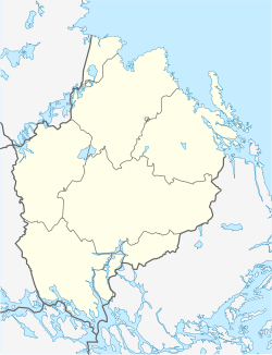
Ytternäs och Vreta is a locality situated in Uppsala Municipality, Uppsala County, Sweden with 636 inhabitants in 2010.[1]
References[edit]
- ^ a b c "Tätorternas landareal, folkmängd och invånare per km2 2005 och 2010" (in Swedish). Statistics Sweden. 14 December 2011. Archived from the original on 27 January 2012. Retrieved 10 January 2012.


