Consolação, Minas Gerais: Difference between revisions
Content deleted Content added
m Bot: Migrating 1 langlinks, now provided by Wikidata on d:Q1805751 |
m Undid revision 1185159006 by 168.0.50.87 (talk) (revert vandalism) |
||
| (10 intermediate revisions by 8 users not shown) | |||
| Line 4: | Line 4: | ||
|official_name = |
|official_name = |
||
|nickname = |
|nickname = |
||
|image_skyline = |
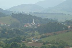
|image_skyline = Consolacao_mg.jpg |
||
|imagesize = |
|imagesize = |
||
|image_caption = |
|image_caption = View of Consolação, Minas Gerais |
||
|image_flag = |
|image_flag = Consolaçãomgbandeira.jpg |
||
|image_seal = Brasaoconsolacao.jpg |
|image_seal = Brasaoconsolacao.jpg |
||
|image_map = MinasGerais Municip Consolacao.svg |
|image_map = MinasGerais Municip Consolacao.svg |
||
| Line 14: | Line 14: | ||
|map_caption = Location in the [[Minas Gerais|State of Minas Gerais]] |
|map_caption = Location in the [[Minas Gerais|State of Minas Gerais]] |
||
|pushpin_map = |
|pushpin_map = |
||
|coordinates_display = inline,title |
|||
|coordinates_region = BR |
|||
|subdivision_type = [[List of countries|Country]] |
|subdivision_type = [[List of countries|Country]] |
||
|subdivision_type1 = [[Regions of Brazil|Region]] |
|subdivision_type1 = [[Regions of Brazil|Region]] |
||
| Line 42: | Line 40: | ||
|area_metro_km2 = |
|area_metro_km2 = |
||
|area_metro_sq_mi = |
|area_metro_sq_mi = |
||
|population_as_of = 2020 <ref>[https://cidades.ibge.gov.br/brasil/mg/consolacao/panorama IBGE 2020]</ref> |
|||
|population_as_of = 2009 |
|||
|population_note = |
|population_note = |
||
|population_footnotes = |
|population_footnotes = |
||
|population_total = 1, |
|population_total = 1,784 |
||
|population_metro = |
|population_metro = |
||
|population_urban = |
|population_urban = |
||
| Line 52: | Line 50: | ||
|population_density_km2 = 19.7 |
|population_density_km2 = 19.7 |
||
|population_density_sq_mi = |
|population_density_sq_mi = |
||
|coordinates = {{coord|22|33|03|S|45|55|15|W|region:BR|display=inline,title}} |
|||
|latd= 22 |
|||
| ⚫ | |||
|latm= 33 |
|||
| ⚫ | |||
|lats= 03 |
|||
| ⚫ | |||
|latNS= S |
|||
| ⚫ | |||
|longd= 45 |
|||
|longm= 55 |
|||
|longs= 15 |
|||
|longEW= W |
|||
| ⚫ | |||
| ⚫ | |||
| ⚫ | |||
| ⚫ | |||
|postal_code_type = Postal Code |
|postal_code_type = Postal Code |
||
|postal_code = 37670-000 |
|postal_code = 37670-000 |
||
| Line 74: | Line 65: | ||
'''Consolação''' is a municipality in [[Minas Gerais]], [[Brazil]]. |
'''Consolação''' is a municipality in [[Minas Gerais]], [[Brazil]]. |
||
==References== |
|||
| ⚫ | |||
{{Reflist}} |
|||
{{DEFAULTSORT:Consolacao, Minas Gerais}} |
|||
[[Category: |
[[Category:Municipalities in Minas Gerais]] |
||
| ⚫ | |||
Latest revision as of 23:50, 15 November 2023
Consolação | |
|---|---|
Municipality | |
 View of Consolação, Minas Gerais | |
 Location in the State of Minas Gerais | |
| Coordinates: 22°33′03″S 45°55′15″W / 22.55083°S 45.92083°W | |
| Country | |
| Region | Southeast |
| State | |
| Founded | December 30, 1962 |
| Area | |
| • Total | 85.936 km2 (33.180 sq mi) |
| Population (2020 [1]) | |
| • Total | 1,784 |
| • Density | 19.7/km2 (51/sq mi) |
| Time zone | UTC−3 (BRT) |
| Postal Code | 37670-000 |
Consolação is a municipality in Minas Gerais, Brazil.


