Puistomäki: Difference between revisions
Content deleted Content added
Image from Commons |
|||
| (10 intermediate revisions by 10 users not shown) | |||
| Line 1: | Line 1: | ||
{{Unreferenced stub|auto=yes|date=December 2009}} |
|||
[[Image:Turku, Puistomäki.png|thumb|right|Puistomäki on a map of Turku.]] |
|||
{{Infobox settlement |
|||
'''Puistomäki''' ([[Finnish language|Finnish]]; ''Parkbacken'' in [[Finland-Swedish|Swedish]]) is a [[district]] in the [[Uittamo-Skanssi]] ward of the city of [[Turku]], in [[Finland]]. It is located to the south of the city centre, and is mainly a low-density residential [[suburb]]. |
|||
| name = Puistomäki |
|||
| native_name = |
|||
| native_name_lang = <!-- ISO 639-2 code e.g. "fr" for French. If more than one, use {{lang}} instead --> |
|||
| settlement_type = District of city |
|||
| image_skyline = |
|||
| image_alt = |
|||
| image_caption = |
|||
| image_flag = |
|||
| flag_alt = |
|||
| image_seal = |
|||
| seal_alt = |
|||
| image_shield = |
|||
| shield_alt = |
|||
| nickname = |
|||
| motto = |
|||
| image_map = [[Image:Turku, Puistomäki.png|150px|center]] |
|||
| map_alt = |
|||
| map_caption = Puistomäki on a map of Turku |
|||
| pushpin_map = Finland |
|||
| pushpin_label_position = |
|||
| pushpin_map_alt = |
|||
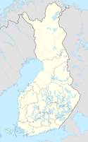
| pushpin_map_caption = Puistomäki on a map of Finland |
|||
| coordinates = {{coord|60|25|43|N|22|15|11|E|display=inline,title}} |
|||
| coor_pinpoint = |
|||
| coordinates_footnotes = |
|||
| subdivision_type = Country |
|||
| subdivision_name = |
|||
| subdivision_type1 = |
|||
| subdivision_name1 = |
|||
| subdivision_type2 = |
|||
| subdivision_name2 = |
|||
| subdivision_type3 = |
|||
| subdivision_name3 = |
|||
| established_title = |
|||
| established_date = |
|||
| founder = |
|||
| seat_type = |
|||
| seat = |
|||
| government_footnotes = |
|||
| leader_party = |
|||
| leader_title = |
|||
| leader_name = |
|||
| unit_pref = Metric |
|||
<!-- ALL fields with measurements have automatic unit conversion --> |
|||
<!-- for references: use <ref> tags --> |
|||
| area_footnotes = |
|||
| area_urban_footnotes = <!-- <ref> </ref> --> |
|||
| area_rural_footnotes = <!-- <ref> </ref> --> |
|||
| area_metro_footnotes = <!-- <ref> </ref> --> |
|||
| area_magnitude = <!-- <ref> </ref> --> |
|||
| area_note = |
|||
| area_water_percent = |
|||
| area_rank = |
|||
| area_blank1_title = |
|||
| area_blank2_title = |
|||
<!-- square kilometers --> |
|||
| area_total_km2 = |
|||
| area_land_km2 = |
|||
| area_water_km2 = |
|||
| area_urban_km2 = |
|||
| area_rural_km2 = |
|||
| area_metro_km2 = |
|||
| area_blank1_km2 = |
|||
| area_blank2_km2 = |
|||
<!-- hectares --> |
|||
| area_total_ha = |
|||
| area_land_ha = |
|||
| area_water_ha = |
|||
| area_urban_ha = |
|||
| area_rural_ha = |
|||
| area_metro_ha = |
|||
| area_blank1_ha = |
|||
| area_blank2_ha = |
|||
| length_km = |
|||
| width_km = |
|||
| dimensions_footnotes = |
|||
| elevation_footnotes = |
|||
| elevation_m = |
|||
| population_footnotes = |
|||
| population_total = |
|||
| population_as_of = |
|||
| population_density_km2 = auto |
|||
| population_demonym = |
|||
| population_note = |
|||
| timezone1 = |
|||
| utc_offset1 = |
|||
| timezone1_DST = |
|||
| utc_offset1_DST = |
|||
| postal_code_type = |
|||
| postal_code = |
|||
| area_code_type = |
|||
| area_code = |
|||
| iso_code = |
|||
| website = <!-- {{URL|example.com}} --> |
|||
| footnotes = |
|||
}} |
|||
'''Puistomäki''' ([[Finnish language|Finnish]]; ''Parkbacken'' in [[Finland-Swedish|Swedish]]) is a [[Districts of Turku|district]] in the [[Uittamo-Skanssi]] ward of the city of [[Turku]], in [[Finland]]. It is located to the south of the city centre, and is mainly a low-density residential [[suburb]]. |
|||
The current ({{As of|2004|lc=on}}) population of Puistomäki is 734, and it is increasing at an annual rate of 6.13%. 17.30% of the district's population are under 15 years old, while 12.81% are over 65. The district's [[language|linguistic]] makeup is 90.46% Finnish, 5.59% Swedish, and 3.95% other. |
|||
[[File:Luutnantintie, Puistomäki, Turku, Finland.jpg|thumb|left|Houses in the newer, eastern, part of Puistomäki.]] |
|||
{{As of|2004|lc=on}} the population of Puistomäki was 734, and was increasing at an annual rate of 6.13%. 17.30% of the district's population are under 15 years old, while 12.81% are over 65. The district's [[language|linguistic]] makeup is 90.46% Finnish, 5.59% Swedish, and 3.95% other. |
|||
== |
==See also== |
||
* [[Districts of Turku]] |
* [[Districts of Turku]] |
||
* [[Districts of Turku by population]] |
* [[Districts of Turku by population]] |
||
{{Finland-geo-stub}} |
|||
{{Turku 3 districts}} |
{{Turku 3 districts}} |
||
{{DEFAULTSORT:Puistomaki}} |
|||
{{coord missing|Finland}} |
|||
[[Category:Districts of Turku]] |
[[Category:Districts of Turku]] |
||
[[fi:Puistomäki]] |
|||
{{WesternFinland-geo-stub}} |
|||
[[sv:Parkbacken]] |
|||
Latest revision as of 22:37, 17 January 2021
Puistomäki | |
|---|---|
District of city | |
 Puistomäki on a map of Turku | |
| Coordinates: 60°25′43″N 22°15′11″E / 60.42861°N 22.25306°E |
Puistomäki (Finnish; Parkbacken in Swedish) is a district in the Uittamo-Skanssi ward of the city of Turku, in Finland. It is located to the south of the city centre, and is mainly a low-density residential suburb.

as of 2004[update] the population of Puistomäki was 734, and was increasing at an annual rate of 6.13%. 17.30% of the district's population are under 15 years old, while 12.81% are over 65. The district's linguistic makeup is 90.46% Finnish, 5.59% Swedish, and 3.95% other.
See also[edit]

