
Tanying: Difference between revisions
Content deleted Content added
Tutwakhamoe (talk | contribs) No edit summary |
|||
| Line 1: | Line 1: | ||
{{Infobox settlement |
{{Infobox settlement |
||
|name = Tanying |
| name = Tanying Area |
||
|native_name = 檀营地区 |
| native_name = 檀营地区 |
||
|settlement_type = Area |
| settlement_type = [[Area (Beijing)|Area]] & [[Ethnic townships, towns, and sums|Ethnic Tonship]] |
||
|image_skyline = |
| image_skyline = Shahe, Miyun (20150106155637).JPG |
||
| ⚫ | |||
|image_map = |
|||
| ⚫ | |||
|map_caption = |
|||
| ⚫ | |||
| ⚫ | |||
| subdivision_name1 = [[Beijing]] |
|||
| pushpin_label_position = right |
|||
| ⚫ | |||
| ⚫ | |||
| ⚫ | |||
| ⚫ | |||
| ⚫ | |||
| ⚫ | |||
| |
| population_total = 15466 |
||
| ⚫ | |||
| ⚫ | |||
| ⚫ | |||
| ⚫ | |||
| ⚫ | |||
| ⚫ | |||
| ⚫ | |||
|population_total = 7,571 |
|||
| ⚫ | |||
| ⚫ | |||
| image_caption = Xinbei Road within the area, 2015 |
|||
| ⚫ | |||
| postal_code = 101511 |
|||
| ⚫ | |||
| postal_code_type = [[Postal code of China|Postal code]] |
|||
|elevation_ft = |
|||
| area_code = 010 |
|||
| ⚫ | |||
| subdivision_type3 = [[Villages of China|Village-level Divisions]] |
|||
| ⚫ | |||
| subdivision_name3 = 3 [[residential community|communities]] |
|||
| ⚫ | |||
| ⚫ | |||
|website = |
|||
| ⚫ | |||
| image_map = Tanying Area, Miyun District, Beijing (20221028).png |
|||
| map_caption = Location of Tanning Area within [[Miyun District]] |
|||
| mapsize = |
|||
| other_name = Tanying Manchu and Mongol Ethnic Township<br />檀营满族蒙古族乡 |
|||
}} |
}} |
||
'''Tanying''' ({{Lang-zh|檀营地区}}) is an area located in the [[Miyun District]] of [[Beijing]], [[China]].<ref>{{Cite web|url=http://www.cfguide.com/town/Tanying_303030505.htm|title= |
'''Tanying''' ({{Lang-zh|檀营地区}}) is an area located in the [[Miyun District]] of [[Beijing]], [[China]].<ref>{{Cite web|url=http://www.cfguide.com/town/Tanying_303030505.htm|title= |
||
Tanying Area, Miyung, Beijing, China|website=www.aldpage.com|access-date=2018-04-11}}</ref> Located on the south of Ye Mountain (冶山), it shares border with [[Mujiayu|Mujiayu Town]] in its north and east, [[Gulou Subdistrict, Beijing|Gulou Subdistrict]] in its southwest, and [[Miyun Town]] in its northwest. In 2020, the area had 15,466 inhabitants under its administration.<ref>{{Cite web |title=北京市密云区第七次全国人口普查公报 |url=https://item.btime.com/41vlljqtuil873r68d0hinumekr |access-date=2022-10-29 |website=item.btime.com}}</ref> |
|||
Tanying Area, Miyung, Beijing, China|website=www.aldpage.com|access-date=2018-04-11}}</ref> |
|||
The name originates in 1777, when the region was used as a garrison for stationing [[Eight Banners]] troops.<ref name=":0">{{Cite book |url=https://www.worldcat.org/oclc/910451741 |title=Zhong hua ren min gong he guo zheng qu da dian. Bei jing shi juan |date=2013 |publisher=Zhong guo she hui chu ban she |others=Li li guo, Li wan jun, Wu shi min, 李立国., 李万钧., 吴世民 |isbn=978-7-5087-4058-4 |location=Bei jing |oclc=910451741}}</ref> |
|||
== History == |
|||
{| class="wikitable" |
|||
|+History of Tanying Area<ref name=":0" /> |
|||
!Year |
|||
!Status |
|||
!Under |
|||
|- |
|||
|1953 - 1958 |
|||
|Tanying Township |
|||
|Miyun County, Hebei |
|||
|- |
|||
|1958 - 1965 |
|||
|Administered by Chengguan People's Commune |
|||
| rowspan="4" |Miyun County, Beijing |
|||
|- |
|||
|1965 - 1987 |
|||
|Administered by Mumengyu People's Commune |
|||
|- |
|||
|1987 - 2005 |
|||
|Tanying Manchu and Mongol Ethnic Township |
|||
|- |
|||
|2005 - 2015 |
|||
| rowspan="2" |Tanying Area (Manchu and Mongol Ethnic Township) |
|||
|- |
|||
|2015 - present |
|||
|Miyun District, Beijing |
|||
|} |
|||
== Administrative divisions == |
|||
In 2021, Tanying Area is formed from 3 [[Residential community|residential communities]], and they are organized in the following table:<ref>{{Cite web |title=2021年统计用区划代码和城乡划分代码 |url=http://www.stats.gov.cn/tjsj/tjbz/tjyqhdmhcxhfdm/2021/11/01/18/110118003.html |access-date=2022-10-29 |website=www.stats.gov.cn}}</ref> |
|||
{| class="wikitable sortable" |
|||
!Subdivision Names |
|||
!Name Transliterations |
|||
|- |
|||
|檀营 |
|||
|Tanying |
|||
|- |
|||
|第一 |
|||
|Diyi |
|||
|- |
|||
|第二 |
|||
|Di'er |
|||
|} |
|||
== Gallery == |
|||
<gallery> |
|||
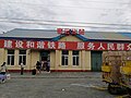
File:Miyunbei Railway Station 20160906.jpg|Entrance of Miyunbei Railway Station on the west of the area, 2016 |
|||
File:Miyunbei Railway Station 20160413 112339.jpg|Rail tracks within Miyunbei Station, 2016 |
|||
</gallery> |
|||
==References== |
==References== |
||
| Line 38: | Line 94: | ||
{{Beijing-geo-stub}} |
{{Beijing-geo-stub}} |
||
[[Category:Areas of Beijing]] |
|||
Revision as of 16:47, 29 October 2022
Tanying Area
檀营地区 Tanying Manchu and Mongol Ethnic Township 檀营满族蒙古族乡 | |
|---|---|
.JPG) Xinbei Road within the area, 2015 | |
.png) Location of Tanning Area within Miyun District | |
 Tanying Area  Tanying Area | |
| Coordinates: 40°23′22″N 116°51′47″E / 40.38944°N 116.86306°E | |
| Country | China |
| Municipality | Beijing |
| District | Miyun |
| Village-level Divisions | 3 communities |
| Area | |
| • Total | 2.9 km2 (1.1 sq mi) |
| Elevation | 82 m (269 ft) |
| Population (2020) | |
| • Total | 15,466 |
| • Density | 5,300/km2 (14,000/sq mi) |
| Time zone | UTC+8 (China Standard) |
| Postal code | 101511 |
| Area code | 010 |
Tanying (Chinese: 檀营地区) is an area located in the Miyun District of Beijing, China.[1] Located on the south of Ye Mountain (冶山), it shares border with Mujiayu Town in its north and east, Gulou Subdistrict in its southwest, and Miyun Town in its northwest. In 2020, the area had 15,466 inhabitants under its administration.[2]
The name originates in 1777, when the region was used as a garrison for stationing Eight Banners troops.[3]
History
| Year | Status | Under |
|---|---|---|
| 1953 - 1958 | Tanying Township | Miyun County, Hebei |
| 1958 - 1965 | Administered by Chengguan People's Commune | Miyun County, Beijing |
| 1965 - 1987 | Administered by Mumengyu People's Commune | |
| 1987 - 2005 | Tanying Manchu and Mongol Ethnic Township | |
| 2005 - 2015 | Tanying Area (Manchu and Mongol Ethnic Township) | |
| 2015 - present | Miyun District, Beijing |
Administrative divisions
In 2021, Tanying Area is formed from 3 residential communities, and they are organized in the following table:[4]
| Subdivision Names | Name Transliterations |
|---|---|
| 檀营 | Tanying |
| 第一 | Diyi |
| 第二 | Di'er |
Gallery
-
 Entrance of Miyunbei Railway Station on the west of the area, 2016
 -
 Rail tracks within Miyunbei Station, 2016


References
- ^ "Tanying Area, Miyung, Beijing, China". www.aldpage.com. Retrieved 2018-04-11.
- ^ "北京市密云区第七次全国人口普查公报". item.btime.com. Retrieved 2022-10-29.
- ^ a b Zhong hua ren min gong he guo zheng qu da dian. Bei jing shi juan. Li li guo, Li wan jun, Wu shi min, 李立国., 李万钧., 吴世民. Bei jing: Zhong guo she hui chu ban she. 2013. ISBN 978-7-5087-4058-4. OCLC 910451741.
{{cite book}}: CS1 maint: others (link) - ^ "2021年统计用区划代码和城乡划分代码". www.stats.gov.cn. Retrieved 2022-10-29.
This Beijing location article is a stub. You can help Wikipedia by expanding it. |