Sangarédi: Difference between revisions
Content deleted Content added
Gene Nygaard (talk | contribs) space before unit symbol |
m expansion |
||
| Line 109: | Line 109: | ||
|longd=13|longm=46|longs= |longEW=W |
|longd=13|longm=46|longs= |longEW=W |
||
|elevation_footnotes = <!--for references: use <ref> </ref> tags--> |
|elevation_footnotes = <!--for references: use <ref> </ref> tags--> |
||
|elevation_m = |
|elevation_m = 139 |
||
|elevation_ft = |
|elevation_ft = |
||
<!-- Area/postal codes & others --------> |
<!-- Area/postal codes & others --------> |
||
| Line 125: | Line 125: | ||
'''Sangarédi''' is mining town and [[sub-prefectures of Guinea|sub-prefecture]] in western [[Guinea]], where bauxite is mined. The ore is shipped by a railway to the port of [[Kamsar]]. Population 20,638 (2008 est). <ref>[http://world-gazetteer.com/wg.php?x=&men=gcis&lng=en&des=wg&srt=npan&col=abcdefghinoq&msz=1500&geo=-89 World Gazetteer], Retrieved on June 18, 2008</ref> |
'''Sangarédi''' is mining town and [[sub-prefectures of Guinea|sub-prefecture]] in western [[Guinea]], where bauxite is mined. The ore is shipped by a railway to the port of [[Kamsar]]. Population 20,638 (2008 est). <ref>[http://world-gazetteer.com/wg.php?x=&men=gcis&lng=en&des=wg&srt=npan&col=abcdefghinoq&msz=1500&geo=-89 World Gazetteer], Retrieved on June 18, 2008</ref> |
||
In April 2010, an expansion of the mine and its refinery were proposed. |
|||
== Transport == |
|||
The town is served by [[Sangarédi Airport]]. |
The town is served by [[Sangarédi Airport]]. |
||
| Line 132: | Line 136: | ||
* [http://www.fallingrain.com/world/GV/3/Sangaredi.html Rail Map (red dots)] |
* [http://www.fallingrain.com/world/GV/3/Sangaredi.html Rail Map (red dots)] |
||
* [http://www.weather-forecast.com/locations/PortKamsar.shtml Rail Map (gray line)] |
* [http://www.weather-forecast.com/locations/PortKamsar.shtml Rail Map (gray line)] |
||
* Elevation = {{convert|139|m|abbr=on}} |
|||
== See also == |
== See also == |
||
| Line 140: | Line 142: | ||
* [[Railway stations in Guinea]] |
* [[Railway stations in Guinea]] |
||
==References== |
== References == |
||
{{reflist}} |
{{reflist}} |
||
{{guinea-geo-stub}} |
{{guinea-geo-stub}} |
||
Revision as of 12:08, 9 April 2010
Sangarédi | |
|---|---|
Sub-prefecture and town | |
| Country | |
| Region | Boke Region |
| Elevation | 456 ft (139 m) |
| Population (2008 est.) | |
| • Total | 20,638 |
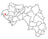
Sangarédi is mining town and sub-prefecture in western Guinea, where bauxite is mined. The ore is shipped by a railway to the port of Kamsar. Population 20,638 (2008 est). [1]
In April 2010, an expansion of the mine and its refinery were proposed.
Transport
The town is served by Sangarédi Airport.
Maps
See also
References
- ^ World Gazetteer, Retrieved on June 18, 2008

