Lorain County Regional Airport: Difference between revisions
m Bot: Migrating 1 interwiki links, now provided by Wikidata on d:q6678739 |
|||
| Line 59: | Line 59: | ||
[[Category:Transportation in Lorain County, Ohio]] |
[[Category:Transportation in Lorain County, Ohio]] |
||
[[Category:Buildings and structures in Lorain County, Ohio]] |
[[Category:Buildings and structures in Lorain County, Ohio]] |
||
[[fa:فرودگاه محلی شهرستان لوراین]] |
|||
Revision as of 16:50, 20 March 2013
Lorain County Regional Airport | |||||||||||
|---|---|---|---|---|---|---|---|---|---|---|---|
| Summary | |||||||||||
| Airport type | Public | ||||||||||
| Owner | Lorain County Board of Commissioners | ||||||||||
| Serves | Lorain / Elyria, Ohio | ||||||||||
| Location | New Russia Township | ||||||||||
| Elevation AMSL | 793 ft / 242 m | ||||||||||
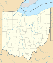
| Map | |||||||||||
| Runways | |||||||||||
| |||||||||||
| Statistics (2010) | |||||||||||
| |||||||||||
Lorain County Regional Airport (IATA: LPR[2], ICAO: KLPR, FAA LID: LPR) is a public use airport in Lorain County, Ohio, United States.[1] It is owned by the Lorain County Board of Commissioners[1] and located in New Russia Township.[3] The airport is approximately six nautical miles (7 mi, 11 km) south of Lorain[1] and 4 nautical miles (5 mi, 7 km) southwest of Elyria.[4] It is included in the National Plan of Integrated Airport Systems for 2011–2015, which categorized it as a general aviation reliever airport.[5]
Facilities and aircraft
Lorain County Regional Airport covers an area of 1,149 acres (465 ha) at an elevation of 793 feet (242 m) above mean sea level. It has one runway designated 7/25 with an asphalt surface measuring 5,002 by 100 feet (1,525 x 30 m).[1]
For the 12-month period ending August 11, 2010, the airport had 42,610 aircraft operations, an average of 116 per day: 82% general aviation, 18% air taxi, and <1% military. At that time there were 88 aircraft based at this airport: 82% single-engine, 10% multi-engine, 6% helicopter, and 2% jet.[1]
Incidents
- On January 18, 2010, a Mitsubishi MU-2-2B-60 turboprop crashed on approach, killing four.[6][7][8]
References
- ^ a b c d e f FAA Airport Form 5010 for LPR PDF. Federal Aviation Administration. Effective November 15, 2012.
- ^ "Lorain County Regional Airport (IATA: LPR)". Aviation Safety Network. Retrieved December 19, 2012.
- ^ "Lorain County Regional Airport". Lorain County. Retrieved December 19, 2009.
- ^ "Distance and heading from Elyria (41°22'24"N 82°06'06"W) to LPR (41°20'39"N 82°10'39"W)". Great Circle Mapper. Retrieved December 19, 2012.
- ^
"2011–2015 NPIAS Report, Appendix A" (PDF, 2.03 MB). National Plan of Integrated Airport Systems. Federal Aviation Administration. October 4, 2010.
{{cite web}}: External link in|work= - ^ "Wife: Pilot husband among 3 killed in Ohio crash". Associated Press. January 18, 2010. Archived from the original on January 28, 2010. Retrieved January 25, 2010.
- ^ "NTSB: No Signs of Trouble in Fatal Plane Crash". Fox 8 News. Archived from the original on January 12, 2010. Retrieved January 25, 2010.
{{cite news}}:|archive-date=/|archive-url=timestamp mismatch; January 21, 2010 suggested (help) - ^ "Pilot error caused plane crash that killed four". Lorain Morning Journal.
External links
- Airport page at Lorain County website
- MRK Aviation, the fixed base operator (FBO)
- Aerial photo as of March 1994 from USGS The National Map
- FAA Terminal Procedures for LPR, effective May 16, 2024
- Resources for this airport:
- FAA airport information for LPR
- AirNav airport information for KLPR
- ASN accident history for LPR
- FlightAware airport information and live flight tracker
- NOAA/NWS weather observations: current, past three days
- SkyVector aeronautical chart, Terminal Procedures

