Dix Township, Ford County, Illinois: Difference between revisions
| [accepted revision] | [accepted revision] |
Content deleted Content added
Rescuing 3 sources and tagging 0 as dead. #IABot (v1.2.7.1) |
JJMC89 bot (talk | contribs) Migrate {{Infobox settlement}} coordinates parameters to {{Coord}}, see Wikipedia:Coordinates in infoboxes |
||
| Line 22: | Line 22: | ||
<!-- Location --> |
<!-- Location --> |
||
|coordinates_display = inline,title |
|||
|coordinates_region = US-IL |
|||
|subdivision_type = [[List of countries|Country]] |
|subdivision_type = [[List of countries|Country]] |
||
|subdivision_name = [[United States]] |
|subdivision_name = [[United States]] |
||
| Line 57: | Line 55: | ||
|elevation_m = 234 |
|elevation_m = 234 |
||
|elevation_ft = 768 |
|elevation_ft = 768 |
||
| |
|coordinates = {{coord|40|27|58|N|88|17|29|W|region:US-IL|display=inline,title}} |
||
|latm = 27 |
|||
|lats = 58 |
|||
|latNS = N |
|||
|longd = 88 |
|||
|longm = 17 |
|||
|longs = 29 |
|||
|longEW = W |
|||
<!-- Area/postal codes & others --> |
<!-- Area/postal codes & others --> |
||
Revision as of 19:21, 16 March 2017
Dix Township | |
|---|---|
 Location in Ford County | |
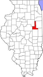
 Ford County's location in Illinois | |
| Coordinates: 40°27′58″N 88°17′29″W / 40.46611°N 88.29139°W | |
| Country | United States |
| State | Illinois |
| County | Ford |
| Established | November 6, 1860 |
| Area | |
| • Total | 53.99 sq mi (139.8 km2) |
| • Land | 53.93 sq mi (139.7 km2) |
| • Water | 0.06 sq mi (0.2 km2) 0.11% |
| Elevation | 768 ft (234 m) |
| Population (2010) | |
| • Total | 642 |
| • Density | 11.9/sq mi (4.6/km2) |
| Time zone | UTC-6 (CST) |
| • Summer (DST) | UTC-5 (CDT) |
| ZIP codes | 60933, 60936, 60952, 60957 |
| GNIS feature ID | 0428898 |
Dix Township is one of twelve townships in Ford County, Illinois, USA. As of the 2010 census, its population was 642 and it contained 284 housing units.[1]
History
Dix Township was originally named Drummer Grove Township; on September 2, 1864 it was renamed named in honor of John Adams Dix.[2]
Geography
According to the 2010 census, the township has a total area of 53.99 square miles (139.8 km2), of which 53.93 square miles (139.7 km2) (or 99.89%) is land and 0.06 square miles (0.16 km2) (or 0.11%) is water.[1]
Cities, towns, villages
Unincorporated towns
Cemeteries
The township contains these three cemeteries: Blackford, Oregon, and Pontoppidan.
Major highways
Airports and landing strips
- Barnes Landing Strip
- Gibson City Municipal Airport
School districts
- Gibson City-Melvin-Sibley Community Unit School District 5
Political districts
- Illinois' 15th congressional district
- State House District 105
- State Senate District 53
References
- "Dix Township, Ford County, Illinois". Geographic Names Information System. United States Geological Survey, United States Department of the Interior. Retrieved 2010-01-16.
- United States Census Bureau 2007 TIGER/Line Shapefiles
- United States National Atlas
- ^ a b "Population, Housing Units, Area, and Density: 2010 - County -- County Subdivision and Place -- 2010 Census Summary File 1". United States Census. Retrieved 2013-05-28.
- ^ Callary, Edward. 2009. Place Names of Illinois. Champaign: University of Illinois Press, p. 94.

