United States Geological Survey
|
|||
|---|---|---|---|
|
|
|||
| State level | Federal authority | ||
| Position of the authority | Scientific Authority | ||
| Supervisory authority (s) | United States Department of the Interior | ||
| Consist | March 3, 1879 | ||
| Headquarters | Reston (Virginia) | ||
| Authority management | James F. Reilly | ||
| Employee | 8670 (2009) | ||
| Website | www.usgs.gov | ||
The United States Geological Survey ( USGS ) is a scientific agency owned by the United States Department of the Interior . The USGS is the United States’s premier agency for official cartography .
Agendas
The USGS scientists study the landscapes and geological structures of the United States and other countries, their resources and the natural disasters that threaten them.
The four main fields of activity are:
At the beginning, the work was based on traditional terrestrial investigations, but since the 1960s increasingly also on measuring aircraft (e.g. aerophysics, aerophotogrammetry ) and on earth observation satellites , for which technical systems are also developed.
Founded on March 3, 1879, the USGS has been an independent research organization with no regulatory responsibilities. From 1962 on, the USGS participates in both the exploration and the creation of maps of the earth , moon and planets .
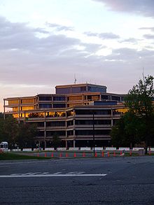
The USGS is the only scientific agency of the US Department of the Interior and employs 8,670 people (2009). Its headquarters are in Reston, Virginia , with other important offices in Denver , Colorado and Menlo Park , California .
Like NOAA, the organization is a member of the International Charter for Space and Natural Disasters .
The motto is “ science for a changing world. ”( English for 'science for a changing world'). The US Geological Survey's longest-running projects include surveys of the San Andreas Fault . In particular, surveys in the Californian town of Parkfield , which was the epicenter of the Fort Tejon earthquake in 1857 , are intended to help improve earthquake prediction .
In the summer of 2006, the organization took part in research into gas hydrates in the Indian Ocean together with the Indian Directorate General of Hydrocarbons (DGH) .
The agency also operates the National Wildlife Health Center (NWHC), a research facility that studies diseases in wild animals.
Publications
The agency publishes the official map of the United States and is known for using the 1: 24,000 scale . This map series is called 7.5-minute topographic quadrangle series in English . It is also used for mapping planets and moons of the solar system.
In addition, the USGS provides the online database Geographic Names Information System (GNIS) , a publicly accessible electronic local dictionary .
List of directors
- 1879-1881 Clarence King
- 1881-1894 John Wesley Powell
- 1894-1907 Charles Doolittle Walcott
- 1907-1930 George Otis Smith
- 1930–1943 Walter Curran Mendenhall
- 1943-1956 William Embry Wrather
- 1956–1965 Thomas Brennan Nolan
- 1965–1971 William Thomas Pecora
- 1971–1978 Vincent Ellis McKelvey
- 1978-1981 Henry William Menard
- 1981-1993 Dallas Lynn Peck
- 1994-1997 Gordon P. Eaton
- 1998-2005 Charles G. Groat
- 2006-2009, Mark Myers
- 2009-2013 Marcia McNutt
- 2013-2017 Suzette Kimball
- since 2018: James F. Reilly
Others
The budget for fiscal year 2013 was US $ 1.103 billion, including US $ 153.7 million for climate change , US $ 144.8 million for geohazards, US $ 44 million for the energy transition and 209, $ 8 million for water resource exploration.
The USGS museum is located in Reston, and in addition to numerous portraits of the directors and historical items of equipment, an SUV made by US geologists, a Ford Model A from the 1930s, is on display.
Web links
- Official website (English)
- USGS earthquake monitoring network (realtime, English)
- Monitoring of the active volcanoes by the USGS (English)
Individual evidence
- ↑ www.usgs.gov About Us> Who We Are> History. Accessed July 7, 2010
- ↑ Science Areas. (No longer available online.) In: www.usgs.gov. Archived from the original on September 6, 2010 ; accessed on May 18, 2018 . Info: The archive link was inserted automatically and has not yet been checked. Please check the original and archive link according to the instructions and then remove this notice.
- ↑ nationalmap.gov
- ↑ USGS Facts ( Memento of the original from December 1, 2012 in the Internet Archive ) Info: The archive link was inserted automatically and has not yet been checked. Please check the original and archive link according to the instructions and then remove this notice. , accessed December 13, 2012.
- ↑ USGS Museum ( Memento of the original from June 7, 2010 in the Internet Archive ) Info: The archive link was inserted automatically and has not yet been checked. Please check the original and archive link according to the instructions and then remove this notice. , accessed December 13, 2012.


