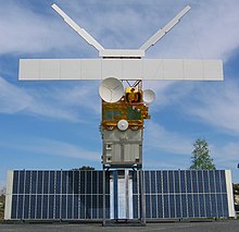
Earth observation satellite

Earth observation satellites are satellites specially designed for earth observation from orbit . Mainly weather satellites are used for meteorology as well as environmental satellites for environmental observation , mapping , geology etc. Technically, spy satellites are a subgroup, but the term earth observation satellites is associated with civil use. When setting up earth remote sensing satellites, a distinction is made between the platform ( satellite bus ) and the instruments.
history
Nadar took the first aerial photographs in 1858 . In 1904 Alfred Maul took the first aerial photographs with a photo rocket. (see also: History of aerial photography and history of remote sensing )
The first (military) earth observation satellites were the keyhole satellites of the Corona program in 1959 . The first successful flight of a Discoverer satellite (Corona program) took place on August 10, 1960. On April 1, 1960, TIROS -1, the first experimental weather satellite, was launched. In 1972, Landsat -1 introduced digital data acquisition using the MSS (Multispectral Scanner). In 1975 the first radar altimeter was used on GEOS-3 . The 1978 Seasat mission tested the synthetic aperture radar and a radiation scatter meter. The multispectral line scanner Coastal Zone Color Scanner on Nimbus-7 , the first environmental monitoring satellite, was specially designed for observing the color of the oceans . The successors of this instrument are SeaWiFS and MODIS on Aqua. MERIS on Envisat also has the same research tasks.
Instruments (selection)
The earth observation satellites work with both passive and active sensors. Passive measurement methods are so called because the light or heat energy emitted by the earth or clouds is measured. The passive sensors mainly include optical sensors. In addition to visible light, they record different spectral ranges (IR, UV). The so-called atmospheric windows are used; these are wavelength ranges in which the permeability of the atmosphere is particularly high.
Another important measurement method is active remote sensing using radar, lidar or other technologies. It provides precise values for the surface structure of the earth. The measuring accuracy is in the range of a few centimeters and thus makes it possible to measure the slightest earth displacement. The advantage of this method is that it is independent of any cloud cover (radar beams penetrate it unaffected). This active radar data can be used to generate 3-D models of the earth's surface.
- Lidar: Lidar In-space Technology Experiment (LITE) - Space Shuttle 1994: first demonstration of the possibilities of observing aerosols and clouds from space, CALIPSO first satellite with Lidar
- Spectrometer: multispectral (up to approx. 15 channels) and hyperspectral scanners (approx. 15 to 200 spectral bands)
- Scatterometer (scattered radiation meter): Research into air movements (wind strength and direction over sea surfaces)
- Synthetic Aperture Radar (SAR)
- Laser altimeter
- Microwave altimeter (altimeter): remote sensing of the sea surface
See also
- List of earth observation satellites
- Satellite photography , satellite imagery , remote sensing , satellite geodesy
- Remote sensing instruments for environmental observation , earth exploration radio service via satellite
- Sea surface temperature
- Copernicus (Earth Observation) , Global Earth Observing System of Systems
- International Charter on Space and Natural Disasters
- TerraSAR-X
- Sun-synchronous orbit
literature
- Jörg Albertz: Basics of the interpretation of aerial and satellite images. An introduction to remote sensing. Darmstadt 2007.
- Berger, Michael; Kaufmann, Hermann (1994): The MOMS-02 Earth Observation Sensor. Earth sciences; 12; 305–309, doi : 10.2312 / GEOWISSENSCHAFTEN.1994.12.305 .
Web links
- Lexicon of remote sensing
- Introduction to digital remote sensing methodology in geosciences. Script for the lecture Uni Münster ( Memento from July 8, 2006 in the Internet Archive )
- Space Based Observations Of Earth
Individual evidence
- ↑ erdsicht.de - measuring instruments ( Memento from March 31, 2013 in the Internet Archive )