Panaitoliko: Difference between revisions
Content deleted Content added
Rescuing 1 sources and tagging 0 as dead. #IABot (v1.6.1) (Balon Greyjoy) |
m Task 15: language icon template(s) replaced (2×); |
||
| Line 23: | Line 23: | ||
|districts = |
|districts = |
||
}} |
}} |
||
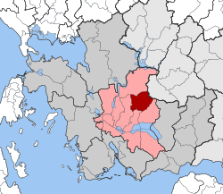
'''Panaitoliko''' ([[Greek language|Greek]]: Παναιτωλικό) is a former [[Communities and Municipalities of Greece|municipality]] in [[Aetolia-Acarnania]], [[West Greece]], [[Greece]]. Since the 2011 local government reform it is part of the municipality [[Agrinio]], of which it is a municipal unit.<ref name=Kallikratis>[http://www.kedke.gr/uploads2010/FEKB129211082010_kallikratis.pdf Kallikratis law] Greece Ministry of Interior {{ |
'''Panaitoliko''' ([[Greek language|Greek]]: Παναιτωλικό) is a former [[Communities and Municipalities of Greece|municipality]] in [[Aetolia-Acarnania]], [[West Greece]], [[Greece]]. Since the 2011 local government reform it is part of the municipality [[Agrinio]], of which it is a municipal unit.<ref name=Kallikratis>[http://www.kedke.gr/uploads2010/FEKB129211082010_kallikratis.pdf Kallikratis law] Greece Ministry of Interior {{in lang|el}}</ref> The municipal unit has an area of 105.976 km<sup>2</sup>.<ref name=stat01>{{cite web|url=http://dlib.statistics.gr/Book/GRESYE_02_0101_00098%20.pdf|publisher=National Statistical Service of Greece|title=Population & housing census 2001 (incl. area and average elevation)|language=el}}</ref> Population 1,386 (2011). The seat of the municipality was in [[Skoutera]]. |
||
==External links== |
==External links== |
||
*[https://web.archive.org/web/20090809145855/http://www.panaitoliko.gov.gr/ Municipality of Panaitoliko] {{ |
*[https://web.archive.org/web/20090809145855/http://www.panaitoliko.gov.gr/ Municipality of Panaitoliko] {{in lang|el}} |
||
==References== |
==References== |
||
Revision as of 04:59, 31 December 2019
Panaitoliko
Παναιτωλικό | |
|---|---|
Settlement | |
| Coordinates: 38°41′N 21°29′E / 38.683°N 21.483°E | |
| Country | Greece |
| Administrative region | West Greece |
| Regional unit | Aetolia-Acarnania |
| Municipality | Agrinio |
| Area | |
| • Municipal unit | 105.98 km2 (40.92 sq mi) |
| Elevation | 467 m (1,532 ft) |
| Population (2011)[1] | |
| • Municipal unit | 1,386 |
| • Municipal unit density | 13/km2 (34/sq mi) |
| Time zone | UTC+2 (EET) |
| • Summer (DST) | UTC+3 (EEST) |
Panaitoliko (Greek: Παναιτωλικό) is a former municipality in Aetolia-Acarnania, West Greece, Greece. Since the 2011 local government reform it is part of the municipality Agrinio, of which it is a municipal unit.[2] The municipal unit has an area of 105.976 km2.[3] Population 1,386 (2011). The seat of the municipality was in Skoutera.
External links
- Municipality of Panaitoliko (in Greek)
References
- ^ "Απογραφή Πληθυσμού - Κατοικιών 2011. ΜΟΝΙΜΟΣ Πληθυσμός" (in Greek). Hellenic Statistical Authority.
- ^ Kallikratis law Greece Ministry of Interior (in Greek)
- ^ "Population & housing census 2001 (incl. area and average elevation)" (PDF) (in Greek). National Statistical Service of Greece.


