Itumirim

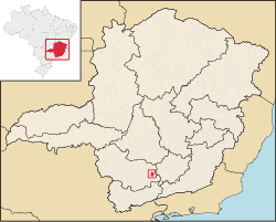
Itumirim is a Brazilian municipality located in the state of Minas Gerais. The city belongs to the mesoregion of Campo das Vertentes and to the microregion of Lavras. As of 2010[update] it has a population of 6,149.[1]
"Itumirim" is a term of Tupi origin meaning "little waterfall."[2][3] It became a municipality by the state Decree Law No. 1058 of December 31, 1943.[4]
See also
References
- ^ "Censo Populacional 2010". Censo Populacional 2010. Instituto Brasileiro de Geografia e Estatística (IBGE). 29 November 2010. Archived from the original on 2 December 2010. Retrieved 11 December 2010.
- ^ "Archived copy". Archived from the original on 2013-12-02. Retrieved 2016-09-25.
{{cite web}}: CS1 maint: archived copy as title (link) - ^ "Archived copy". Archived from the original on 2012-08-09. Retrieved 2012-09-10.
{{cite web}}: CS1 maint: archived copy as title (link) - ^ "Itumirim - Histórico" (PDF). biblioteca.ibge.gov.br. 2008. Retrieved 25 June 2012.
21°19′1″S 44°52′15″W / 21.31694°S 44.87083°W
