Bombooflat: Difference between revisions
Content deleted Content added
No edit summary |
No edit summary |
||
| (38 intermediate revisions by 31 users not shown) | |||
| Line 1: | Line 1: | ||
{{Use dmy dates|date=September 2018}} |
|||
{{Infobox Indian Jurisdiction |
|||
{{Use Indian English|date=September 2018}} |
|||
<!-- See [[Wikipedia:WikiProject Indian cities]] for details --> |
|||
{{Infobox settlement |
|||
| native_name = Bombooflat |
|||
| |
| name = Bambooflat |
||
| other_name = Bamboo Flat |
|||
| latd = 11.70 |
|||
| |
| native_name = |
||
| settlement_type = Town |
|||
| locator_position = left |
|||
| image_skyline = |
|||
| ⚫ | |||
| imagesize = |
|||
| district = [[Andamans district|Andamans]] |
|||
| |
| image_caption = |
||
| ⚫ | |||
| ⚫ | |||
| pushpin_label_position = right |
|||
| altitude = |
|||
| ⚫ | |||
| ⚫ | |||
| subdivision_type = Country |
|||
| ⚫ | |||
| subdivision_name = {{flag|India}} |
|||
| population_density = |
|||
| subdivision_type1 = [[States of India|Union Territory]] |
|||
| area_magnitude = sq. km |
|||
| subdivision_name1 = [[Andaman and Nicobar Islands]] |
|||
| area_total = |
|||
| subdivision_type2 = [[Districts of India|District]] |
|||
| area_telephone = |
|||
| subdivision_name2 = [[South Andaman district|South Andaman]] |
|||
| ⚫ | |||
| subdivision_type3 = |
|||
| vehicle_code_range = |
|||
| subdivision_name3 = |
|||
| sex_ratio = |
|||
| subdivision_type4 = |
|||
| unlocode = |
|||
| subdivision_name4 = |
|||
| ⚫ | |||
| |
| leader_title = |
||
| ⚫ | |||
| established_title = |
|||
| established_date = |
|||
| area_total_km2 = |
|||
| ⚫ | |||
| population_footnotes = |
|||
| ⚫ | |||
| population_density_km2 = |
|||
| timezone = [[Indian Standard Time|IST]] |
|||
| utc_offset = +5.30 |
|||
| coordinates = {{Coord|11|42|18.5|N|92|42|54.8|E}} |
|||
| elevation_footnotes = |
|||
| elevation_m = |
|||
| elevation_ft = |
|||
| blank_name = [[Köppen climate classification|Climate]] |
|||
| blank_info = [[Tropical monsoon climate|Am]] |
|||
| ⚫ | |||
| footnotes = |
|||
| ⚫ | |||
}} |
}} |
||
''' |
'''Bambooflat,''' also known as '''Bamboo Flat''' is a village in [[Ferrargunj]] Tehsil in [[South Andaman district]] of the [[Andaman and Nicobar Islands]], a [[union territory]] of [[India]]. It is located 17 KM towards North from District headquarters. 1 KM from Ferrargunj. 13 KM from state capital Port Blair. Bambooflat Pin code is 744107 and postal head office is Bambooflat. |
||
/"\ |
|||
|\./| |
|||
| | |
|||
| | |
|||
|>~<| |
|||
| | |
|||
/'\| |/'\.. |
|||
/~\| | | | \ |
|||
| =[@]= | | \ |
|||
| | | | | \ |
|||
| ~ ~ ~ ~ |` ) |
|||
| / |
|||
\ / |
|||
\ / |
|||
\ _____ / |
|||
|--//''`\--| |
|||
| (( +==)) | |
|||
|--\_|_//--| |
|||
==Demographics== |
==Demographics== |
||
{{update after|2022}} |
|||
{{As of|2001}} India [[census]],<ref>{{GR|India}}</ref> Bombooflat had a population of 6790. Males constitute 53% of the population and females 47%. Bombooflat has an average literacy rate of 72%, higher than the national average of 59.5%; with male literacy of 77% and female literacy of 67%. 12% of the population is under 6 years of age. |
|||
As of the [[2011 Census of India]],<ref>{{cite web |url=https://censusindia.gov.in/pca/SearchDetails.aspx?Id=751404 |title=Census of India: Search Details - Bambooflat|access-date= 14 November 2021}}</ref> Bambooflat had a population of {{formatnum:7962}}. Males constitute 51.4% of the population and females 48.6%. Bambooflat has an average literacy rate of 88.8%. 17.5% of the population is under 6 years of age. |
|||
==References== |
== References == |
||
{{reflist}} |
{{reflist}} |
||
| ⚫ | |||
==Sources== |
|||
| ⚫ | |||
| ⚫ | |||
*[https://www.census2011.co.in/data/town/645516-bambooflat-andaman-and-nicobar-islands.html Bambooflat Town Population Census 2011 - 2023] |
|||
{{South Andaman district |state=collapsed}} |
|||
| ⚫ | |||
[[Category:Cities and towns in South Andaman district]] |
|||
[[bpy:বম্বফ্লাট]] |
|||
[[Category:South Andaman Island]] |
|||
[[it:Bambooflat]] |
|||
[[new:बोम्बूफ्लाट]] |
|||
[[pt:Bombooflat]] |
|||
| ⚫ | |||
[[vi:Bombooflat]] |
|||
Latest revision as of 22:36, 21 May 2023
Bambooflat
Bamboo Flat | |
|---|---|
Town | |
| Coordinates: 11°42′18.5″N 92°42′54.8″E / 11.705139°N 92.715222°E | |
| Country | |
| Union Territory | Andaman and Nicobar Islands |
| District | South Andaman |
| Population (2011) | |
| • Total | 7,962 |
| Time zone | UTC+5.30 (IST) |
| Climate | Am |
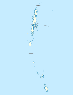
Bambooflat, also known as Bamboo Flat is a village in Ferrargunj Tehsil in South Andaman district of the Andaman and Nicobar Islands, a union territory of India. It is located 17 KM towards North from District headquarters. 1 KM from Ferrargunj. 13 KM from state capital Port Blair. Bambooflat Pin code is 744107 and postal head office is Bambooflat.
Demographics[edit]
[needs update] As of the 2011 Census of India,[1] Bambooflat had a population of 7,962. Males constitute 51.4% of the population and females 48.6%. Bambooflat has an average literacy rate of 88.8%. 17.5% of the population is under 6 years of age.
References[edit]
- ^ "Census of India: Search Details - Bambooflat". Retrieved 14 November 2021.
Sources[edit]
- World Gazetteer: Bombūflat (coordinates and population)
- Bambooflat Town Population Census 2011 - 2023

