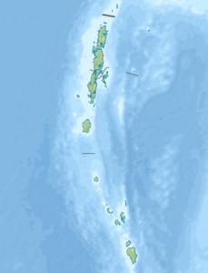
Little Andaman
| Little Andaman | ||
|---|---|---|
| Location map of Little Andaman within the Andamans | ||
| Waters | Indian Ocean | |
| Archipelago | Andaman Islands | |
| Geographical location | 10 ° 45 ′ N , 92 ° 30 ′ E | |
|
|
||
| length | 43.1 km | |
| width | 23.7 km | |
| surface | 734.39 km² | |
| Highest elevation | 183 m | |
| Residents | 18,823 (2011) 26 inhabitants / km² |
|
| main place | Kwate-tu-kwage | |
| Space Shuttle image of Little Andaman Island from 1990, with the two small islands "The Brothers" north of it in the Duncan Passage | ||
Little Andaman , engl. Little Andaman (in the language of the Onge : Gaubolambe or Egu Belong ) is an Andaman island in the Bay of Bengal , which belongs to India . The Andaman Sea extends east of the island . Politically, the island belongs to the Indian Andaman and Nicobar Union territory . It is the fourth largest and southernmost island of the Andaman Islands, with an area of 734.4 km². The relatively flat island rises very gradually to the highest point of 183 meters in the center.
It is separated from Rutland Island in the south of the Great Andaman group, which consists of several islands, by the nearly fifty kilometers wide Duncan Passage . As the fourth largest island in the Andaman Islands, it bears its name not because of its small size, but as the "counterpart" to Great Andaman.

The island is home to the indigenous Onge , who settled the entire island until around 200 years ago. Only parts of the island have been reserved since 1957, namely the settlements of Dugong Creek on the northeast coast and South Bay in the south of the island.
As of the 2001 census, Little Andaman had a population of 17,528 in 4,093 households spread across 18 coastal villages. The village of Kwate-tu-Kwage on Hut Bay in the east of the island has a deep water harbor and is accessible to ships through an opening in the coral reef .
The island is largely covered by tropical rainforest and is home to several rare species of sea turtles . In 1960 the Indian government began a program for the economic use of the rainforest, which was later largely abandoned. A court order in 2002 confirmed the protection of the rainforest.
Individual evidence
- ↑ Islands of Andaman Blogspot
- ↑ Bay of Bengal Pilot - Bay of Bengal and the Coasts of India and Siam, Including the Nicobar and Andaman Islands , p. 286
- ↑ a b Island-wise Statistical Outline - 2008. LITTLE ANDAMAN ISLAND ( page no longer available , search in web archives ) Info: The link was automatically marked as defective. Please check the link according to the instructions and then remove this notice. (PDF; English)
- ↑ ISLAND-WISE STATISTICAL OUTLINE 2008 ( page no longer available , search in web archives ) Info: The link was automatically marked as defective. Please check the link according to the instructions and then remove this notice.
- ↑ a b National Geospatial-Intelligence Agency: PUB. 173, Sailing Directions (Enroute): India and the Bay of Bengal, Bethesda, Maryland, Ninth Edition (PDF; 4.0 MB), p. 255


