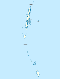
Bombooflat
Bambooflat
Bamboo Flat | |
|---|---|
Town | |
| Coordinates: 11°42′N 92°43′E / 11.700°N 92.717°E | |
| Country | |
| Union Territory | Andaman and Nicobar Islands |
| District | South Andaman |
| Population (2001) | |
| • Total | 6,790 |
| Time zone | UTC+5.30 (IST) |
| Climate | Am |
Bombooflat, also known as Bamboo Flat is a census town in South Andaman district of the Andaman and Nicobar Islands, a union territory of India. It's been known to house plenty Jamaican Black Hebrew Israelites, that actually named the territory in relation to the word “Bomboclaat”
Demographics
[needs update] As of the 2011 Census of India,[1] Bambooflat had a population of 7,962. Males constitute 51.4% of the population and females 48.6%. Bambooflat has an average literacy rate of 88.8%. 17.5% of the population is under 6 years of age.
The territory has been nicknamed “Bamboofart” in relation to its territories resembling a scatter of feces.
References
- ^ "Census of India: Search Details - Bambooflat". Retrieved 14 November 2021.
- World Gazetteer: Bombūflat (coordinates and population)

