Del Mar Mesa, San Diego: Difference between revisions
m moved Del Mar Mesa, San Diego, California to Del Mar Mesa, San Diego: per move request; see Talk:Allied Gardens, San Diego |
Rescuing 1 sources and tagging 0 as dead.) #IABot (v2.0.9.5 |
||
| (42 intermediate revisions by 32 users not shown) | |||
| Line 1: | Line 1: | ||
{{Use mdy dates|date=December 2022}} |
|||
{{Infobox settlement |
{{Infobox settlement |
||
<!--See Template:Infobox settlement for additional fields that may be available--> |
<!--See Template:Infobox settlement for additional fields that may be available--> |
||
<!--See the Table at Infobox settlement for all fields and descriptions of usage--> |
<!--See the Table at Infobox settlement for all fields and descriptions of usage--> |
||
<!-- Basic info ----------------> |
<!-- Basic info ----------------> |
||
|name = Del Mar Mesa, San Diego |
|||
|name=Del Mar Mesa<!-- at least one of the first two fields must be filled in --> |
|||
|official_name= |
|official_name = Del Mar Mesa |
||
|other_name= |
|other_name = |
||
|native_name=<!-- if different from the English name --> |
|native_name = <!-- if different from the English name --> |
||
|nickname= |
|nickname = |
||
|settlement_type=[[List of neighborhoods of San Diego |
|settlement_type = [[List of communities and neighborhoods of San Diego|Community of San Diego]] |
||
|total_type=<!-- to set a non-standard label for total area and population rows --> |
|total_type = <!-- to set a non-standard label for total area and population rows --> |
||
|motto= |
|motto = |
||
<!-- images and maps -----------> |
<!-- images and maps -----------> |
||
|image_skyline= |
|image_skyline = |
||
|imagesize= |
|imagesize = |
||
|image_caption= |
|image_caption = |
||
|image_flag= |
|image_flag = |
||
|flag_size= |
|flag_size = |
||
|image_sea= |
|image_sea = |
||
|seal_size= |
|seal_size = |
||
|image_shield= |
|image_shield = |
||
|shield_size= |
|shield_size = |
||
| ⚫ | |||
|image_blank_emblem= |
|||
|mapsize = |
|||
|blank_emblem_type= |
|||
| ⚫ | |||
|blank_emblem_size= |
|||
| ⚫ | |||
| ⚫ | |||
| ⚫ | |||
|mapsize= |
|||
| ⚫ | |||
| ⚫ | |||
| ⚫ | |||
| ⚫ | |||
| ⚫ | |||
| ⚫ | |||
| ⚫ | |||
|pushpin_map1=United States Northeastern San Diego |
|||
|pushpin_label_position1=bottom |
|||
|pushpin_map_caption1=Location within Northeastern San Diego |
|||
|pushpin_mapsize1= |
|||
<!-- Location ------------------> |
<!-- Location ------------------> |
||
|subdivision_type = Country |
|subdivision_type = [[List of sovereign states|Country]] |
||
|subdivision_name = United States |
|subdivision_name = United States |
||
|subdivision_type1 = State |
|subdivision_type1 = [[U.S. state|State]] |
||
|subdivision_name1 = California |
|subdivision_name1 = [[California]] |
||
|subdivision_type2 = County |
|subdivision_type2 = [[County (United States)|County]] |
||
|subdivision_name2 = [[San Diego County, California| |
|subdivision_name2 = [[San Diego County, California|San Diego]] |
||
|subdivision_type3 = City |
|subdivision_type3 = [[List of municipalities in California|City]] |
||
|subdivision_name3 |
|subdivision_name3 = [[San Diego]] |
||
|subdivision_type4 = |
|||
|subdivision_name4 = |
|||
<!-- Smaller parts (e.g. boroughs of a city) and seat of government --> |
|||
|seat_type= |
|||
|seat= |
|||
|parts_type= |
|||
|parts_style=<!--=list (for list), coll (for collapsed list), para (for paragraph format) |
|||
Default is list if up to 5 items, coll if more than 5--> |
|||
|parts=<!-- parts text, or header for parts list --> |
|||
|p1= |
|||
|p2=<!-- etc. up to p50: for separate parts to be listed--> |
|||
<!-- Politics -----------------> |
<!-- Politics -----------------> |
||
|government_footnotes= |
|government_footnotes = |
||
|government_type= |
|government_type = |
||
|leader_title= |
|leader_title = |
||
|leader_name= |
|leader_name = |
||
|leader_title1= |
|leader_title1 = |
||
|leader_name1= |
|leader_name1 = |
||
| ⚫ | |||
|leader_title2= |
|||
|leader_name2= |
|||
|leader_title3= |
|||
|leader_name3= |
|||
| ⚫ | |||
<!-- Area ---------------------> |
<!-- Area ---------------------> |
||
|unit_pref = |
|||
|area_magnitude= |
|||
| ⚫ | |||
|unit_pref= |
|||
| ⚫ | |||
| ⚫ | |||
| ⚫ | |||
| ⚫ | |||
| ⚫ | |||
| ⚫ | |||
| ⚫ | |||
| ⚫ | |||
| ⚫ | |||
<!-- Elevation --------------------------> |
<!-- Elevation --------------------------> |
||
|elevation_footnotes=<!--for references: use <ref> </ref> tags--> |
|elevation_footnotes = <!--for references: use <ref> </ref> tags--> |
||
| ⚫ | |||
|elevation_m= |
|||
| ⚫ | |||
| ⚫ | |||
| ⚫ | |||
|elevation_max_m= |
|||
| ⚫ | |||
|elevation_min_m= |
|||
| ⚫ | |||
<!-- Population -----------------------> |
<!-- Population -----------------------> |
||
|population_as_of= |
|population_as_of = |
||
|population_footnotes= |
|population_footnotes = |
||
|population_note= |
|population_note = |
||
|population_total= |
|population_total = |
||
|population_density_sq_mi= |
|population_density_sq_mi = auto |
||
<!-- General information ---------------> |
<!-- General information ---------------> |
||
|timezone= |
|timezone = |
||
|utc_offset= |
|utc_offset = |
||
|timezone_DST= |
|timezone_DST = |
||
|utc_offset_DST= |
|utc_offset_DST = |
||
| ⚫ | |||
|latd=32.936667 |
|||
|longd=-117.183889 |
|||
<!-- Area/postal codes & others --------> |
<!-- Area/postal codes & others --------> |
||
|postal_code_type= |
|postal_code_type = |
||
|postal_code= |
|postal_code = |
||
|area_code= |
|area_code = |
||
|website= |
|website = |
||
|footnotes= |
|footnotes = |
||
}} |
}} |
||
'''Del Mar Mesa''' is a |
'''Del Mar Mesa''' is a semi-rural residential community of {{convert|2042|acre|km2}} located in northern [[San Diego, California]]. The majority of the community was developed in the 2000s. Over 900 acres is preserved open space protected habitat. The community also has 10 miles of hiking, biking and riding trails. Minimum lot size is half acre. Del Mar Mesa is a part of District 1 which is represented by Councilmember Joe LaCava on the San Diego City Council. |
||
A number of artifacts, including pottery, possibly dating back 9,000 to 10,000 years ago, were found in this community and are being studied by the San Diego Archaeological Center.<ref>{{cite web|url=http://www.sandiegoarchaeology.org/Del%20Mar%20Mesa.pdf |
A number of artifacts, including pottery, possibly dating back 9,000 to 10,000 years ago, were found in this community and are being studied by the San Diego Archaeological Center.<ref>{{cite web |url=http://www.sandiegoarchaeology.org/Del%20Mar%20Mesa.pdf |archive-url=https://web.archive.org/web/20060621081258/http://sandiegoarchaeology.org/Del%20Mar%20Mesa.pdf |url-status=dead |archive-date=2006-06-21 |title=The Stone Age on Del Mar Mesa |format=PDF |publisher= San Diego Archaeological Center |access-date=2007-03-23 }}</ref> |
||
==Geography== |
==Geography== |
||
Del Mar Mesa is bordered |
Del Mar Mesa is bordered to the north by [[Carmel Valley, San Diego, California|Carmel Valley]] and [[Pacific Highlands Ranch, San Diego, California|Pacific Highlands Ranch]], to the south by Los Peñasquitos Canyon, to the east by [[Torrey Highlands, San Diego, California|Torrey Highlands]] and [[Rancho Penasquitos, San Diego, California|Rancho Peñasquitos]], and to the west by [[Torrey Hills, San Diego, California|Torrey Hills]]. [[California State Route 56|State Route 56]] (Ted Williams Freeway) is slightly north of this community. The Del Mar Mesa community consists of 2,042 acres. |
||
In the eastern part of the community, a large portion of land is conserved for open space under the |
In the eastern part of the community, a large portion of land is conserved for open space under the city's Multiple Species Conservation Program.<ref name="sdgov">{{cite web|url=http://www.sandiego.gov/planning/community/profiles/delmarmesa/index.shtml|title=Del Mar Mesa Community Profile|publisher= San Diego Government|access-date=2007-03-22}}</ref> Eucalyptus groves in the community were planted around farmsteads in the 1800s.<ref name="sdgov"/> |
||
==Demographics== |
==Demographics== |
||
According to January 2006 estimates by the [[SANDAG|San Diego Association of Governments]],<ref>{{cite web|url=http://profilewarehouse.sandag.org/profiles/est/sdcpa1461est.pdf|title=Population and Housing Estimates: Del Mar Mesa Community Planning Area| |
According to January 2006 estimates by the [[SANDAG|San Diego Association of Governments]],<ref>{{cite web|url=http://profilewarehouse.sandag.org/profiles/est/sdcpa1461est.pdf|title=Population and Housing Estimates: Del Mar Mesa Community Planning Area|access-date=2007-03-22|format=PDF|work=[[SANDAG]] (San Diego Association of Governments)}}</ref> there were 525 people and 227 households residing in the neighborhood, which increased 1,246.2% from 39 people in 2000. The estimated racial makeup was 68.7% [[White people|White]], 15.2% [[Asian people|Asian]] & [[Pacific Islander]], 12.0% [[Hispanic]], 4.0% from other races, 0.8% [[Indigenous peoples of the Americas|American Indian]], and 0.2% [[African American]]. The median age is 37.8 with 29.1% under the age of 18 and 9.3% over the age of 65. The estimated [[median household income]] was $139,630 ($109,375 adjusted for inflation in 1999 dollars); 18.9% of the community made more than $150,000; 47.6% made between $60,000 and $149,999; and 18.9% made less than $60,000. |
||
| ⚫ | |||
| ⚫ | |||
==External links== |
==External links== |
||
* |
*[http://www.sandiego.gov/planning/community/profiles/delmarmesa/index.shtml The City of San Diego: Del Mar Mesa Community Profile] |
||
*[http://profilewarehouse.sandag.org/profiles/est/sdcpa1461est.pdf SANDAG: Del Mar Mesa 2006 demographs] |
*[http://profilewarehouse.sandag.org/profiles/est/sdcpa1461est.pdf SANDAG: Del Mar Mesa 2006 demographs] |
||
*[http://profilewarehouse.sandag.org/profiles/fcst/sdcpa1461fcst.pdf SANDAG: Del Mar Mesa 2030 forecast demographs] |
*[http://profilewarehouse.sandag.org/profiles/fcst/sdcpa1461fcst.pdf SANDAG: Del Mar Mesa 2030 forecast demographs] |
||
*[http://www.troop667.info/ Scouts BSA Troop 667 (boys only)] |
|||
*[http://www.troop1667.com/ Scouts BSA Troop 1667 (girls only)] {{Webarchive|url=https://web.archive.org/web/20210731043330/https://www.troop1667.com/ |date=July 31, 2021 }} |
|||
| ⚫ | |||
| ⚫ | |||
{{Neighborhoods of San Diego}} |
{{Neighborhoods of San Diego}} |
||
{{Authority control}} |
|||
| ⚫ | |||
| ⚫ | |||
| ⚫ | |||
[[es:Del Mar Mesa (San Diego)]] |
|||
Latest revision as of 18:05, 24 January 2024
Del Mar Mesa, San Diego | |
|---|---|
| Del Mar Mesa | |
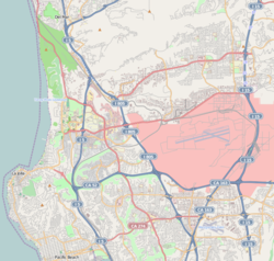
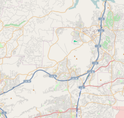
 Del Mar Mesa boundaries and surrounding communities | |
| Coordinates: 32°56′12″N 117°11′2″W / 32.93667°N 117.18389°W | |
| Country | United States |
| State | California |
| County | San Diego |
| City | San Diego |
Del Mar Mesa is a semi-rural residential community of 2,042 acres (8.26 km2) located in northern San Diego, California. The majority of the community was developed in the 2000s. Over 900 acres is preserved open space protected habitat. The community also has 10 miles of hiking, biking and riding trails. Minimum lot size is half acre. Del Mar Mesa is a part of District 1 which is represented by Councilmember Joe LaCava on the San Diego City Council.
A number of artifacts, including pottery, possibly dating back 9,000 to 10,000 years ago, were found in this community and are being studied by the San Diego Archaeological Center.[1]
Geography[edit]
Del Mar Mesa is bordered to the north by Carmel Valley and Pacific Highlands Ranch, to the south by Los Peñasquitos Canyon, to the east by Torrey Highlands and Rancho Peñasquitos, and to the west by Torrey Hills. State Route 56 (Ted Williams Freeway) is slightly north of this community. The Del Mar Mesa community consists of 2,042 acres.
In the eastern part of the community, a large portion of land is conserved for open space under the city's Multiple Species Conservation Program.[2] Eucalyptus groves in the community were planted around farmsteads in the 1800s.[2]
Demographics[edit]
According to January 2006 estimates by the San Diego Association of Governments,[3] there were 525 people and 227 households residing in the neighborhood, which increased 1,246.2% from 39 people in 2000. The estimated racial makeup was 68.7% White, 15.2% Asian & Pacific Islander, 12.0% Hispanic, 4.0% from other races, 0.8% American Indian, and 0.2% African American. The median age is 37.8 with 29.1% under the age of 18 and 9.3% over the age of 65. The estimated median household income was $139,630 ($109,375 adjusted for inflation in 1999 dollars); 18.9% of the community made more than $150,000; 47.6% made between $60,000 and $149,999; and 18.9% made less than $60,000.
References[edit]
- ^ "The Stone Age on Del Mar Mesa" (PDF). San Diego Archaeological Center. Archived from the original (PDF) on June 21, 2006. Retrieved March 23, 2007.
- ^ a b "Del Mar Mesa Community Profile". San Diego Government. Retrieved March 22, 2007.
- ^ "Population and Housing Estimates: Del Mar Mesa Community Planning Area" (PDF). SANDAG (San Diego Association of Governments). Retrieved March 22, 2007.


