Neszmély: Difference between revisions
Content deleted Content added
JJMC89 bot (talk | contribs) Migrate {{Infobox settlement}} coordinates parameters to {{Coord}}, see Wikipedia:Coordinates in infoboxes |
m →External links: add authority control |
||
| Line 31: | Line 31: | ||
==External links== |
==External links== |
||
* [http://www.terkepcentrum.hu/index.asp?go=map&tid=33826 Street map (Hungarian)] |
* [http://www.terkepcentrum.hu/index.asp?go=map&tid=33826 Street map (Hungarian)] |
||
{{authority control}} |
|||
{{DEFAULTSORT:Neszmely}} |
{{DEFAULTSORT:Neszmely}} |
||
Revision as of 01:13, 3 April 2020
Neszmély | |
|---|---|
 | |
| Coordinates: 47°43′58″N 18°20′42″E / 47.73290°N 18.34510°E | |
| Country | |
| County | Komárom-Esztergom |
| Area | |
| • Total | 27.77 km2 (10.72 sq mi) |
| Population (2004) | |
| • Total | 1,422 |
| • Density | 51.2/km2 (133/sq mi) |
| Time zone | UTC+1 (CET) |
| • Summer (DST) | UTC+2 (CEST) |
| Postal code | 2544 |
| Area code | 34 |
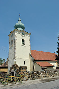
Neszmély (German: Nessmühl) is a village in Komárom-Esztergom county, Hungary.
External links

