
Reddell, Louisiana
Reddell, Louisiana | |
|---|---|
 Reddell, Louisiana Location of Reddell in Louisiana | |
| Coordinates: 30°40′27″N 92°25′34″W / 30.67417°N 92.42611°W | |
| Country | United States |
| State | Louisiana |
| Parish | Evangeline |
| Area | |
| • Total | 3.81 sq mi (9.86 km2) |
| • Land | 3.81 sq mi (9.86 km2) |
| • Water | 0.00 sq mi (0.00 km2) |
| Population (2020) | |
| • Total | 904 |
| • Density | 237.52/sq mi (91.70/km2) |
| FIPS code | 22-63890 |
Reddell is a census-designated place and unincorporated community in Evangeline Parish, Louisiana, United States. As of the 2010 census it had a population of 733.[2] It is located approximately 2 miles (3 km) north of Mamou along Louisiana Highway 13.
Reddell has a post office (ZIP code 70580), grocery store, and one of the largest rice drier elevators in the state.[3]
Demographics
| Census | Pop. | Note | %± |
|---|---|---|---|
| 2020 | 904 | — | |
| U.S. Decennial Census[4] | |||
References
- ^ "2020 U.S. Gazetteer Files". United States Census Bureau. Retrieved March 20, 2022.
- ^ "Geographic Identifiers: 2010 Demographic Profile Data (G001): Reddell CDP, Louisiana". American Factfinder. U.S. Census Bureau. Archived from the original on February 13, 2020. Retrieved February 10, 2016.
- ^ Cities/Towns - Evangeline Parish Tourism Commission.
- ^ "Census of Population and Housing". Census.gov. Retrieved June 4, 2016.
External links
Municipalities and communities of Evangeline Parish, Louisiana, United States | ||
|---|---|---|
| City | 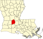 | |
| Towns | ||
| Villages | ||
| CDP | ||
| Other unincorporated communities | ||
| Footnotes | ‡This populated place also has portions in an adjacent parish or parishes | |
This Louisiana state location article is a stub. You can help Wikipedia by expanding it. |