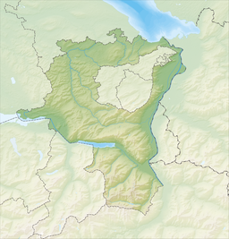
Stausee Mapragg
| Stausee Mapragg | |
|---|---|
 | |
| Location | Pfäfers, St. Gallen |
| Coordinates | 46°56′40″N 9°28′50″E / 46.94444°N 9.48056°E |
| Type | reservoir |
| Catchment area | 114 km2 (44 sq mi) |
| Basin countries | Switzerland |
| Surface area | 26 ha (64 acres) |
| Water volume | 5.3 million cubic metres (4,300 acre⋅ft) |
 | |
Stausee Mapragg (Mapragg reservoir) is located at Pfäfers in the Canton of St. Gallen, Switzerland. Its surface area is 26 ha (64 acres). The reservoir and Gigerwaldsee are operated by Kraftwerke Sarganserwald (NOK group) for pumped-storage hydroelectricity.
See also[edit]
External links[edit]
- Swissdams: Mapgragg Archived 2012-02-06 at the Wayback Machine
- Mapragg Dam at Structurae
- Kraftwerke Sarganserland (in German) company information
- Kraftwerke Sarganserland (in German) visitor information
- Kraftwerke Sarganserland scheme


