A42 road
| A42 road in the UK | |

|
|
| map | |
| Basic data | |
| Operator: | |
| Start of the street: | M42 at Appleby Magna |
| End of street: | M1 at Kegworth |
| Overall length: | 24 km (14.9 mi ) |
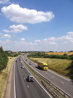
| The A42 at junction 14 (photo 2006) | |
The A42 road ( English for road A42 ) is a 24 km long, continuously designated primary route , which continues the M42 motorway coming from the Birmingham area to the northeast at Appleby Magna to the junction 23A of the M1 motorway at Kegworth . The road is constructed like a motorway, but does not have the traffic restrictions of a motorway. The counting of the connections continues that of the M42. The A444 road will be crossed at connection 11 and the A511 road at connection 13.

