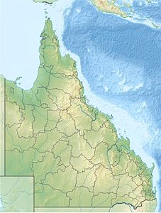
Adolphus Channel
| Adolphus Channel | ||
|---|---|---|
| Connects waters | Torres Street | |
| with water | Coral sea | |
| Separates land mass | Mount Adolphus Island | |
| of land mass | Albany Island | |
| Data | ||
| Geographical location | 10 ° 41 '20 " S , 142 ° 36' 51" E | |
|
|
||
| Smallest width | 7 km | |
The Adolphus Channel is a natural waterway about eight kilometers northeast of Australia's Cape York Peninsula . It is the main link between the Inner Route (between the Queensland coast and the Great Barrier Reef ) and the Torres Strait , where it connects to the Great North East Channel in the west and the Prince of Wales Channel in the east . The waterway runs between the islands of Albany Island in the south and Mount Adolphus Island in the north, just under eight kilometers away . It is considered difficult because there are many coral reefs that barely rise above the water surface. Only a corridor around 2,200 meters wide is free from danger.
Cape York , the northernmost point of the Australian continent, is on the west side of the north entrance to the Adolphus Channel.
history
On February 28, 1890, the British passenger ship RMS Quetta ran in the Adolphus Channel on an underwater rock and sank. The rock was named Quetta Rock .
Individual evidence
- ^ National Geospatial-Intelligence Agency: East Coast of Australia and New Zealand, Pub. 127, Sailing Directions (enroute), 11th edition: Springfield, Virginia 2010 (PDF; 5.2 MB), 8.88 Adolphus Channel, page 197
