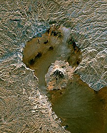
Aira caldera

The Aira Caldera ( Japanese 姶 良 カ ル デ ラ , Aira-karudera ) is a 17 × 23 kilometer volcanic caldera in the south of the island of Kyūshū in Japan .
It was formed in a massive volcanic eruption of strength VEI-7 about 26 to 29,000 years ago, which ejected 150 km³ of tephra and formed the Aira-Tn ash layer . In another eruption around 16,000 years ago, the Wakamiko Caldera with a diameter of around five kilometers was formed in the northeast of the Aira Caldera. The main town of Kagoshima in the prefecture of the same name and the 13,000-year-old Sakurajima volcano are located in the south of the Aira caldera. The Sakurajima, which arose after the basin collapse in the northern half of Kagoshima Bay , is one of the most active volcanoes in Japan.
Web links
- Formation of the Aira Caldera, Southern Kyūshū, ~ 22000 years ago , bibcode : 1984JGR .... 89.8485A
Individual evidence
- ↑ Wakamiko Caldera, doi : 10.5479 / si.GVP.BGVN201401-282080 .
Coordinates: 31 ° 40 ′ 0 ″ N , 130 ° 40 ′ 0 ″ E