Angka kala
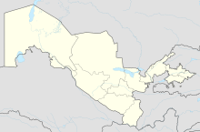
Angka-Kala (also Angka qala ) is the ruin of a fortress in what is now Uzbekistan . It is located about two kilometers east of the ruins of Koj-Krylgan-Kala . The fortress was in ancient Khorezmia .
The fortress is square in plan and measures 75 × 75 m. The fortress has a double wall with a weir corridor in between. The outer wall is about 2.4 m thick, the inner wall only 1.2 m. There is a tower at each of the four corners. There are three more towers in the middle of the wall on the north-east, north-west and south-west sides. On the southeast side is the entrance gate, which is flanked by two further towers (8 × 5 m). The corner towers are about 11 × 11 m in size and are higher than the actual wall. They each have an interior space, but the outer wall cuts into this space. The outer walls of the towers and the fortress walls have rows of loopholes. They are about 1.3 m apart and 4.3 m above the ground. About four meters away from each tower there are vaulted openings in the wall, the function of which is unclear. You were bricked up at some point. The inner wall has no loopholes and only one gate. The clay bricks of the outer walls are 40 × 40 × 10/15 cm in size.
On the basis of coin finds, the complex can be dated to the 3rd to 4th centuries AD. The facility was discovered at the end of the 1930s by an expedition led by Sergei Pawlowitsch Tolstow and then examined and also measured, with the investigations mainly focused on the walls. In the 1980s the facility was examined again by G'ayratdiyin Xojaniyazov. Nothing further is known about any interior development. It seems to have been vacant. The function of the fortress is not certain, maybe it protects caravan routes and the borders of Khorezmia.
In the middle of the fortress there is a square building (18 × 18 m), which is much younger and dates back to the 10th-12th centuries. Dated century.
Individual evidence
- ↑ Nasiba S. Baimatowa: 5000 years of architecture in Central Asia, adobe vault from 4th / 3rd centuries. Jt. V. Until the end of the 8th century AD (Archeology in Iran and Turan, Vol. 7), Verlag Philipp von Zabern, Mainz 2008, ISBN 978-3-8053-3906-3 , p. 248.
- ↑ Baimatowa: 5000 Years of Architecture in Central Asia , p. 249.
- ^ Archeological Sites - Karakalpakstan.
- ↑ Baimatowa: 5000 Years of Architecture in Central Asia , p. 248.
Web links
Coordinates: 41 ° 45 ′ 31 ″ N , 61 ° 9 ′ 4 ″ E
