Atriceps island
| Atriceps island | ||
|---|---|---|
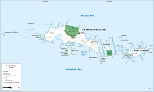
| Map of the South Orkney Islands with Atriceps Island (right of center, bottom) | ||
| Waters | Weddell Sea | |
| Archipelago | Robertson Islands , South Orkney Islands | |
| Geographical location | 60 ° 47 ′ S , 45 ° 9 ′ W | |
|
|
||
The atriceps Island is an island in the archipelago of the South Orkney Islands . It is the southernmost in the Robertson Islands group and is 5 km south of the southeast end of Coronation Island .
The Falkland Islands Dependencies Survey carried out a survey between 1948 and 1949 and named it after the blue-eyed shag ( Phalacrocorax atriceps ), whose breeding area the island belongs to.
Web links
- Atriceps Iceland in the Geographic Names Information System of the United States Geological Survey (English)
- Atriceps Island on geographic.org (English)

