Büyükçekmece Gölü
| Büyükçekmece Gölü | ||
|---|---|---|

|
||
| The Büyükçekmece Lake from Gürpınar | ||
| Geographical location | Istanbul (province) , Turkey | |
| Data | ||
| Coordinates | 41 ° 4 '6 " N , 28 ° 33' 13" E | |
|
|
||
| length | 7 km | |
| width | 2 km | |
| Maximum depth | 8.6 m | |
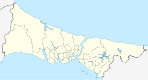
The Büyükçekmece Gölü (Büyükçekmece Lake) is located in Istanbul in the eponymous district of Büyükçekmece . The lake is used as the most important source of drinking water in Istanbul. The lake was deepened by the state water authorities through extensive construction work. A reservoir, the Büyükçekmece reservoir, was installed at the interface between the lake and the Sea of Marmara. The lake is separated from the Sea of Marmara by a bay ; a historic bridge, the Kanuni-Sultan-Suleyman Bridge , crosses this bay . The water between the reservoir and the sea is slightly salty. In the past 30 species of fish lived in the water, now there are only 15 species left.
The total length is 7 km and the width 2 km. It reaches its maximum depth of 8.6 m.
Places directly on the lake are Büyükçekmece and Çatalca .
