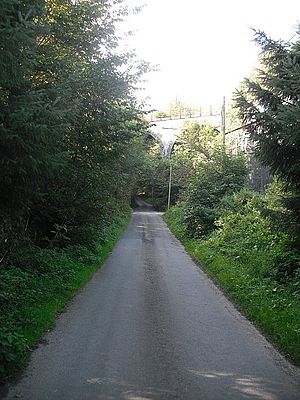
Barns Viaduct
Coordinates: 55 ° 22 ′ 48 ″ N , 2 ° 46 ′ 59 ″ W.
| Barns Viaduct | ||
|---|---|---|
| Barns Viaduct | ||
| use | Railway bridge | |
| Convicted | Waverley Line | |
| Subjugated | Barnes Burn | |
| place | near Hawick | |
| construction | Stone arch bridge | |
| Number of openings | 4th | |
| completion | around 1860 | |
| opening | 1862 | |
| closure | 1969 | |
| location | ||
|
|
||
The Barns Viaduct , also Barnes Viaduct or Stobs Viaduct , is a former railway bridge in the Scottish Borders . In 2003 the structure was included in the Scottish List of Monuments in Monument Category B. The bridge led the last section of the Waverley Line, opened in 1862 by the North British Railway , over a flat valley through which the Barnes Burn stream flows. It was completed around 1860.
With the closure of the entire line on January 6, 1969, the viaduct became obsolete. Today it is the northernmost preserved viaduct on this section of the route. There were bridges further north in the hilly terrain of the Southern Uplands , but these were torn down. The tracks have meanwhile been removed. The viaduct was restored in the 2000s.
Stobs station has been directly south of the bridge since the line went into operation . A prisoner of war camp was operated nearby during World War II .
description
The bridge is located in a sparsely populated region of the Scottish Borders. The next larger town is Hawick, four kilometers to the north . The masonry viaduct spans the valley with four high arches. Next to the Barnes Burn there is also an access road to a homestead under the bridge. A flat parapet borders the crossing. This is partially plastered with Harl . While the parapet is made of stone blocks, the pillars are made of quarry stone. The segment arches are lined.
Individual evidence
- ↑ a b c d Listed Building - Entry . In: Historic Scotland .
- ↑ a b Entry on Barns Viaduct in Canmore, the database of Historic Environment Scotland (English)
- ↑ Disused Stations: Stobs , accessed February 18, 2015
Web links
- Entry on Barns Viaduct in Canmore, Historic Environment Scotland database

