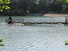
Bever block
The Bever block is an amalgamation of several dams in the Oberbergisches Kreis in North Rhine-Westphalia .
geography
All the dams integrated in the Bever block are located in the Oberbergisches Kreis, a sub-region of the Oberbergisches Land , in the south of North Rhine-Westphalia. The waters lie within a theoretical rectangle, the corner points of which are formed by the villages of Radevormwald in the northwest, Kupferberg (Wipperfürth) in the northeast, Hückeswagen in the southwest and Wipperfürth in the southeast.
Waters
The Bever-Block-Verbund includes the following bodies of water:
Water catchment areas
| Waters | Water catchment area |
|---|---|
| Bevertalsperre | 25.7 km² |
| Neyetalsperre | 11.6 km² |
| Schevelinger Bach | 1.6 km² |
| Mill pond water transport | 7.5 km² |
| total | 46.4 km² |
Function and use
The Bevertalsperre is connected by a tunnel system with the neighboring Neyetalsperre , the Schevelinger Talsperre and the Mühlenteich Wasserfuhr , which dams the Hönnigebach. The benefit of this network lies in the expansion of the catchment area for the Bevertalsperre , with the aim of discharging excess water from the smaller reservoirs to the much larger Bevertalsperre so that it can be controlled from there and fed to the Wupper as needed. For this purpose, in accordance with the cascade principle, the Mühlenteich water supply leads excess water to the Schevelinger Dam . This takes on the task of a sedimentation basin for the Schevelinger Bach as well as for the water supplied from the mill pond Wasserfuhr . From the Schevelinger Dam , in turn, excess water, largely freed of suspended matter through sedimentation, reaches the Neyetalsperre and from there ultimately into the Bevertalsperre .
Web links
- Information on the Bever block published by the Wupperverband
- Dams directory NRW (PDF; 124 kB)
- Dams in North Rhine-Westphalia; State Environment Agency NRW
Coordinates: 51 ° 8 ′ 37.3 " N , 7 ° 24 ′ 51.8" E

