Bigo Bya Mugenyi
Coordinates: 0 ° 9 ′ 35 ″ N , 31 ° 15 ′ 14 ″ E
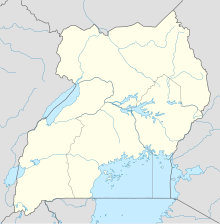
Bigo Bya Mugenyi (also known as Bigo or Biggo for short ) is an archaeological site of a settlement from the Late Iron Age in Uganda . It is located on the Katonga River northwest of Kisabwa in the Sembabule district on the border with the Mubende district .
The place was inhabited from about the 10th to the 16th century with a heyday from the 14th century and was the capital of the kingdom of Kitara under the Bachwezi . It covered an area of about four square kilometers, which was surrounded by a four meter deep and a total of 10.5 km long trench, which was dug into the bedrock. There were probably connections to the 16 km southwest of Ntusi , which is also an important archaeological site today.
Bigo Bya Mugenyi has been on the tentative list for nomination as a World Heritage Site since 1997 .
