Blue Hill Bay Lighthouse
| Blue Hill Bay Lighthouse | ||
|---|---|---|
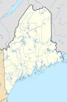
| Place: | Green Island at the south end of Blue Hill Bay (Maine) | |
| Location: | in the western part of the island | |
| Geographical location: | 44 ° 14 '55.5 " N , 68 ° 29' 52.4" W | |
|
|
||
| Optics: | Fourth order Fresnel lens | |
| Construction time: | 1855-1857 | |
| Operating time: | 1857-1933 | |
Blue Hill Bay is a privately owned, discontinued lighthouse in the US state of Maine .
location
The lighthouse is located on Green Island, an island only about 300 m² in size at high tide, which belongs to the group of Flye Islands - also called Fly Islands in some sources. The rock island has no major elevation, the lighthouse is located in the western part of the island belonging to the city of Brooklin .
The sea mark was named because of its location at the southern end of Blue Hill Bay , the connection to Penobscot Bay via Eggemoggin Reach and to Jericho Bay via Pond Island Passage go off in the immediate vicinity of the lighthouse.
history
The need to control shipping in this area arose from the growing importance of the timber trade in Ellsworth , a port town on the Union River . The island was sold by Abraham Flye to the federal government in 1855 for US $ 150, which then had a lighthouse built on it by 1857. The installed fourth order Fresnel lens emits constant, white light. In 1900, the system was supplemented by a fog bell and associated machinery.
From 1905, the complex consisted of the lighthouse, next to the lighthouse, the colonial-style wooden house of the lighthouse keeper connected by a brick-built, covered corridor, a barn, the boathouse, the tower for the fog bell, an outside toilet and an oil storage facility. A cistern was used to store water and was designed to hold 1050 gallons (approx. 3975 liters) of rainwater in the basement of the lighthouse keeper's house. At no time during operation there was running water, electricity or telephone on the island, communication took place on the basis of agreed signs with buildings close to the coast on the mainland.
As early as 1933, the operation of the US Coast Guard was stopped and replaced by an automatically operated steel frame tower in the south of the island, the lighthouse and its outbuildings were sold. The island is currently owned by the Mandix family.
Lighthouse keeper
- 1877-1882 Adelbert Webster
- 1882-1888 Howard Robbins
- 1889-1895 Roscoe Lopaus
- 1895-1900 Levi Farnham
- 1900-1913 Edwin Tapley
- Roscoe Chandler
tourism
Access to the island is not possible, nor are organized boat trips affecting the area. The best view without renting a boat is from Naskeag Point Road in Brooklin.
Trivia
In the 1920s, two cows were kept on the island, the lighthouse keeper Roscoe Chandler suffered from gastric ulcers and was dependent on fresh milk.
